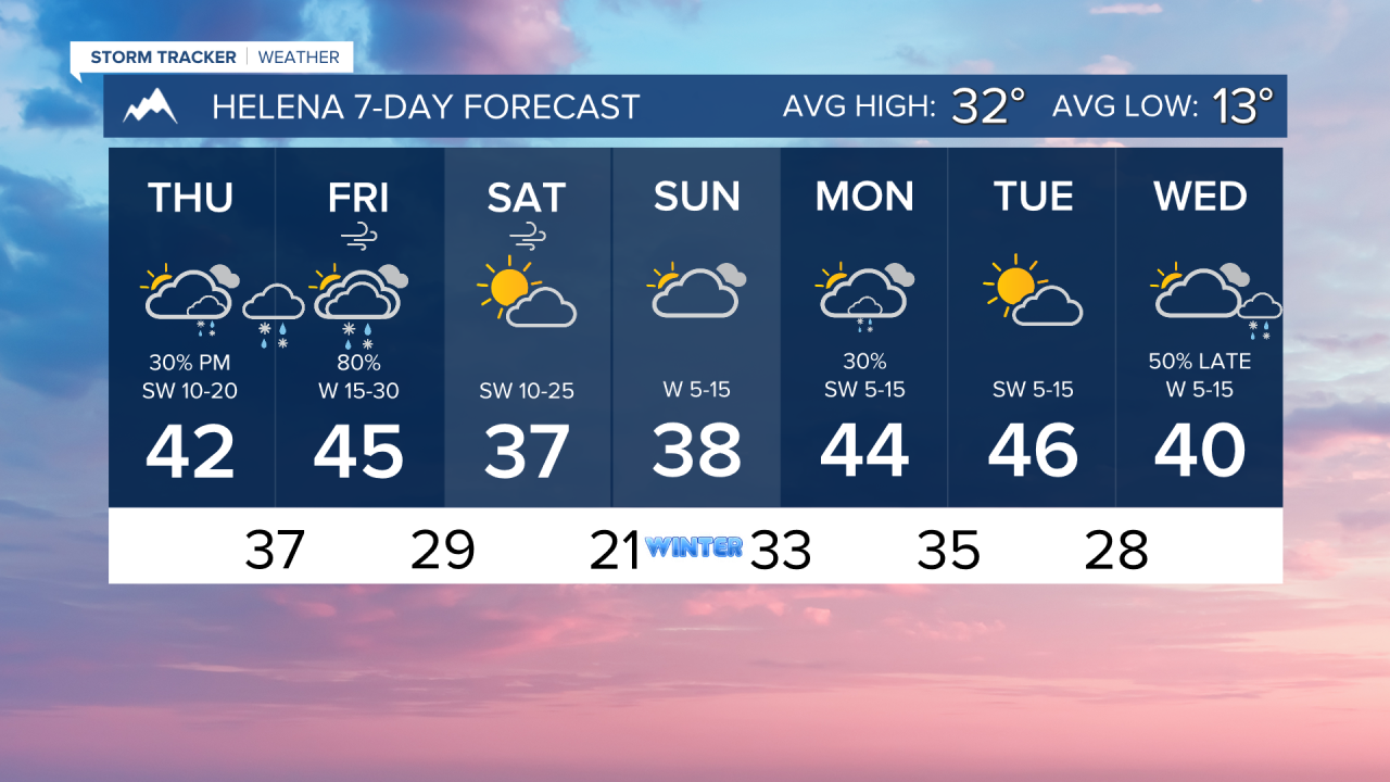


We will only have a brief break on Thursday morning after yesterday's windstorm before another area of low pressure enters the state. Rain, snow, and more wind are expected in portions of the state.
While I don't expect the wind coming in with the next system to be as bad as Wednesday, it is important to note that a lot of trees and power lines have already been stressed. I suspect it wouldn't take much more to topple over some weaker trees and poles. Gusts could approach 75 MPh along the Rocky Mountain Front. Gusts in Helena will max out around 40-50 MPH.
Todays highs will come after dark when the winds pick up. Most of the day will be in the 30s under mostly cloudy skies. A few showers will move in later tonight as a cold front approaches.
Showers will become a bit more widespread around the Helena area overnight and into tomorrow morning. While most of it will be rain in the lower elevations, I can't rule out a brief period of snow behind the cold front in the late morning/early afternoon.
Highs will be cooler heading into the weekend, with the wind still staying breezy but overall less impactful.
A weaker storm system arrives late Sunday into Monday, introducing a low chance for precipitation around Helena.
——————————————————————————————————————————
WEATHER ALERTS:
NWS Weather and Hazards Viewer
——————————————————————————————————————————
Helena Temperature Records Today:
High: 59 (1917)
Low: -30 (1924)
AVG: 32/13
Great Falls Temperature Records Today:
High: 58 (1979)
Low: -27 (1924)
AVG: 35/16