


TUESDAY, MARCH 3RD: Hope everyone was able to see the eclipse early this morning! It was quite the spectacle! We are in store for really nice weather across the state today, with highs in the upper 50s to mid 60s under mostly sunny to partly cloudy skies.
Some wind will pick up in north-central Montana with gusts around 30 MPH in the afternoon. Helena will have a light breeze.
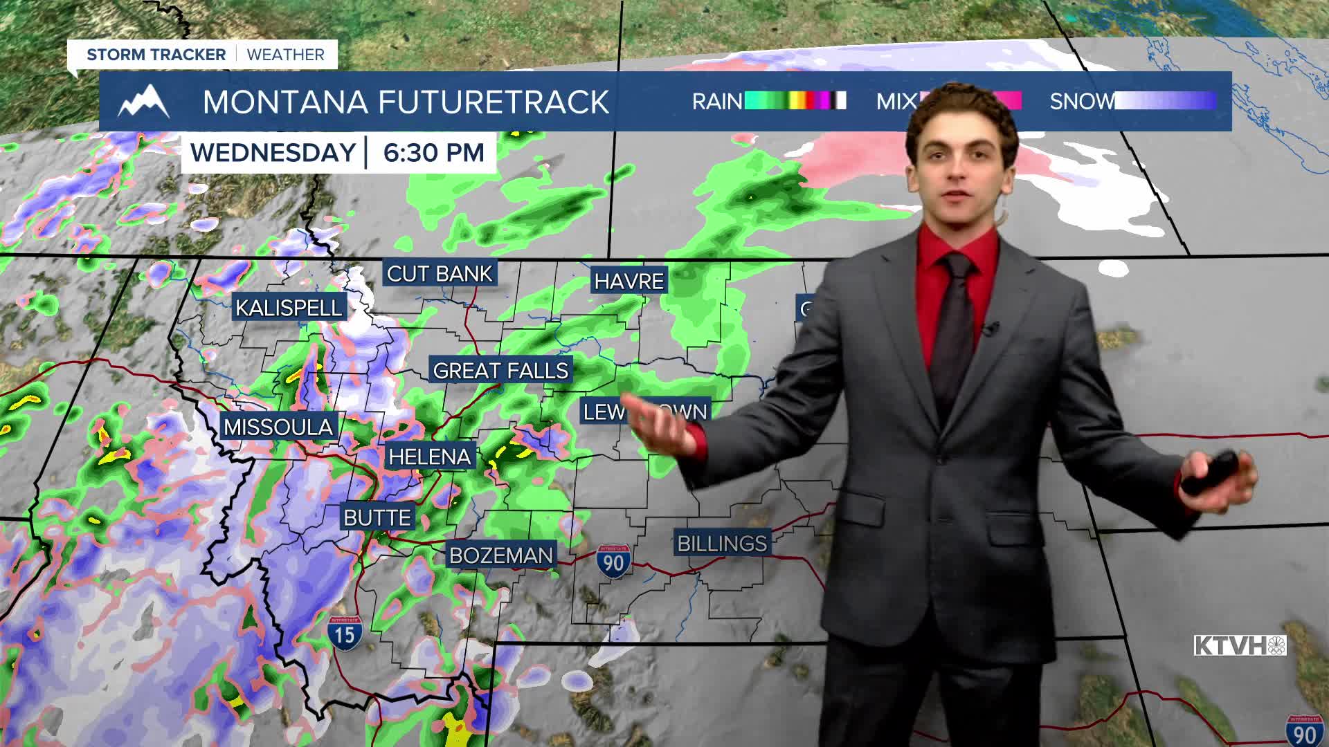
WEDNESDAY, MARCH 4TH: Cloud cover will increase by Wednesday morning. We will remain dry through most of the day until a cold front approaches in the late afternoon and evening.
A mix of rain and snow will fall in the lower elevations. Heavy snowfall rates and reduced visibility are more likely in southwest Montana. Any snow that falls Wednesday night into Thursday morning will melt by Thursday afternoon in the valleys and plains.
It will still be a mild day with highs in the 50s before the front arrives
THURSDAY, MARCH 5TH: More consistent rain and snow showers will last into early Thursday morning before moving east out of our area. A few pop-up snow showers are possible in the mountains in the afternoon. Highs reach the 40s and low 50s. Wind will begin to pick up on Thursday afternoon for most locations. Wind speeds are expected to reach around 20-30 MPH.
FRIDAY, MARCH 6TH: Expect dry weather but still windy. The winds will push temperatures back up in the low 50s for some locations under partly to mostly sunny skies. Maximum winds will approach 30-40 MPH.
LONG-RANGE FORECAST: Warm, dry, and windy conditions last through the weekend, with the potential for heightened fire danger. Rain and snow return to our area towards the beginning of next week.
——————————————————————————————————————————
WEATHER ALERTS:
NONE
——————————————————————————————————————————
Helena Temperature Records Today:
High: 67 (1994)
Low: -15 (1976)
AVG: 42/20
Great Falls Temperature Records Today:
High: 67 (1934)
Low: -27 (1896)
AVG: 41/17
