


Arctic air will return to much of the state later this week as an upper-level trough moves in. Lows can dip below zero for some by Friday morning.
MONDAY, JANUARY 19TH: Today will be the warmest day of the week. Highs reach the upper 30s to mid-40s under mostly sunny skies to start, with some clouds moving in by the afternoon.
It will be breezy in the plains today, with winds between 15 and 20 MPH.
Snow showers will begin to come in from Canada along a cold front later tonight to areas along the Hi-Line.
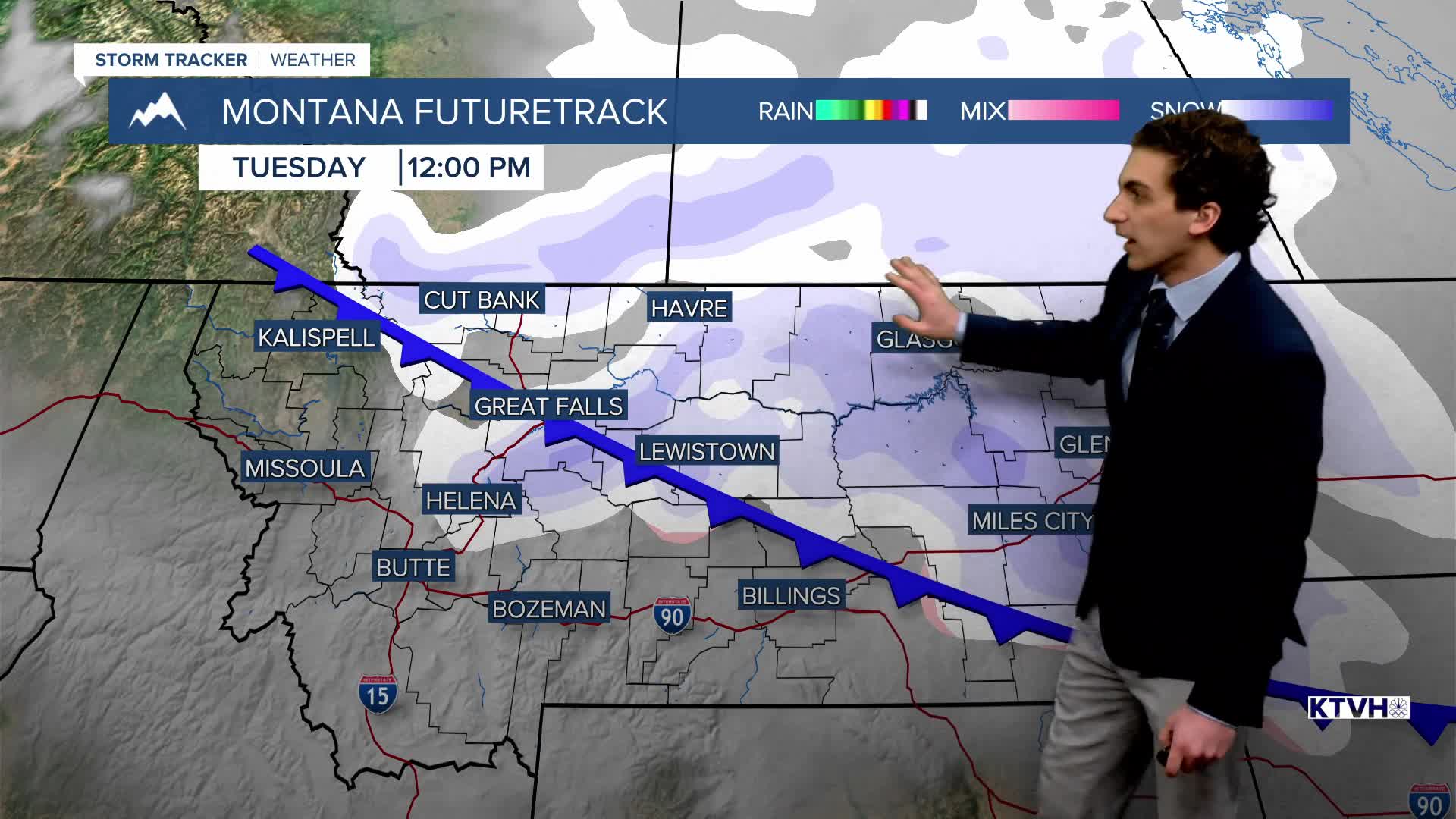
TUESDAY, JANUARY 20TH: The cold front will come through the Great Falls and Helena areas in the morning. This will bring some scattered snow showers with it. The snow will be light and won't accumulate much. Expect less than an inch. Highs will reach the 20s and 30s.
The day will start out mostly cloudy, but we will see the sun by the afternoon.
WEDNESDAY, JANUARY 21ST: A minor system scrapes by in eastern Montana, bringing another round of light snow to the area. It will be dry back in our area. We will have some clouds around with highs in the 30s.
THURSDAY, JANUARY 22ND: Lows will drop into the single digits by the morning. Highs only reach the teens and 20s. This will be the first of two days of arctic air in the state. Little to no precipitation is expected.
LONG-TERM FORECAST: The cold air lasts until Saturday morning. West wind will pick up by Saturday afternoon to begin warming the state up back to near-normal temperatures.
——————————————————————————————————————————
WEATHER ALERTS:
A WINTER WEATHER ADVISORY has been issued for Dawson, McCone, Prairie, Richland, and Wibaux Counties from 2 AM Tuesday until 5 PM Tuesday
——————————————————————————————————————————
Helena Temperature Records Today:
High: 55 (2005)
Low: -34 (1883)
AVG: 33/14
Great Falls Temperature Records Today:
High: 61 (1986)
Low: -28 (1935)
AVG: 35/15


