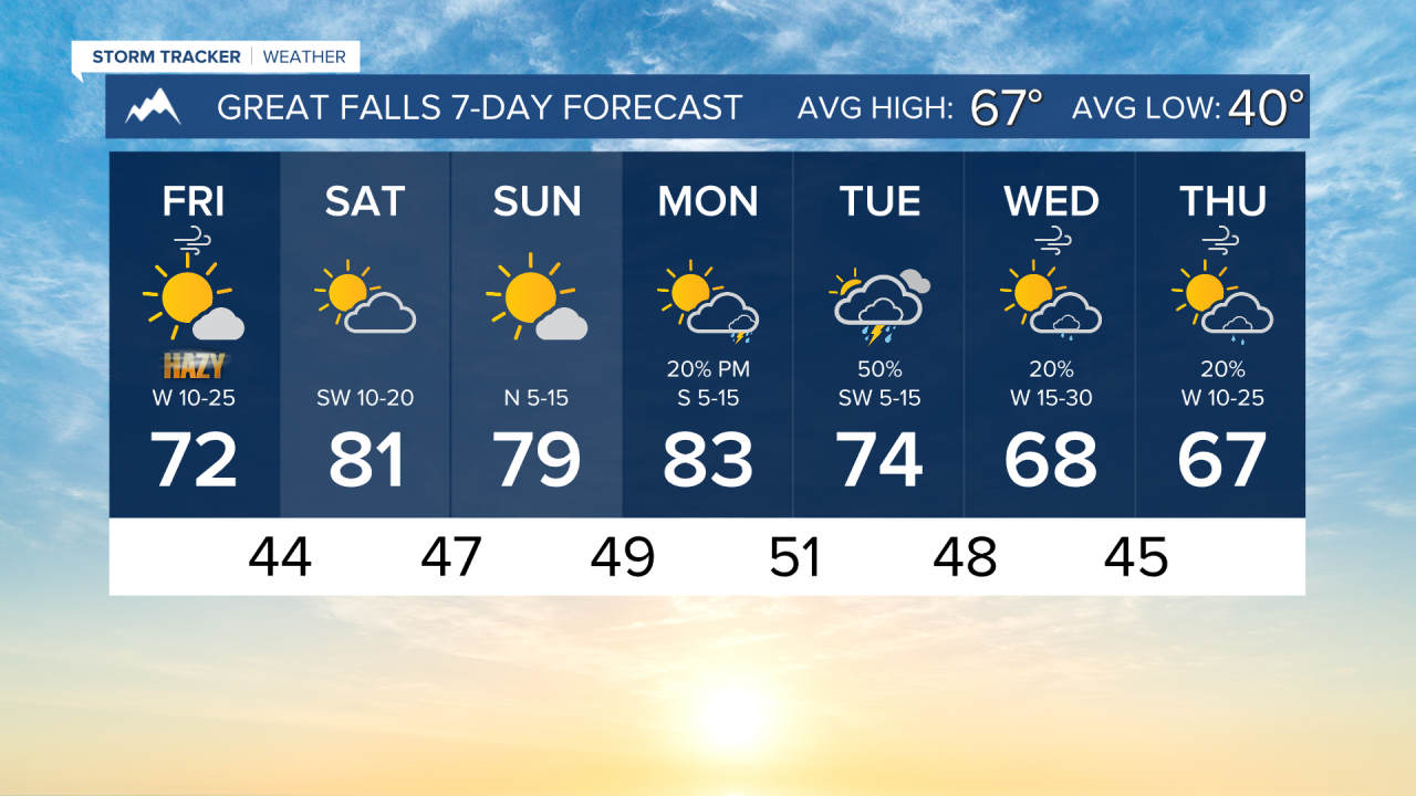


It will be hazy around Montana today as a cold front ushers in smoke from the Pacific Northwest. But air quality should improve over the weekend.
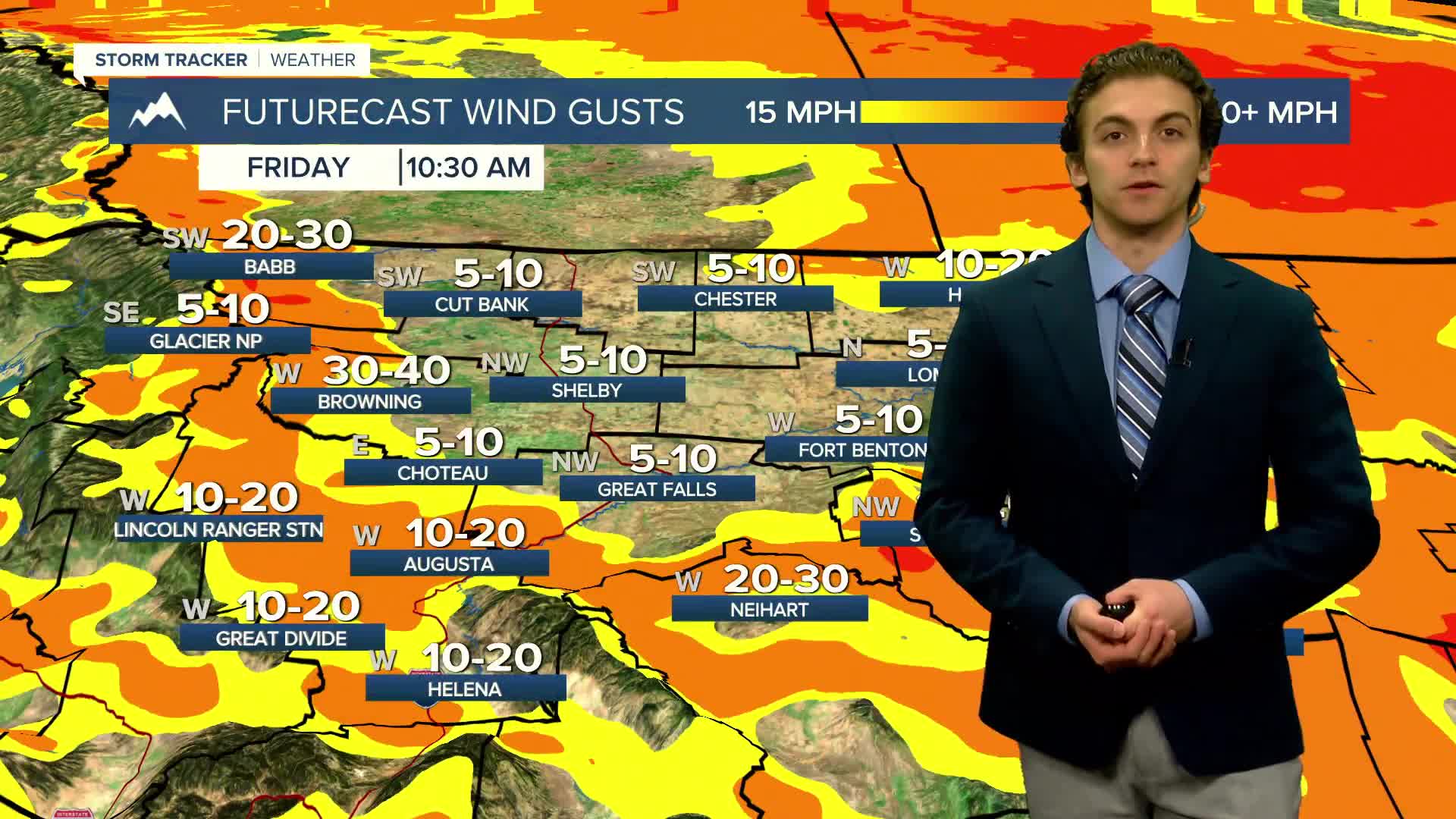
Although we stay dry today, we will start partly cloudy and breezy. Max wind gusts, especially around the Rocky Mountain Front, could be as high as 40-50 MPH, but generally expect 20-30 MPH winds around most of the state.
Afternoon highs cool a bit today, down into the 70s behind the front.
The weekend will be warmer once again with highs in the low to mid-80s. Partly to mostly sunny skies will be present.
A weather system starts to enter the region from the Pacific on Monday, bringing isolated showers and thunderstorms to western Montana.
Showers and storms become a bit more widespread on Tuesday into Wednesday, with some unsettled weather lasting through most of the week.
——————————————————————————————————————————
WEATHER ALERTS:
A LAKE WIND ADVISORY continues for Fort Peck Lake until 6 PM Friday
——————————————————————————————————————————
Helena Temperature Records Today:
High: 88 (1952)
Low: 20 (1900)
AVG: 69/42
Great Falls Temperature Records Today:
High: 89 (1963)
Low: 20 (1934)
AVG: 67/40