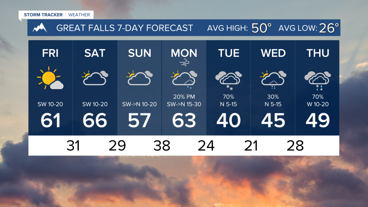


FRIDAY, MARCH 27TH: Morning lows dip into the teens and 20s for most areas. Temperatures rebound and warm into the 50s by the afternoon under mostly sunny skies. The wind will be light.
SATURDAY, MARCH 28TH: Temperatures in the morning will be in the 20s and 30s, but the overall pattern continues to warm as afternoon highs reach the 60s. Expect partly to mostly cloudy conditions with no precipitation.
SUNDAY, MARCH 29TH: Sunday will be similar to Saturday in the Helena area, but a back-door cold front moves into northern Montana. Highs will only reach the 40s and 50s near and north of Great Falls. Some moisture moves in along the divide, with isolated showers and a thunderstorm or two in southwest Montana.
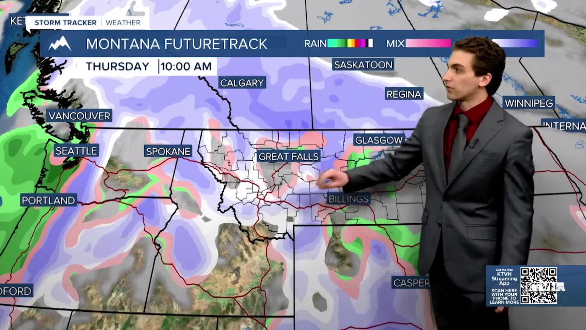
MONDAY, MARCH 29TH: A cold front should make its way through the state Monday afternoon into Tuesday morning. Temperatures will warm up ahead of this front into the 60s and even low 70s, but forecast models are struggling with the timing of this front. As of now, I believe this front comes in later on in the day to the Helena area, allowing us to have a high temperature in the 60s before temperatures drop below freezing Monday night. A few rain showers will come into our area in the afternoon, transitioning to snow once the front moves over.
LONG-RANGE FORECAST: Monday night into Tuesday looks to be the next transition back to predominantly cooler and wetter weather.
——————————————————————————————————————————
WEATHER ALERTS:

——————————————————————————————————————————
Helena Temperature Records Today:
High: 73 (1978)
Low: -22 (1955)
AVG: 51/28
Great Falls Temperature Records Today:
High: 71 (2025)
Low: -15 (1898)
AVG: 50/26