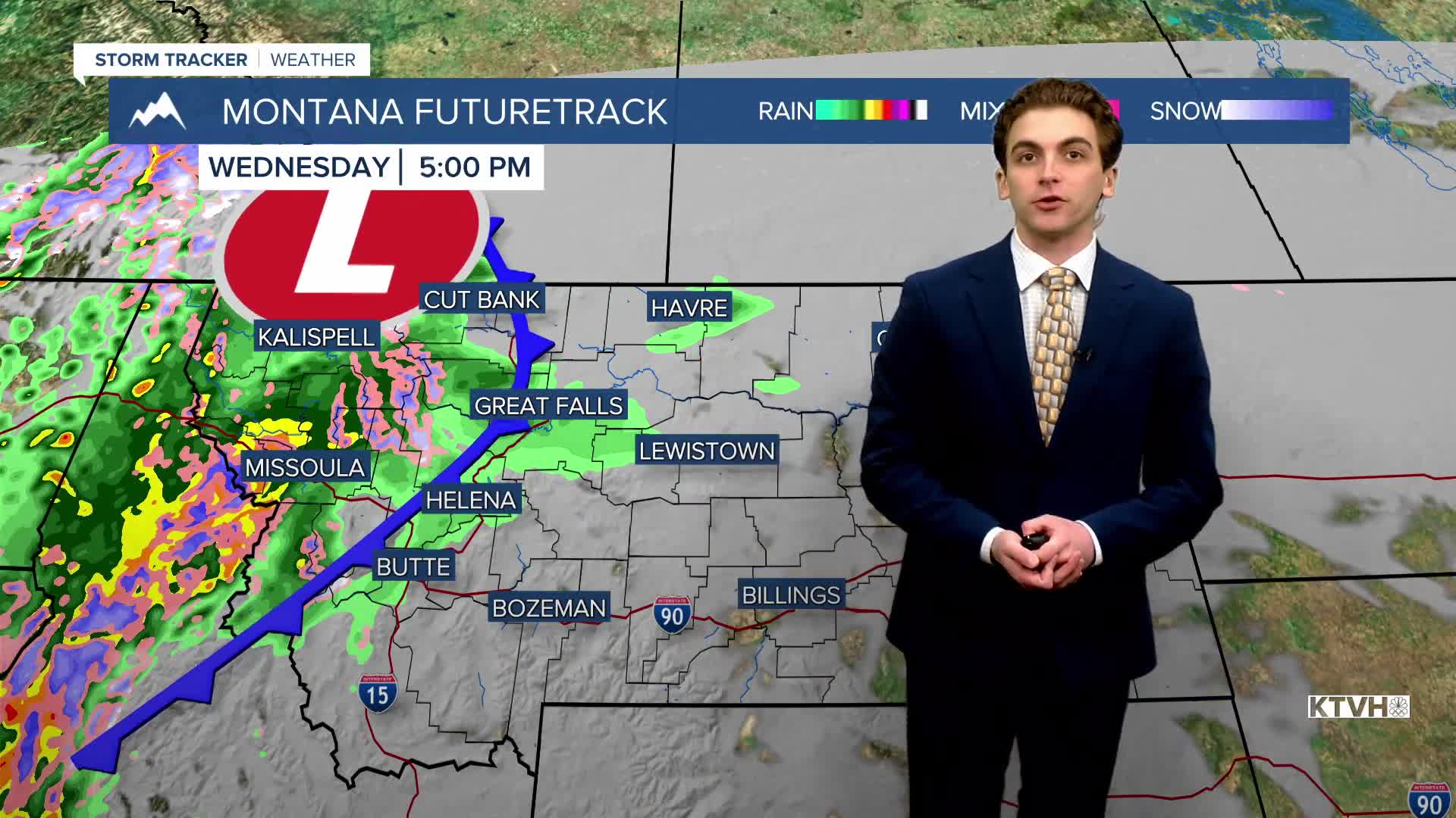


WEDNESDAY, MARCH 4TH: Rain and snow will be moving into the state along a cold front later this afternoon and Thursday. Beneficial precipitation will fall for many areas.
Expected a mostly cloudy day with highs in the upper 50s.
Mostly rain is expected for lower elevations, but snow may fall to valley floors by Thursday morning in southwestern Montana. Rain will convert to a rain/snow mix in Helena, with very little snow accumulation. Wet weather will arrive in the valley around 7-8 PM. We will see some nice rain, though, with around 0.1" to 0.3" expected for most locations.
A wet snow will create slushy conditions over mountain passes by Thursday morning. Bozeman Pass, Lolo Pass, and Lost Trail Pass are a few that will see the greatest impact.
Afternoon pop-up showers will form in western and central Montana on Thursday. However, most precipitation will fall overnight tonight.
THURSDAY, MARCH 5TH: More consistent rain and snow showers will last into early Thursday morning before moving east out of our area. A few pop-up rain and snow showers are possible in the mountains and plains in the afternoon. Highs reach the 40s. Wind gust speeds are expected to reach around 30-40 MPH near the Rocky Mountain Front.
FRIDAY, MARCH 6TH: With a little remaining moisture, isolated mountain snow showers will form in the mountains in the afternoon. Highs will reach the 40s and low 50s with partly cloudy skies. Winds will continue to slightly increase in the plains, with gusts around 50 MPH near the Rocky Mountain Front. Winds in Helena will be around 5-15 MPH. Winds in Great Falls will reach around 20-30 MPH.
SATURDAY, MARCH 7TH: Snow showers move out temporarily, but winds significantly increase. Gusts near the Rocky Mountain Front will approach 70-80 MPH. It will be windy for mostly lower elevations. Winds will push temperatures back up into the 50s and 60s for most.
LONG-RANGE FORECAST: Warm, dry, and windy conditions last through the weekend, with the potential for heightened fire danger. Rain and snow return to our area towards the beginning of next week.
——————————————————————————————————————————
WEATHER ALERTS:

——————————————————————————————————————————
Helena Temperature Records Today:
High: 71 (1987)
Low: -30 (2019)
AVG: 43/21
Great Falls Temperature Records Today:
High: 72 (1987)
Low: -24 (2019)
AVG: 42/18


