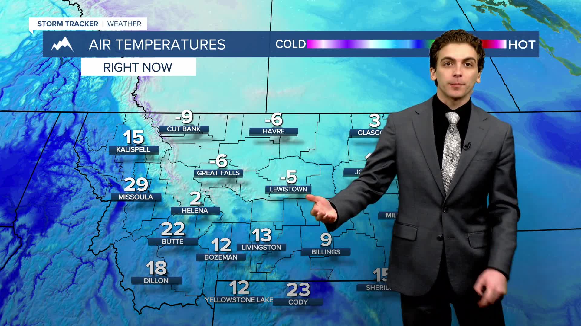


Winter is making up for lost time this morning. Many are experiencing the coldest air of the season so far, and below-average temperatures are locked in through the end of the week.
WEDNESDAY, FEBRUARY 18TH: We are waking up to dangerously cold wind chill temperatures across north-central Montana and the Helena area. Wind Chills are ranging from 10 to 40 degrees below zero across the area. Make sure to stay indoors if you are able. If you have to go outside, dress in layers. High temperatures will only reach the single digits, with afternoon wind chills still below zero.
More light snow will be coming through the state again today. Snow will be the most impactful south of Interstate 90, but 1-2 inches of accumulation is possible near Helena and into the plains of north-central Montana, east of Great Falls.
THURSDAY, FEBRUARY 19TH: Thursday will be another cold day. Lows dip below zero again Thursday morning, with wind chills as low as 30 below zero for most of the Hi-Line and Great Falls area. Highs only reach the single digits and teens. Pop-up snow showers will form in the mountains of southwestern Montana in the afternoon.
FRIDAY, FEBRUARY 20TH: Temperatures will begin to warm slightly on Friday, but not by much. Morning lows will be in the single digits above and below zero. Highs will reach the teens and 20s. More light snow will come through western Montana in the afternoon and evening. Significant accumulation is not expected.
SATURDAY, FEBRUARY 21ST: Morning lows dip into the single digits and teens. Highs will reach the 20s and 30s with mostly sunny skies.
LONG-RANGE FORECAST: Colder than average air sticks around through the weekend. Another storm system approaches on Monday night and Tuesday.
——————————————————————————————————————————
WEATHER ALERTS:
——————————————————————————————————————————
Helena Temperature Records Today:
High: 64 (1930)
Low: -24 (1942)
AVG: 38/18
Great Falls Temperature Records Today:
High: 64 (1930)
Low: -35 (1936)
AVG: 37/15


