


A lot of Montana cities experienced their first freezes this morning on the heels of a weather system that brought rain and snow over the weekend. Sunny and warmer conditions are expected through the rest of the workweek.
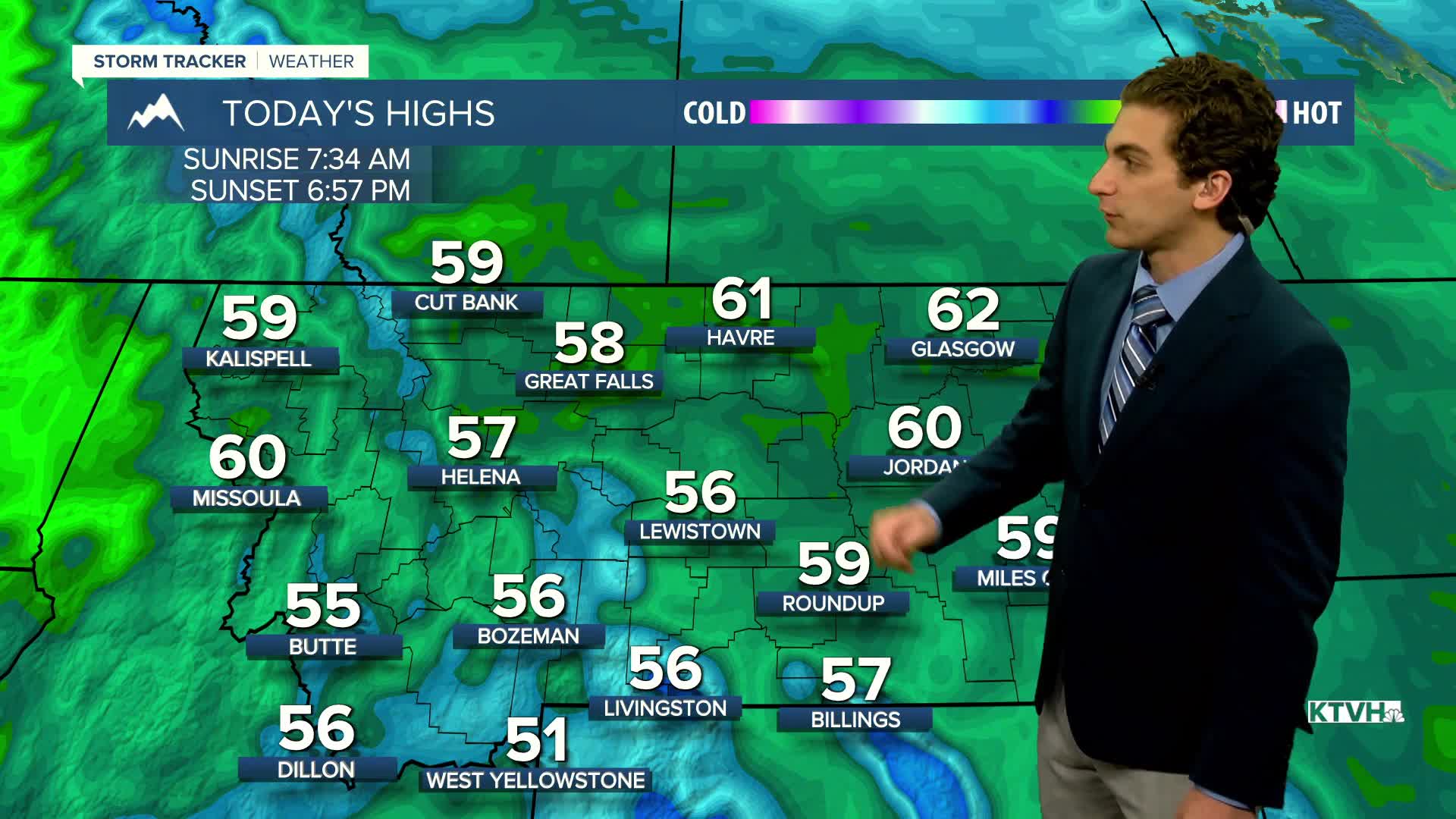
Frosty windshields are common across western Montana this morning. Areas of freezing fog are also possible. High temperatures will be warmer than yesterday, but still on the cooler side, reaching the 50s for most areas.
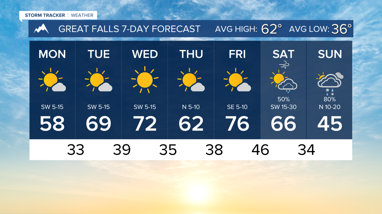
An inactive weather pattern will persist through the remainder of the workweek, with highs warming into the 60s by Tuesday and the 70s by Wednesday. Sunny to mostly sunny skies are expected.
Another storm system looks to make its way into the state over the weekend, bringing another round of rain and snow. While we are too far out for specifics, expect a weekend showing similarities to this past weekend.
——————————————————————————————————————————
WEATHER ALERTS:
A FREEZE WARNING has been issued for the Flathead/Mission Valleys until 10 AM Monday
A FREEZE WARNING has been issued for the Missoula/Bitterroot Valleys until 10 AM Monday
——————————————————————————————————————————
Helena Temperature Records Today:
High: 84 (2020)
Low: 19 (2012)
AVG: 63/38
Great Falls Temperature Records Today:
High: 83 (1980)
Low: 16 (2000)
AVG: 62/36