



WEDNESDAY. MAY 27TH: More general thunderstorms will move through Helena on Wednesday afternoon. A few storms could produce gusty winds and frequent lightning. Scattered storms will pop in the early afternoon and move northward through the early evening. Expect partly to mostly cloudy skies with highs in the low 80s.
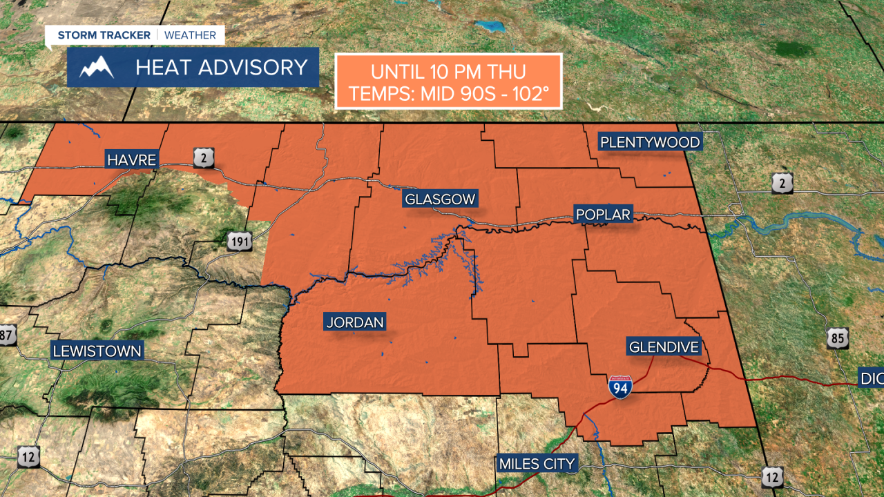
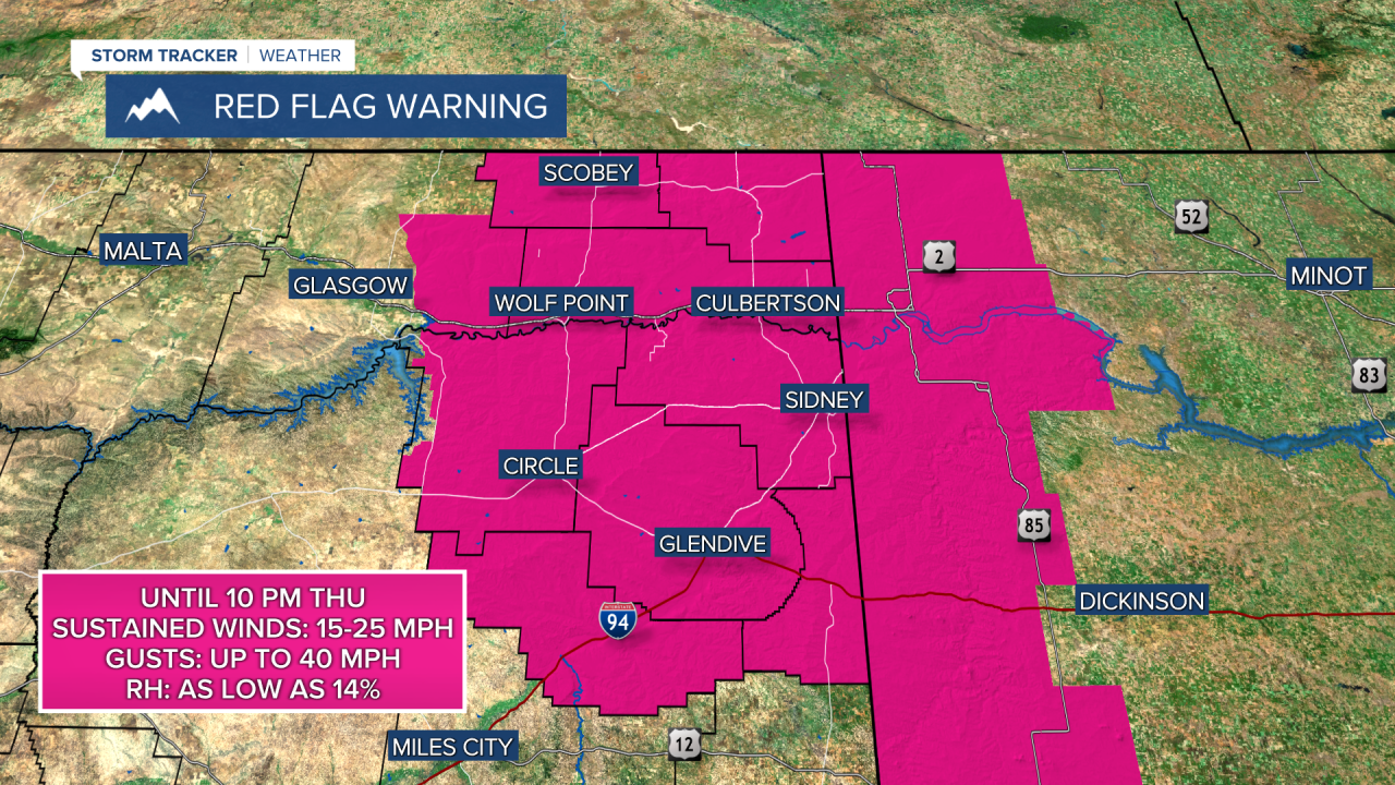
Red Flag Warnings continue in northeast Montana with gusty winds, low relative humidity, and hot temperatures in the 90s.
THURSDAY. MAY 28TH: Skies will be mostly sunny to partly cloudy. Highs will be the hottest of the week in the upper 80s to 90s across our area. An isolated storm or two is possible in the afternoon.
FRIDAY. MAY 29TH: Expect a bit more thunderstorm activity compared to Thursday. Scatter showers and storms will be around the area in the afternoon with partly cloudy skies.
Storms could be strong to severe on Friday. The Storm Prediction Center has already outlined an area in western Montana, including Helena and Great Falls, to see marginally severe storms with gusty winds and small hail.
This is expected to be the last day of temperatures in the 80s and 90s before slightly cooler air moves in for the weekend.
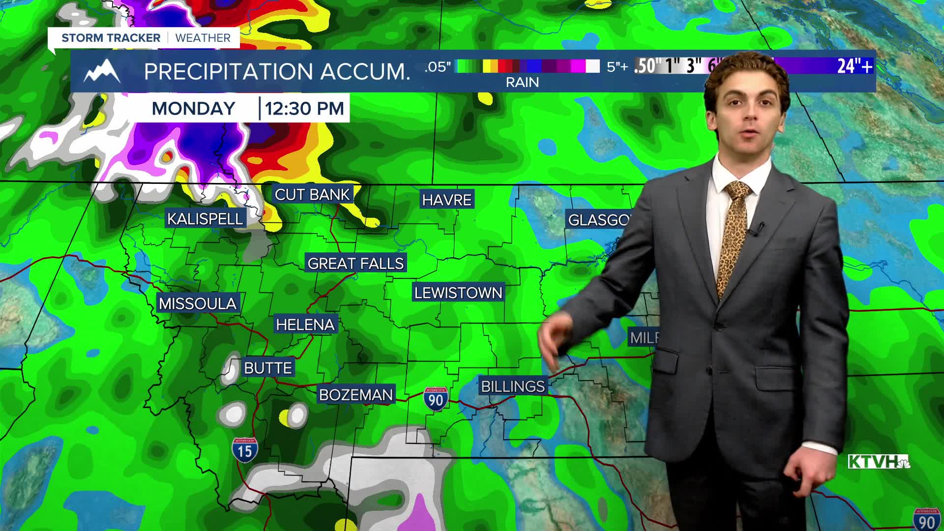
SATURDAY. MAY 30TH: A center of low pressure moves over the state, bringing widespread thunderstorms and showers to the area. Rain could accumulate several inches in northwest Montana. The Helena area will get a good, wetting rain as well.
Highs cool into the 60s and 70s.
LONG-RANGE FORECAST: Expect cooler temperatures for the weekend, but stormy conditions will stick around through the end of the month.
——————————————————————————————————————————
WEATHER ALERTS:
——————————————————————————————————————————
Helena Temperature Records Today:
High: 90 (1986)
Low: 27 (1995)
AVG: 70/45
Great Falls Temperature Records Today:
High: 95 (1936)
Low: 28 (1918)
AVG: 68/42


