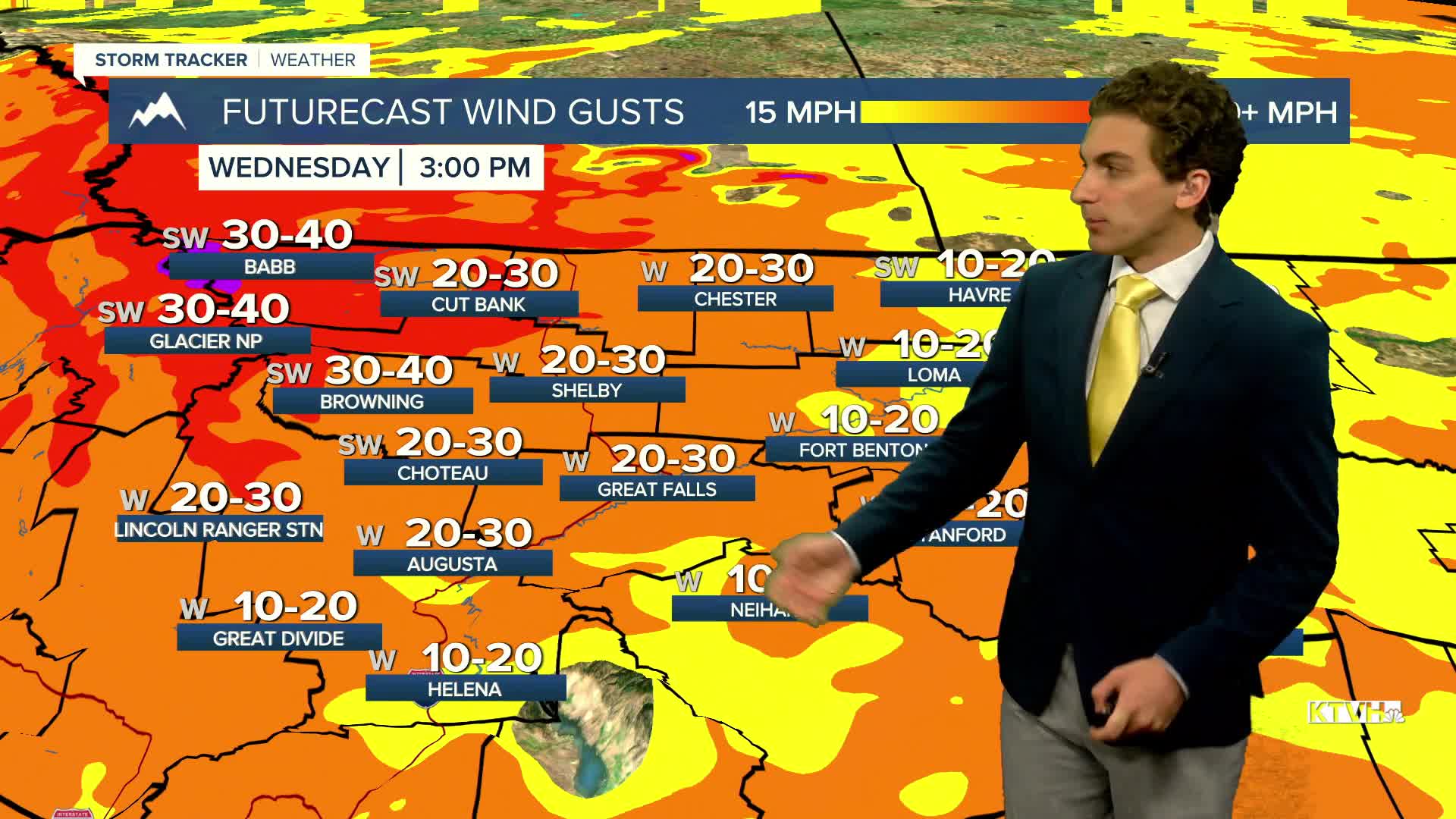


Fire weather danger increases today as temperatures rise into the upper 80s to low 90s across the state, wind picks up off the Rocky Mountain Front, and relative humidity drops. Current fires could spread more rapidly, and new ones could start. Stay vigilant over the coming days
The Venus and Jupiter conjunction took place earlier this morning as well. This will be visible in our eastern morning skies over the next few days. Additionally, the Perseid Meteor Shower is ongoing and peaks tonight, where you could view up to 100 meteors an hour.
Today will be mostly dry across the state, aside from a few thunderstorms forming in the Beartooth Mountains. Mostly sunny skies can be expected.
Wednesday will be the hottest day, with highs in the state ranging from the low to mid-90s.
Another cold front is expected to arrive from the north on Thursday, bringing cooler air and minimal precipitation. Highs dip back into the 70s and 80s across the state.
Towards the end of the week, thunderstorms are expected to return to the forecast, but they will be isolated in nature.
——————————————————————————————————————————
WEATHER ALERTS:
A FIRE WEATHER WATCH has been issued for the Beaverhead-Deerlodge National Forest from Wednesday afternoon until Wednesday evening
A FIRE WEATHER WATCH has been issued for the Salish and Kootenai Reservation from Wednesday afternoon until Wednesday evening
——————————————————————————————————————————
Helena Temperature Records Today:
High: 103 (1940)
Low: 41 (1987)
AVG: 86/54
Great Falls Temperature Records Today:
High: 105 (1940)
Low: 38 (1966)
AVG: 85/51
Have a great Tuesday!
Joey Biancone
Meteorologist


