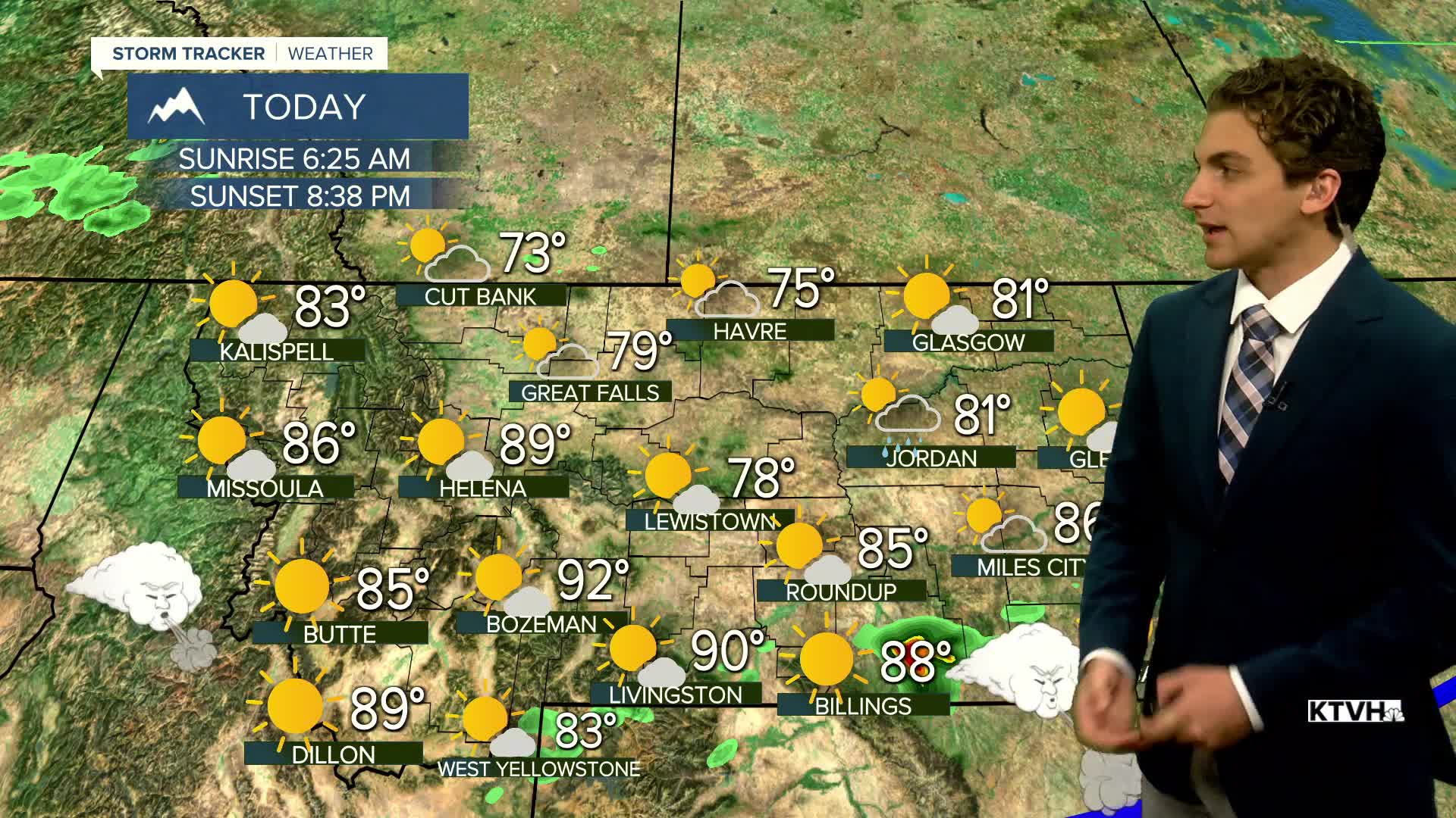


A cold front pushed through north-central Montana today, which will lower temperatures back into the 70s and 80s. It still will be hot and dry in the mountains of western Montana. Fire danger stays high today for many areas south of Helena.
Friday remains dry and mostly sunny. Some clouds move in late to western Montana. Highs will reach the mid-80s to low-90s across the state.
Some isolated thunderstorms are possible on Saturday as a small-scale weather system passes by to the north, bringing limited Pacific moisture. Temperatures remain in the 80s to low 90s.
The best chance for thunderstorms will be on Sunday with another upper-level disturbance coming in.
Next week will be hot again, with most locations returning to highs in the 90s by Monday and Tuesday with mostly dry conditions.
——————————————————————————————————————————
WEATHER ALERTS:
A RED FLAG WARNING has been issued for the Beaverhead-Deerlodge National Forest from noon Thursday until 9:00 PM Thursday
——————————————————————————————————————————
Helena Temperature Records Today:
High: 99 (2003)
Low: 36 (1995)
AVG: 86/54
Great Falls Temperature Records Today:
High: 101 (1971)
Low: 36 (1995)
AVG: 84/51
Have a great Thursday!
Joey Biancone
Meteorologist


