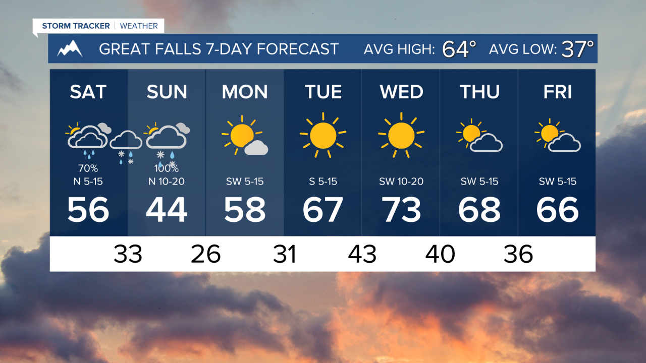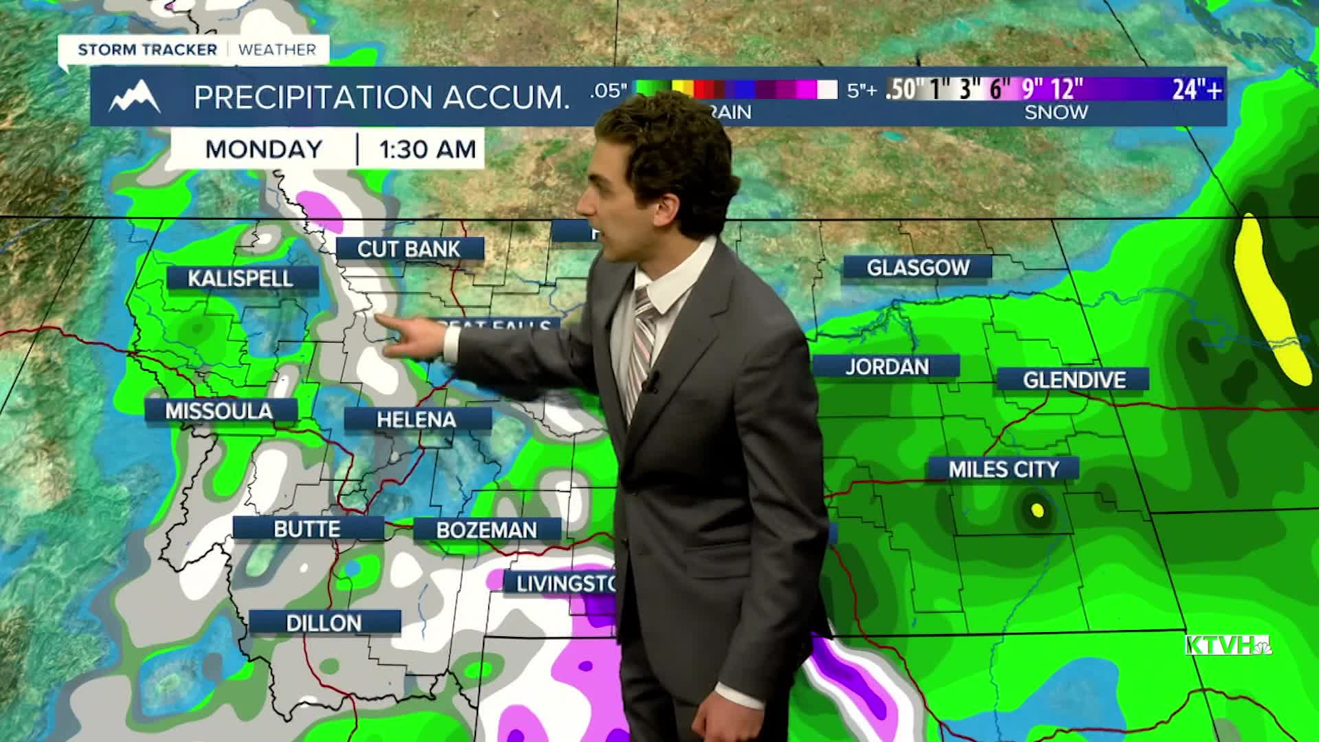


The weekend will be cloudy, rainy, and snowy for a good majority of Montana, with snow levels dropping close to most lower elevation locations by early Sunday morning.
Through the rest of the evening, temperatures will drop into the 40s with scattered rain showers around the Helena area.
A cold front from the north will move through the state Saturday afternoon and evening. This will lower snow levels and allow for some accumulation in the mountains. The freezing point is expected to lower to about 5-6k feet by Sunday morning, allowing for snow at mountain passes. Some flakes may fly in lower elevations as well, but accumulation is unlikely.
The first freeze for many lower elevations will come on Monday morning behind the storm system. Clear skies will allow for cooler morning temperatures next week.
Expect cold mornings and warming afternoon temperatures early next week under clear to mostly clear skies
——————————————————————————————————————————
WEATHER ALERTS:
A WINTER STORM WARNING has been issued for the East Glacier Park Region from midnight Saturday to noon Sunday
A WINTER STORM WARNING has been issued for the West Glacier Park Region from midnight Saturday to noon Sunday
A WINTER STORM WARNING has been issued for the Absaroka/Beartooth Mountains and Crazy Mountains from 6 AM Saturday to 6 PM Sunday
A WINTER WEATHER ADVISORY has been issued for the Gallatin and Madison County Mountains and Centennial Mountains from 6 PM Saturday to 6 PM Sunday
A WINTER WEATHER ADVISORY has been issued for the Highwood, Little Belt, Judith, and Snowy Mountains, and Southern Rocky Mountain Front from midnight Saturday to noon Sunday
A WINTER WEATHER ADVISORY has been issued for the Northern High Plains from midnight Saturday to noon Sunday
A WINTER WEATHER ADVISORY has been issued for the Potomac/Seeley Lake Region from midnight Saturday to noon Sunday
A WINTER WEATHER ADVISORY has been issued for the Butte/Blackfoot Region from midnight Saturday to noon Sunday
A WINTER WEATHER ADVISORY has been issued for the Pryor/Northern Bighorn Mountains from 6 PM Saturday to midnight Sunday
——————————————————————————————————————————
Helena Temperature Records Today:
High: 85 (2011)
Low: 18 (1999)
AVG: 65/39
Great Falls Temperature Records Today:
High: 91 (1943)
Low: 17 (1999)
AVG: 64/37