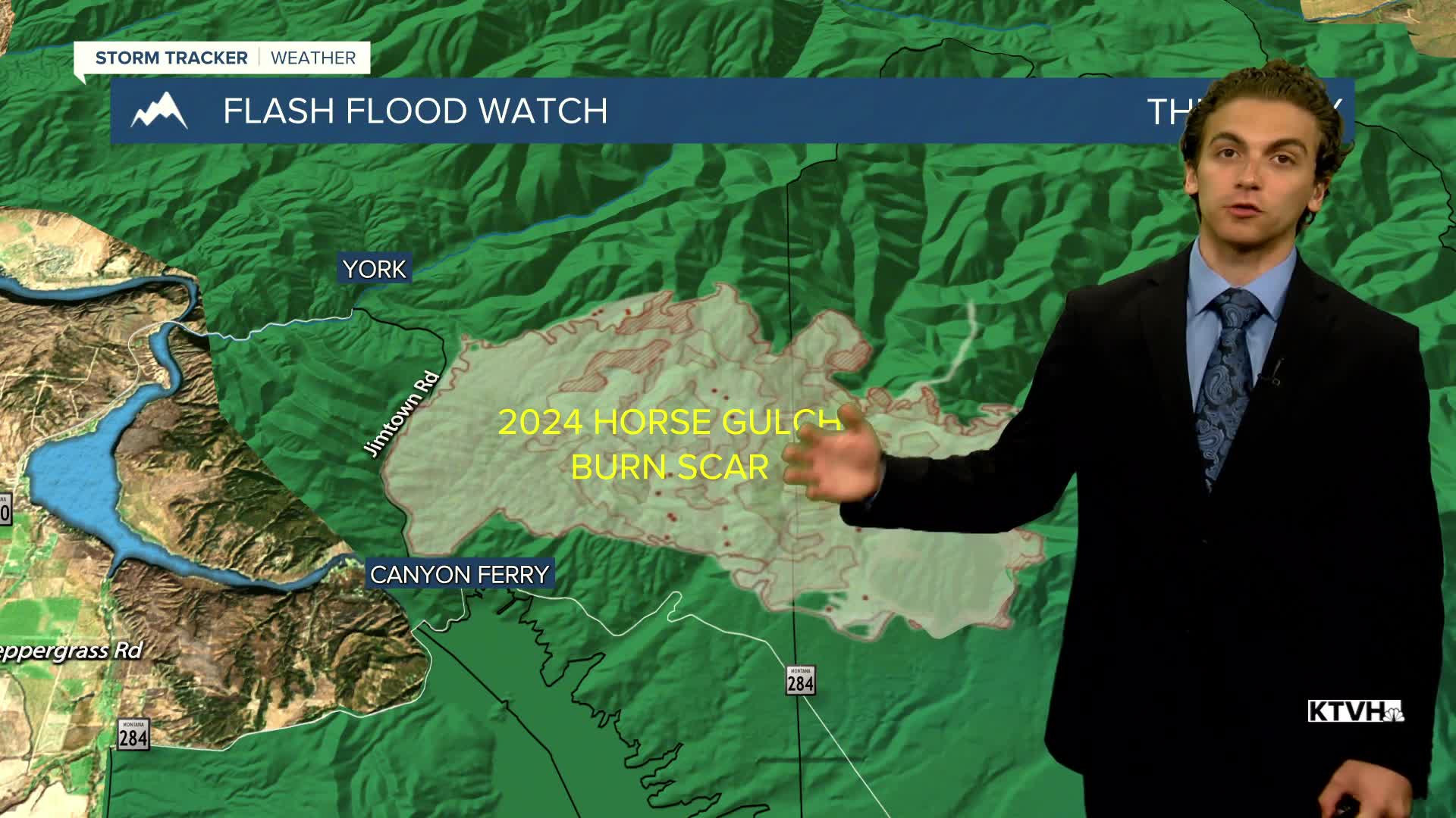


Widespread thunderstorm activity is expected this afternoon and evening in western Montana. Semi-stationary storms are expected over mountainous regions; therefore, a Flash Flood Watch has been issued in the Big Belts, east of Helena. The Horse Gulch Burn Scar is of particular concern.
NOTE: The Missoula radar is undergoing repairs until August 9th. There will be limited to no radar coverage west of the divide until then. Helena should not be impacted too much, as much of the coverage area is served by the Great Falls radar site.
Storms will move into Helena between 5 PM and 7 PM tonight and stick around after dark. A few storms may turn marginally severe with strong wind gusts and small hail, but I think the flash flood threat takes priority.
Scattered thunderstorms will develop across much of the same areas tomorrow. I think the flash flood threat will continue, as many thunderstorms will form due to the higher terrain and stay over the same areas for a while. They will develop in the early afternoon.
Thunderstorms become slightly less widespread on Saturday, concentrated mostly over north-central Montana. But there will still be a few storms around Helena.
There will be significantly fewer storms around on Sunday. It will probably be the nicest early August day with mostly sunny conditions. High temperatures over the course of the next four days will stay about the same in the mid-80s.
A cold front will move through the area on Monday, allowing another chance for scattered thunderstorms. Highs reach the upper 80s before the arrival of storms.
Drier conditions are expected for the middle of the week, but temperatures won't get too hot just yet. The upper 80s to low 90s are expected.
——————————————————————————————————————————
WEATHER ALERTS:
A FLASH FLOOD WATCH has been issued for the Big Belt, Bridger, and Castle Mountains and the Canyon Ferry area from Thursday afternoon until midnight Thursday
A FLOOD WATCH has been issued for Ravalli County from Thursday afternoon until midnight Thursday
——————————————————————————————————————————
Helena Temperature Records Today:
High: 101 (2022)
Low: 39 (1995)
AVG: 89/56
Great Falls Temperature Records Today:
High: 100 (1930)
Low: 42 (1968)
AVG: 87/53
Have a great Thursday
Joey Biancone
Meteorologist
