


Flooding was reported near the Horse Gulch Burn Scar, north of Canyon Ferry, yesterday evening. This prompted the Lewis and Clark County Sheriff's Office to close a majority of Jimtown Road. Great Falls had up to 6 inches of flowing water in roadways, turning streets into rivers. Additionally, there were other portions of Cascade and Chouteau County that experienced flash flooding overnight.
▶ WATCH: FLOODING VIDEO AND SEVERE WEATHER PICTURES FROM THURSDAY
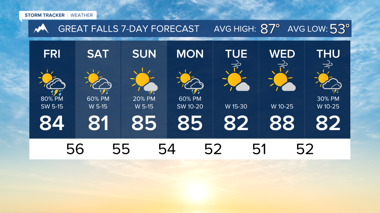
A similar day is expected, as another disturbance will enter southwest Montana early this afternoon. Thunderstorms will fire a little earlier than they did yesterday, around 1 PM to 3 PM. They will be slow-moving and produce heavy rain. There is also a marginal severe risk for gusty winds and small hail. Storms will move into the north-central plains in the early evening, lasting into the overnight.
A surface low develops overnight tonight in southern Canada that will change general storm movement from south-north to west-east on Saturday. Scattered storms will move through in the afternoon.
Sunday will be the nicest weekend day, with only some isolated storms around, with less of a flood threat.
However, a cold front blasts through the state on Monday, bringing another chance for scattered storms, especially in north-central Montana.
Temperatures throughout this period will remain in the low to mid 80s for highs, with overnight lows dropping into the 50s.
Drier weather returns for the middle of the week. Expect an increase in the wind on Tuesday and Wednesday.
——————————————————————————————————————————
WEATHER ALERTS:
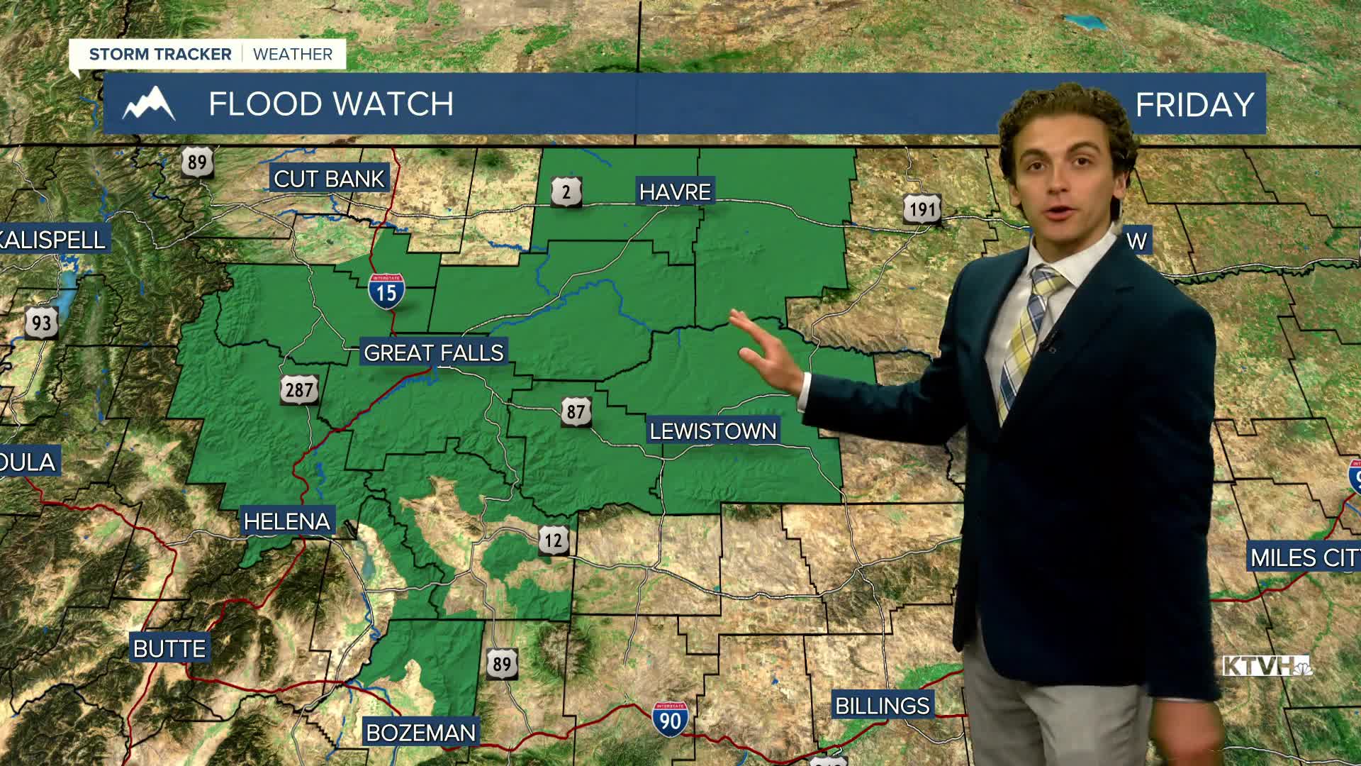
A FLOOD WATCH has been issued for Portions of central and north central Montana, including the following areas, in central Montana, Big Belt, Bridger and Castle Mountains, Gates of the Mountains, Helena Valley, Little Belt and Highwood Mountains, Snowy and Judith Mountains and Upper Blackfoot and MacDonald Pass. In north central Montana, Bears Paw Mountains and Southern Blaine, Cascade County below 5000ft, Eastern Pondera and Eastern Teton, Fergus County below 4500ft, Hill County, Judith Basin County and Judith Gap, Northern Blaine County, Southern High Plains, Southern Rocky Mountain Front and Western and Central Chouteau County from 2 PM Friday until midnight Friday
A FLOOD ADVISORY continues for central Phillips County until 11:30 AM Friday
——————————————————————————————————————————
Helena Temperature Records Today:
High: 102 (2022)
Low: 42 (1995)
AVG: 89/56
Great Falls Temperature Records Today:
High: 101 (2022)
Low: 38 (1999)
AVG: 87/53
Have a great and safe weekend
Joey Biancone
Meteorologist