A DENSE FOG ADVISORY continues for Helena Valley; Elkhorn and Boulder Mountains; Canyon Ferry Area; Missouri Headwaters; Gallatin Valley until 10 AM this morning
——————————————————————————————————————————
This morning, areas of thick fog were around the capital city. Visibility can be reduced significantly, particularly when traveling south of Helena. The fog will stick around for the next few hours. Due to cold air temperatures and a lowering cloud deck, the Weather Service issued a Dense Fog Advisory for the area.
Lows were down into the negatives in northeast Montana this morning. Single digits and teens were common for the rest of the state.
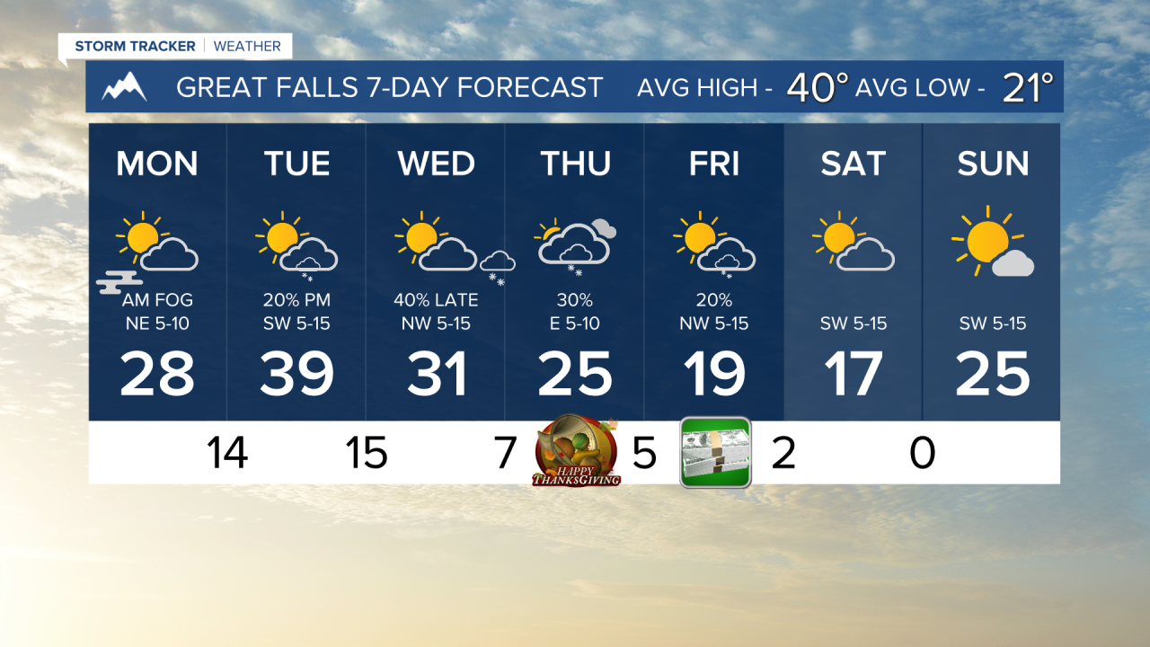
In the plains, highs will only reach the teens and 20s today. Helena and other higher elevation areas will be in the 30s and 40s this afternoon with partly cloudy skies.
There will be some isolated snow showers today. No lower elevation accumulation is expected, but a brief period of light snow cannot be ruled out for Helena and Great Falls.
Tomorrow, a small disturbance propagates along the Hi-Line which can cause a dusting of snow to blanket places like Havre and Cut Bank. Isolated snow showers will be around the mountains once again. Highs will be in the 30s and 40s once again.
Wednesday will be a mostly dry day and slightly colder. Another small disturbance moves from northwest to southeast across the plains beginning in the afternoon hours along the Hi-Line, reaching Great Falls by late in the night. That is where we could see up to 2 inches of snow in isolated locations.
Thanksgiving will be cold for much of the state as highs will only reach the 20s and 30s. Scattered snow showers and mostly cloudy conditions for most of Montana.
Helena Temperature Records Today:
High: 64 (1949)
Low: -15 (1985)
AVG: 39/20
Great Falls Temperature Records Today:
High: 67 (1914)
Low: -21 (1985)
AVG: 40/21
Have a great Monday!
Joey Biancone
Meteorologist
Facebook: Meteorologist Joey Biancone
Instagram: joeybianconewx
Email: joey.biancone@ktvh.com


