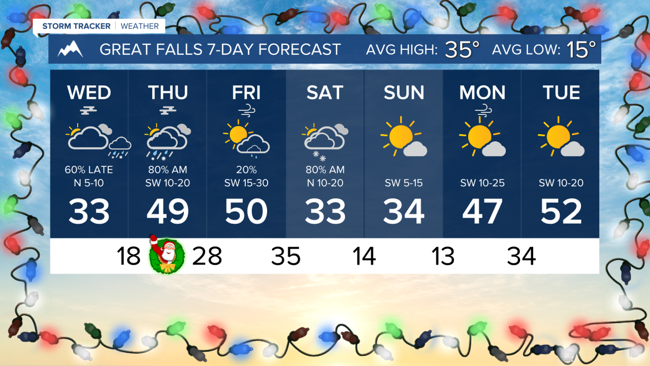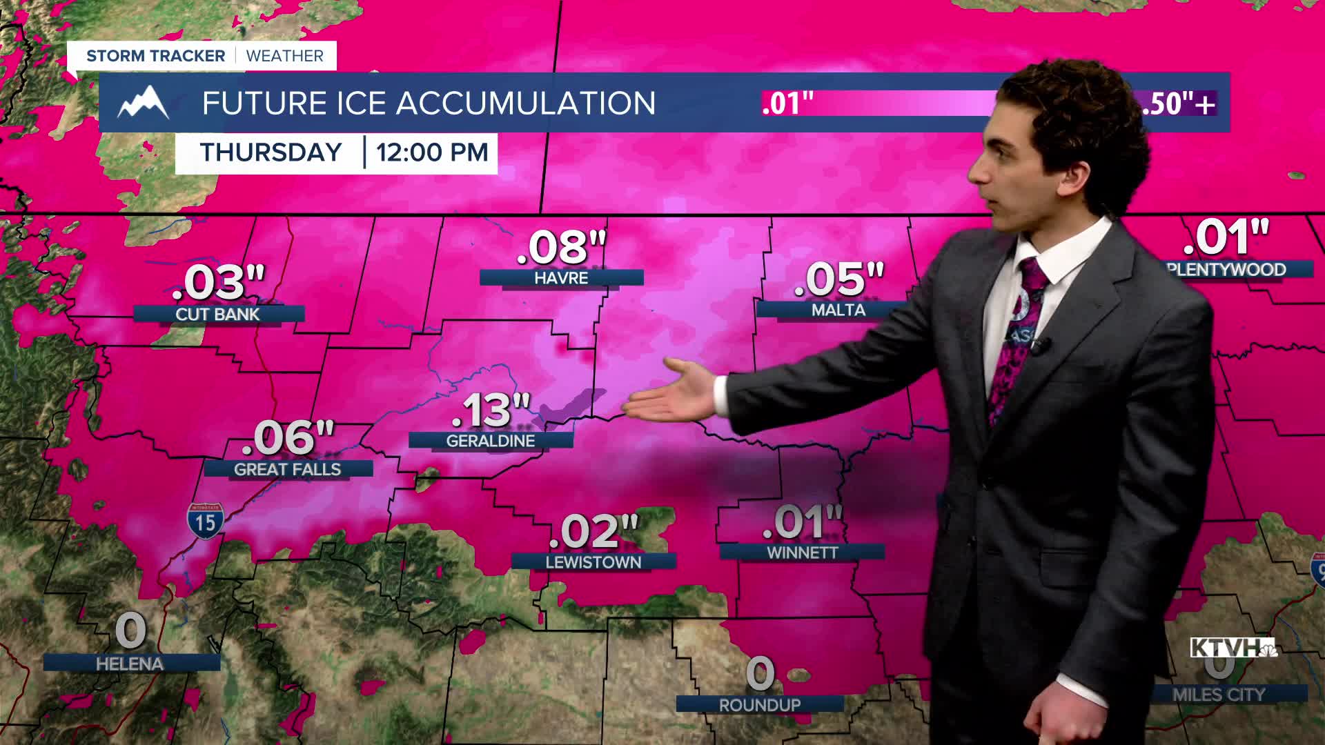


Light lower-elevation rain and mountain snow are expected to fall on Christmas Eve night. It is likely for ice to form on Christmas morning in north-central Montana.
A wave of moisture will begin to move in on Christmas Eve. Most lower elevations will see rain. The mountains above 7000 feet will get some snow. As warmer air moves over the shallow cold air mass in the plains, freezing rain will form heading into Christmas morning. A light glaze may be present on roadways around Great Falls and Havre, creating slick conditions.
The cold air mass will eventually move south into Helena on Saturday. Overnight lows across the state will range from the 0s to the 20s by Sunday morning. Highs will be in the teens and low 30s.
Warmer air is expected to return to much of the state next week, accompanied by overall dry conditions; however, inversions will still form in valleys like Helena, keeping our temperatures colder.
——————————————————————————————————————————
WEATHER ALERTS:
NWS Weather and Hazards Viewer
——————————————————————————————————————————
Helena Temperature Records Today:
High: 57 (1919)
Low: -37 (1983)
AVG: 31/13
Great Falls Temperature Records Today:
High: 58 (1950)
Low: -42 (1983)
AVG: 35/15