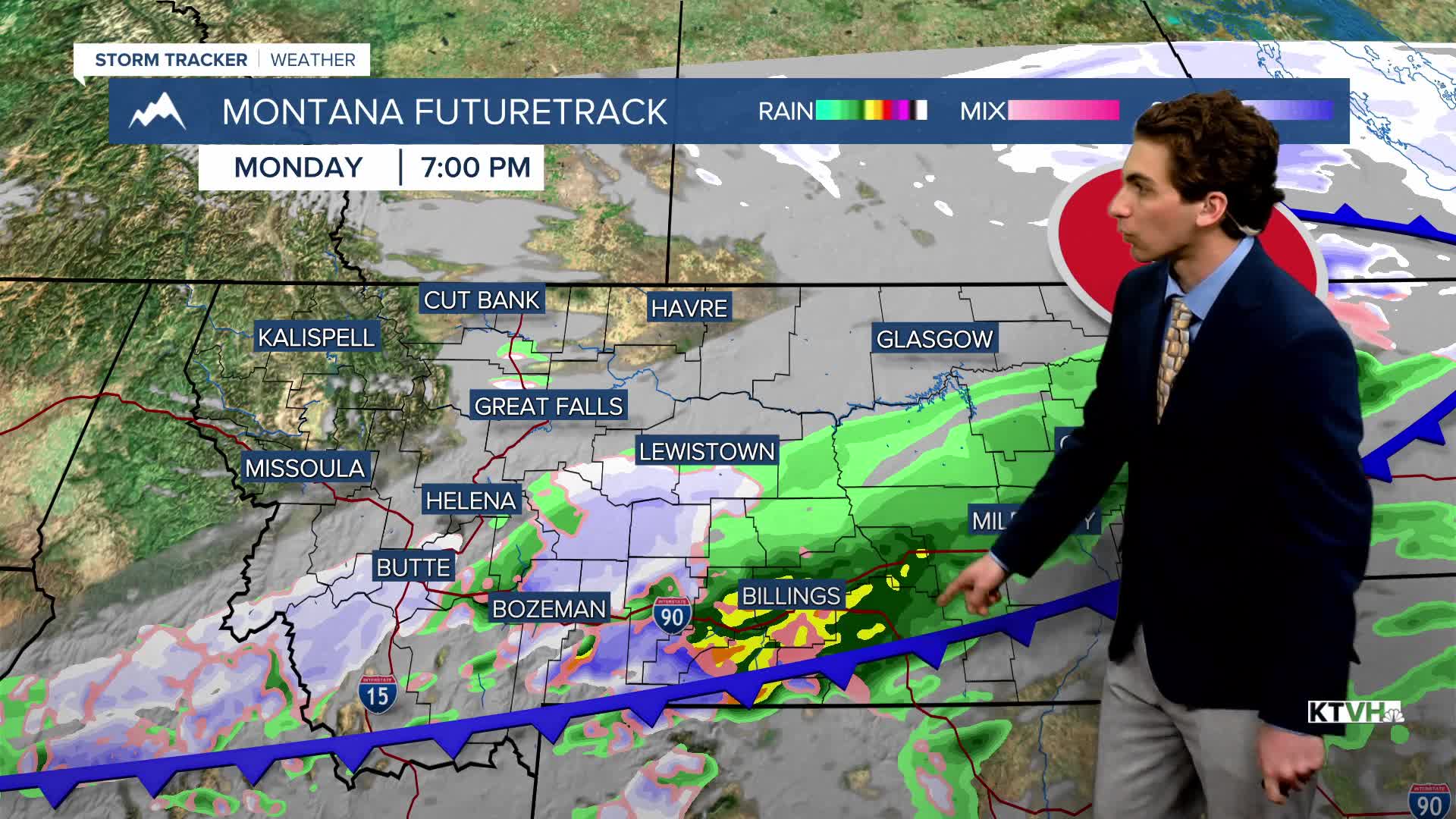


MONDAY, MARCH 30TH: A cold front moving through the state will bring scattered showers to the Helena area this morning. Expect rain in the valley, with a mix of rain/snow in the mountains. Most of the precipitation should advance to the southeast by noon.
Highs will only reach the 40s today before temperatures drop behind the cold front. Expect afternoon temperatures in the upper 30s to low 40s.
Wind will also pick up out of the northwest this afternoon, at about 15-30 MPH.
TUESDAY, MARCH 31ST: It will be cold tomorrow morning, with lows dipping to the teens and 20s. The day will start dry, but southwest winds aloft will bring scattered showers back to southwest Montana, as far north as Helena in the afternoon.
WEDNESDAY, APRIL 1ST: Morning lows will be in the 20s and low 30s. Highs reach the 50s under mostly cloudy skies. Rain showers will move in on Wednesday evening ahead of a low-pressure system. We will see a conversion to snow in the higher terrain by Wednesday night, with snow levels dropping progressively lower through the evening.
THURSDAY, APRIL 2ND: The way this low is tracking in current model runs, it is in a favorable position to bring lower elevation snow to the state. Highs will only reach the 30s and 40s. Precipitation will be around the area for most of the day. Lower elevations may see a rain-snow mix to begin the day, but by the afternoon, we should see the conversion to mostly snow. There will be some wind with this system as well, with gusts reaching about 30 MPH.
LONG-RANGE FORECAST: Snow continues into Friday morning before a warmer and drier easter weekend.
——————————————————————————————————————————
WEATHER ALERTS:


——————————————————————————————————————————
Helena Temperature Records Today:
High: N/A
Low: N/A
AVG: 52/29
Great Falls Temperature Records Today:
High: N/A
Low: N/A
AVG: 51/27


