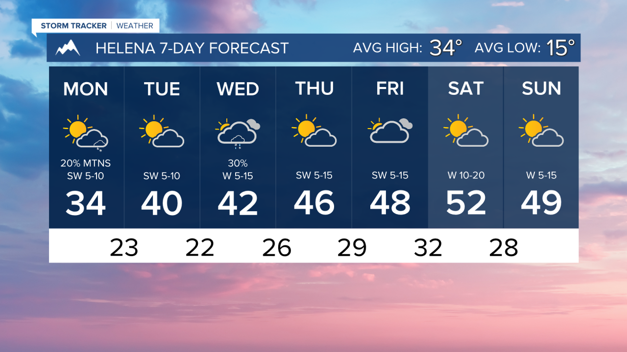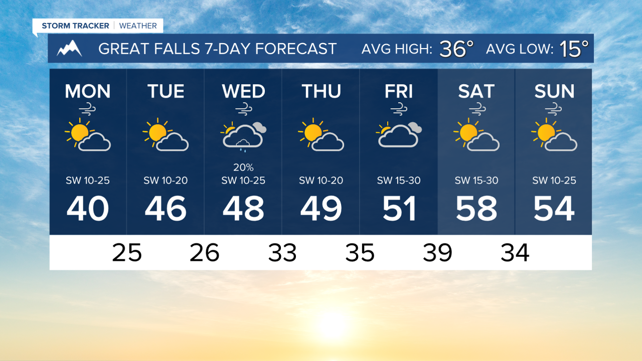


Warming conditions will replace the chilly air that we dealt with through the weekend. Some areas will be close to 60 degrees by the end of the week.
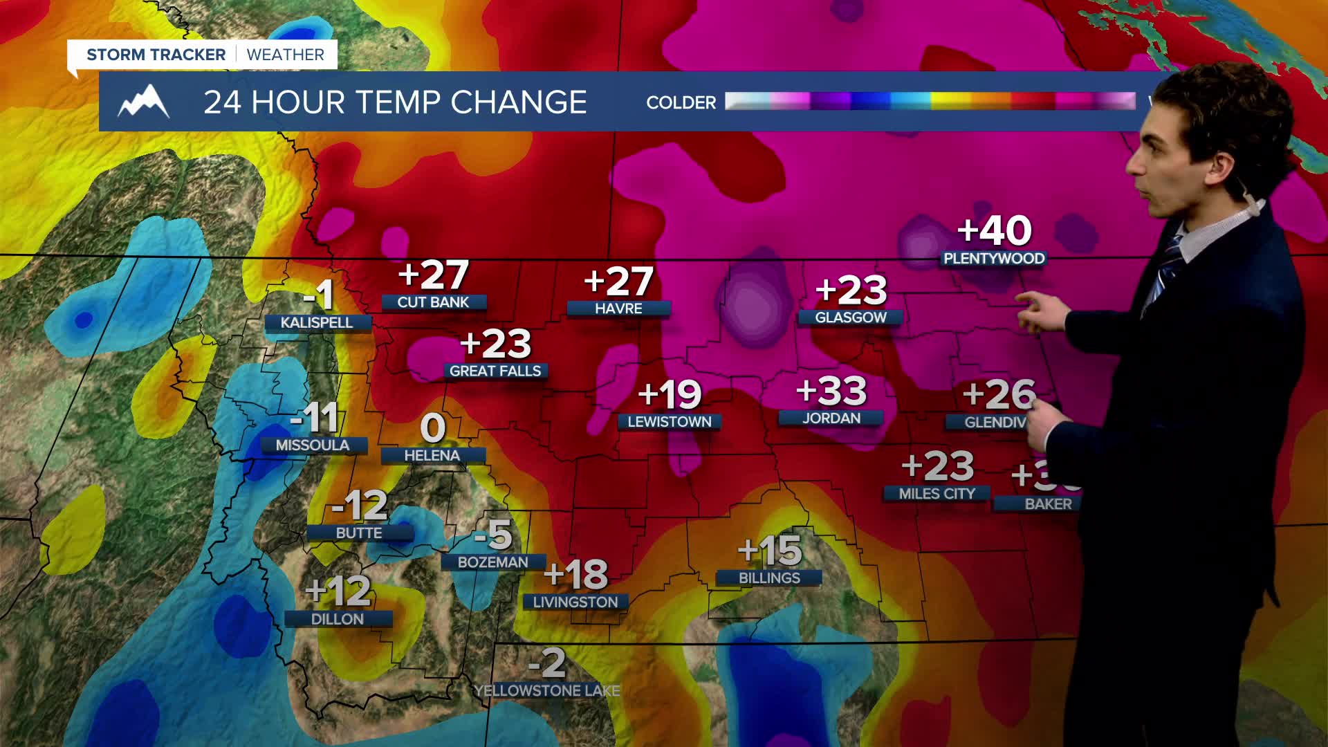
MONDAY, JANUARY 26TH: Although it is very cold again this morning for many locations, the arctic air will begin to push out today. Helena will warm up close to the freezing point. Highs in north-central Montana will creep up close to 40°. Expect increasing cloud cover into this afternoon and evening.
Wind in north-central Montana will be breezy, around 15-25 MPH. Isolated areas of blowing snow may impact travel.
There may be a brief snow shower in the mountains around Helena tonight. Accumulation will be minimal, if anything at all.
A stationary boundary has set up just to the west of Havre, and is aligned towards the southeast. This separates the true arctic air and will persist through most of the week.
TUESDAY, JANUARY 27TH: Temperatures continue to warm, with most areas west of Havre warming into the 40s. Dry conditions with some passing clouds are expected. Winds will be around 10-20 MPH in the north-central plains.
WEDNESDAY, JANUARY 27TH: A cold front will move through the state. This will bring some scattered snow and rain showers. High temperatures will reach the upper 30s to mid 40s. Showers will arrive west of the divide by the morning, spreading east of the divide by the afternoon.
THURSDAY, JANUARY 28TH: Temperatures will be about 10-20 degrees above normal with dry air coming back. Most areas will be in the 40s, but some locations in more wind-prone areas could be near the low 50s.
LONG-RANGE FORECAST: Wamrer and drier weather will stick around through the end of January and into the beginning of February.
——————————————————————————————————————————
WEATHER ALERTS:
A HIGH WIND WARNING continues for the Beartooth Foothills and Livingston Area until 3 PM Monday
A HIGH WIND WARNING continues for the Melville Foothills and Northern Sweet Grass until 3 PM Monday
——————————————————————————————————————————
Helena Temperature Records Today:
High: 57 (2003)
Low: -41 (1957)
AVG: 34/15
Great Falls Temperature Records Today:
High: 67 (2015)
Low: -37 (1916)
AVG: 36/15