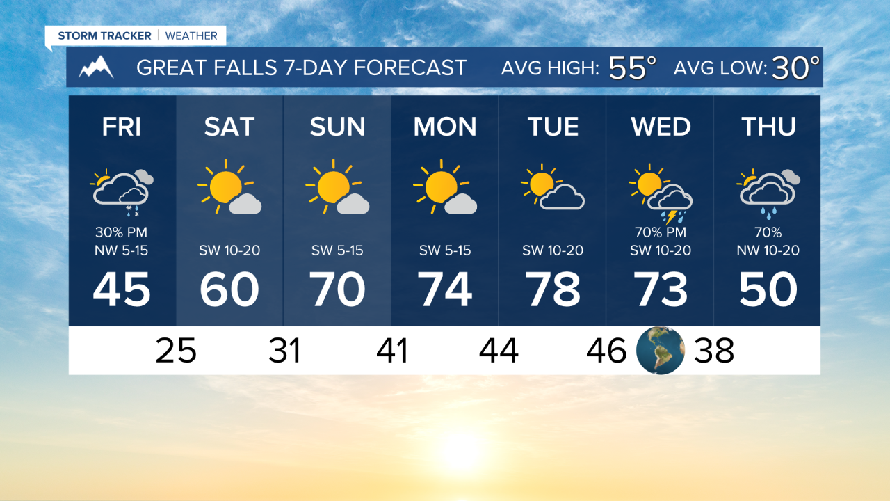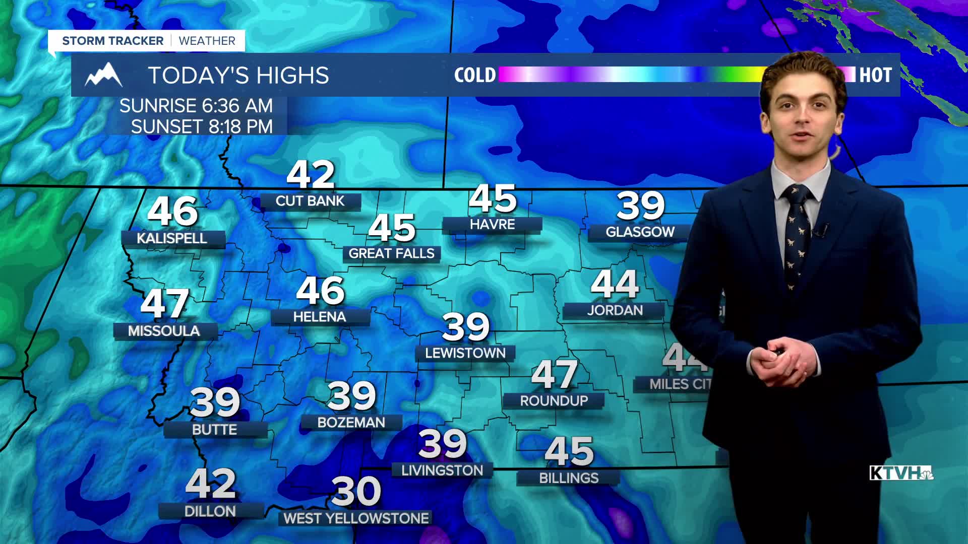


FRIDAY, APRIL 17TH: It's cold and cloudy this morning. Lows across the plains are in the teens and 20s. The Helena area is in the 20s and 30s.
Scattered to numerous snow showers will form over the mountains in the early afternoon and last through this evening. The mountains could pick up 1-2" where heavier showers form. Watch out for slick roads over the higher terrain. A couple of the showers may move over the north-central plains and the Helena Valley at times. I don't expect much automation, if any at all.
Winds will be on the lighter side for most of the area, but I can't rule out a stray 20-30 MPH gust this afternoon in the Helena Valley.
SATURDAY, APRIL 18TH: Clouds and precipitation will move out by Saturday morning. Morning lows will be cold with temperatures in the 20s. Afternoon temperatures will warm up to the 50s and low 60s under mostly sunny conditions. Winds will be out of the southwest at 5-15 MPH.
SUNDAY, APRIL 19TH: Temperatures continue to warm on Sunday under mostly sunny conditions and light southwest winds. Highs will reach the upper 60s to low 70s.
MONDAY, APRIL 20TH: Similar to the weekend, Montana will continue to warm as a ridge of high pressure builds over the state. Mostly sunny skies will allow high temperatures to reach the mid to upper 70s. Winds will be out of the west at 5-15 MPH.
LONG-RANGE FORECAST: The weekend will be warmer and drier. Another storm system will move in towards the middle of next week.
——————————————————————————————————————————
WEATHER ALERTS:
NONE
——————————————————————————————————————————
Helena Temperature Records Today:
High: 80 (1994)
Low: 9 (1896)
AVG: 57/33
Great Falls Temperature Records Today:
High: 82 (1936)
Low: 12 (1968)
AVG: 55/30