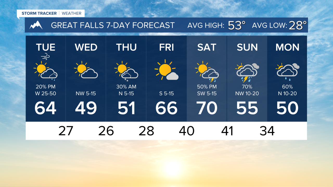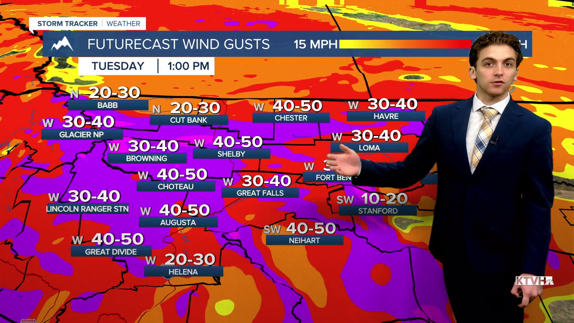


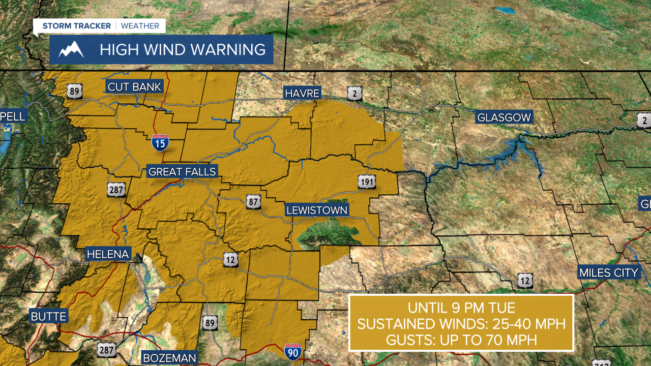
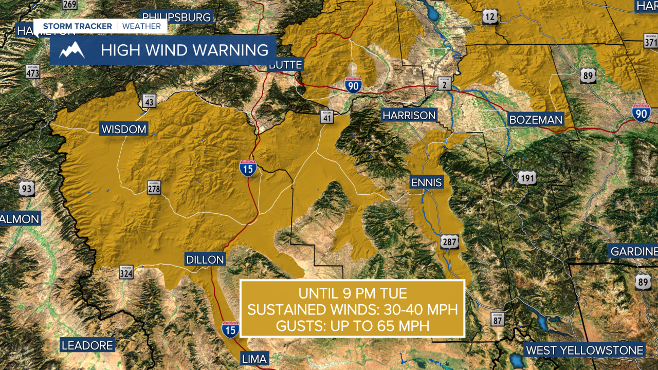
TUESDAY, APRIL 7TH: A strong wind event is set to unfold this afternoon through most of the state. A low-pressure system with an associated cold front will move just north of our state. This, combined with strong mid-level winds, will enhance surface-level winds. Gusts could reach up to 70 MPH in lower elevations, with the Rocky Mountain Front gusting to near 90 MPH at times.
Expect partly cloudy skies for most of the day. A little more cloud cover may be present on and east of the Rocky Mountain Front. The wind will push high temperatures into the mid to upper 60s.
Most of the day will be dry, but a few rain showers will form along the cold front as it moves from northwest to southeast in the afternoon and evening. A few showers and a thunderstorm or two may also form in southwest Montana.
WEDNESDAY, APRIL 8TH: Winds will die down in the morning throughout central Montana, but will still be gusty throughout the afternoon in the eastern portion of the state. Temperatures will be cooler behind the front, with morning lows in the 20s and 30s. Afternoon highs will only reach the 40s and 50s.
A few morning snow showers will impact northeast Montana on the backside of the low-pressure system. Impactful accumulation is not expected.
THURSDAY, APRIL 9TH: A shortwave disturbance bringing isolated rain and snow showers will move through north-central Montana on Thursday. This may bring snowflakes in the morning, but it is not likely that this snow will stick. Morning lows will be in the 20s and 30s again. Highs will reach the 50s.
FRIDAY, APRIL 10TH: Friday will be a beautiful day with highs warming into the 60s for most areas, with a few spots potentially hitting 70 under mostly sunny conditions. A couple of thunderstorms will move into southwest Montana. These should stay south of I-90.
LONG-RANGE FORECAST: Another storm system begins to influence the state on Saturday afternoon. Moist southwest flow ahead of a center of low will bring air temperatures in the 60s and 70s with scattered thunderstorms. There will be some wet weather around on Sunday as well, with cooler temperatures.
——————————————————————————————————————————
WEATHER ALERTS:


——————————————————————————————————————————
Helena Temperature Records Today:
High: 77 (1930)
Low: 7 (1923)
AVG: 54/30
Great Falls Temperature Records Today:
High: 81 (1930)
Low: 4 (1982)
AVG: 53/28