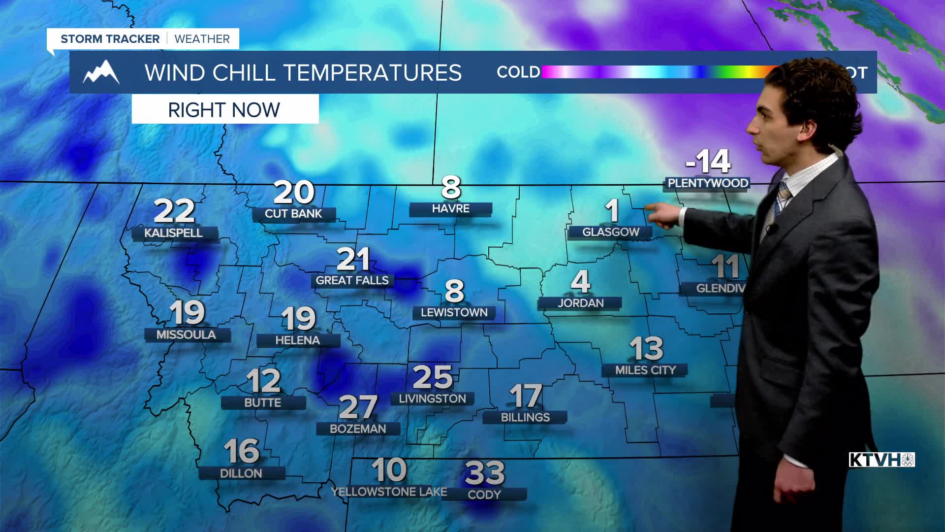


Lows in the panhandle of Florida dipped into the teens this morning, while a large portion of Montana continues to warm after the weekend cold.
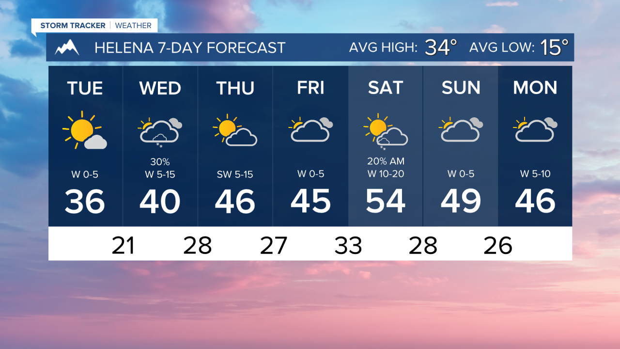
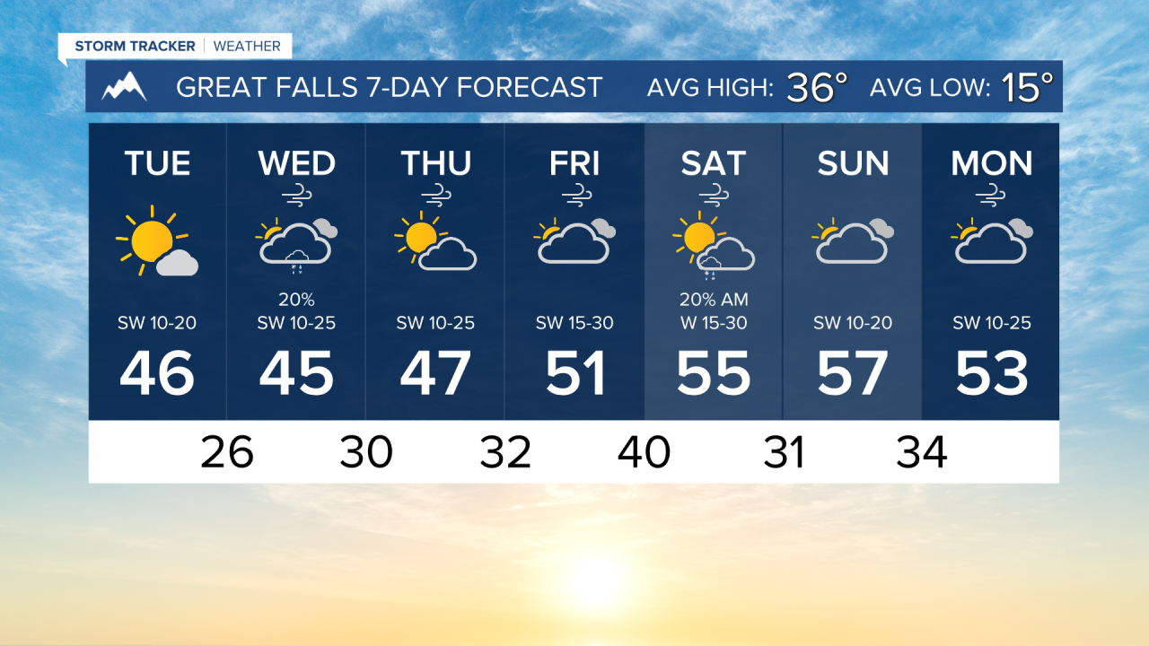
TUESDAY, JANUARY 27TH: Temperatures continue to warm, with most areas west of Havre warming into the 40s. Dry conditions with some passing clouds in the morning are expected, with sunshine in the afternoon. Winds will be around 10-25 MPH in the north-central plains.
WEDNESDAY, JANUARY 27TH: A cold front will move through the state. This will bring some scattered snow and rain showers, mainly to the mountains. High temperatures will reach the upper 30s to mid-40s. Showers will arrive west of the divide by the morning, spreading east of the divide by the afternoon.
THURSDAY, JANUARY 28TH: Temperatures will be about 10-20 degrees above normal with dry air coming back. Most areas will be in the 40s, but some locations in more wind-prone areas could be near the upper 40s. Some light snow will develop along the stationary boundary in northeast Montana. Around an inch or two may accumulate around the Glasgow area.
FRIDAY, JANUARY 29TH: Expect a day similar to Thursday near the Helena and Great Falls areas, aside from a little more cloud cover. Eastern Montana will dry out.
LONG-RANGE FORECAST: Warmer and drier weather will stick around through the end of January and into the beginning of February.
——————————————————————————————————————————
WEATHER ALERTS:
NONE
——————————————————————————————————————————
Helena Temperature Records Today:
High: 56 (1983)
Low: -37 (1957)
AVG: 34/15
Great Falls Temperature Records Today:
High: 64 (2015)
Low: -40 (1916)
AVG: 36/15