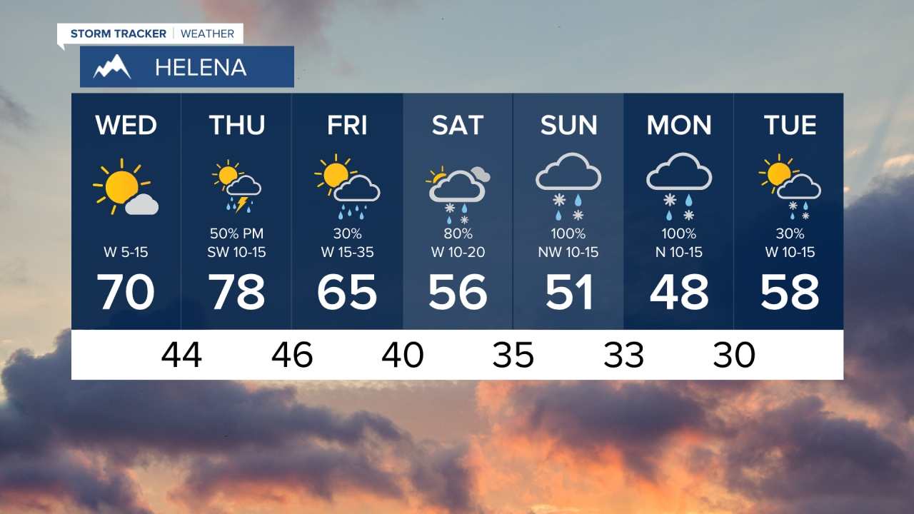
Believe it or not, there was one day back in April when temperatures soared into the 70s and 80s. Overall the month of April was the coldest since 1997, and there have not been too many warm days. Well get ready for a return of the 70s and 80s. Wednesday will be a beautiful spring day across most of the state. Skies will be mostly sunny, wind will be fairly light, and temperatures will warm into the 60s and 70s. Thursday will be even warmer with highs in the 70s and 80s. Southwest wind will be a little stronger and a cold front will kick off showers and thunderstorms late in the day in western and north central Montana. Our warm up will be short lived. Friday it's back to showers, clouds and cooler temperatures. Mother's Day Weekend will be cooler with more showers and higher elevation snow as well. A new area of low pressure will spread rain showers and mainly higher elevation snow on Saturday. It's more unsettled than downright stormy. Mother's Day on Sunday will be cooler with highs in the 40s and 50s. Some snow may mix down with the rain in the lower elevations. The mountains once again could have a few inches of snow. There is the likelihood that wet and cool weather will continue into Monday and Tuesday with more snow in the mountains and a mix of rain and snow in the lower elevations. Cool and active weather with more chances of much needed precipitation will continue through the middle of May. Even average precipitation would be great for the drought conditions. At the very least it does not look like the drought will worsen through this month.
Have a great day.
Curtis Grevenitz
Chief Meteorologist


