


A HIGH WIND WARNING continues for north central Montana, east of the Continental Divide through 12 PM Wednesday.
A HIGH WIND WATCH continues for MacDonald Pass, Big Belt, Little Belt and Highwood Mountains through 12 PM Wednesday.
A WIND ADVISORY continues for areas west of the Continental Divide through 9 PM Wednesday.
——————————————————————————————————————————
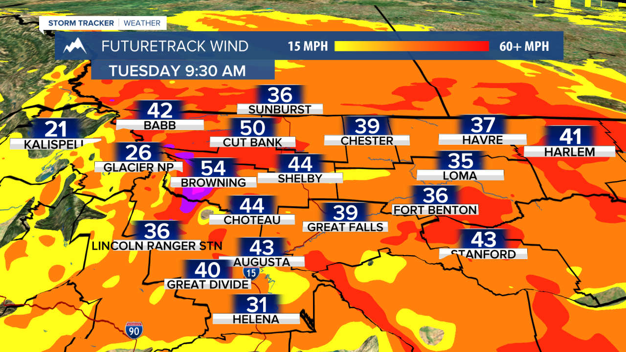
An area of low pressure to our north will be the engine driving strong wind speeds for much of the state today and tomorrow. wind gusts of over 50 MPH are likely, especially tomorrow.

That same system will bring showers and storms to a lot of communities today, especially along the cold front as it passes through Helena around 1-3 PM. Cloud cover will start to decrease after the frontal passage, and wind will increase. Temperatures will be in the mid to upper 60s for the highs.
The potential for the strongest wind gusts will be tomorrow. Isolated gusts of over 75 MPH are possible near the Rocky Mountain Front. Most places will be dry with just some isolated light showers in higher elevations. Temperatures will be similar to today's.
A ridge of high pressure will build in on Wednesday and last through the weekend. Mostly dry and warm conditions will be present, along with minimal cloud cover. There is a good chance on Thursday and Friday that we crack the mid 80s here in Helena.
Helena Temperature Records Today:
High: 94 (2021)
Low: 31 (1987)
AVG: 71/46
Great Falls Temperature Records Today:
High: 93 (2021)
Low: 33 (1943)
AVG: 69/44
Have a great Monday!
Joey Biancone
Meteorologist
Facebook: Meteorologist Joey Biancone
Instagram: joeybianconewx
Email: joey.biancone@ktvh.com
