


Strong winds will blow throughout central Montana today, as several areas are expected to approach record high temperatures.
MONDAY, JANUARY 12th: A jet streak aloft will bring strong downslope winds to the plains. Wind gusts could exceed 80 MPH at times near the Rocky Mountain Front. Widespread 50 to 60 MPH gusts will be recorded at times from Cut Bank to Havre to Livingston.
The Helena Valley will take a little while for the wind to mix down to the surface, but once it does, we will see our temperatures shoot up into the mid to upper 50s.
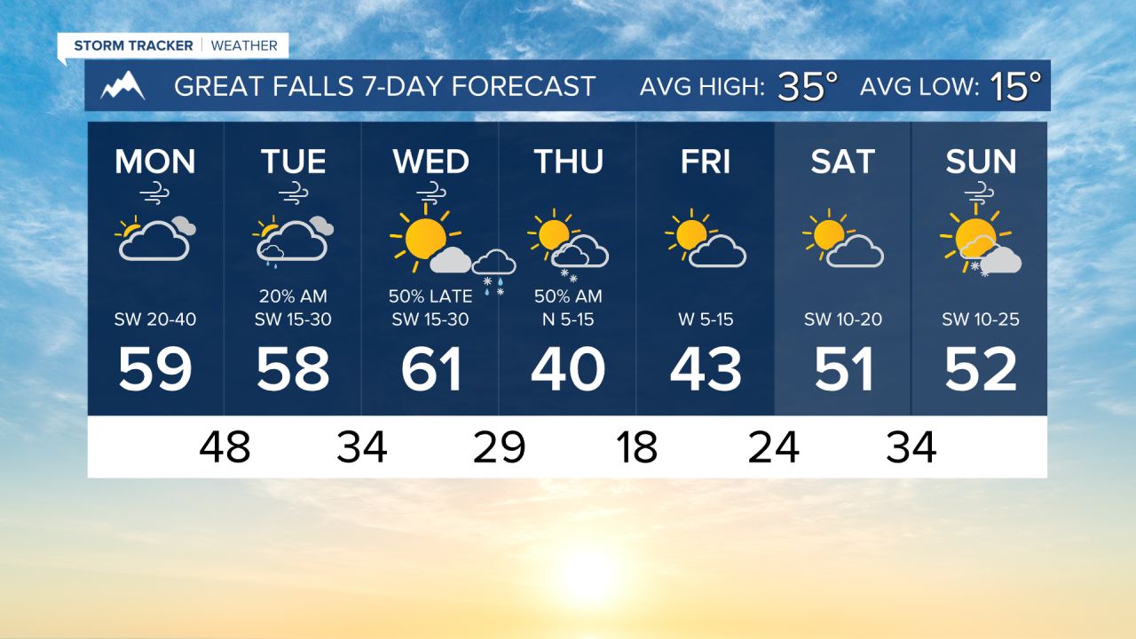
The air continues to warm with the stronger wind. Highs will reach the 50s and low 60s for most locations. There is the potential for record-breaking highs today, and on Tuesday and Wednesday as well.
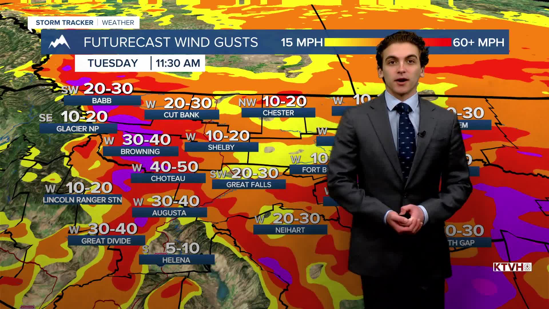
TUESDAY, JANUARY 13th: Strong, gusty winds will continue through the plains through at least the first half of the day. The winds will start to calm as we head towards Tuesday evening.
Record highs will be approached again, as most of the state reaches a maximum temperature in the upper 50s to low 60s.
A couple of light rain showers will move through central Montana in the early morning. They will mainly stay in the mountains and have almost no impact on most of us.
WEDNESDAY, JANUARY 14th: The third day of potential record highs will be highlighted by plenty of sunshine with highs in the upper 50s to low 60s yet again.
A cold front will come through late Wednesday night, which will start to bring cooler air back to our area. There may be a few snow showers along this front, but overall staying light with minimal accumulation.
THURSDAY, JANUARY 15th: Highs will only reach the upper 30s to low 40s as a brief period of slightly above normal temperatures returns to the state. The skies will be partly cloudy after a round of light morning snow showers comes through.
LONG-RANGE FORECAST: Warmer air will return to the plains by the weekend, but valleys are looking to be stuck in inversions. Highs will reach the 50s in the plains, while the valleys will be in the 30s and 40s.
——————————————————————————————————————————
WEATHER ALERTS:
A HIGH WIND WARNING continues for the Rocky Mountain Front and adjacent foothills and plains, and Eastern Glacier, Western Toole, and Central Pondera Counties until 9 PM Monday
A HIGH WIND WARNING continues for Eastern Toole and Liberty Counties, Eastern Pondera and Eastern Teton Counties, Hill County, Northern Blaine County, Western and Central Chouteau County, Bears Paw Mountains and Southern Blaine, Cascade County below 5000ft, Judith Basin County and Judith Gap, and Fergus County below 4500ft until 9 PM Monday
A HIGH WIND WARNING continues for Upper Blackfoot and MacDonald Pass until 9 PM Monday
A HIGH WIND WARNING continues for Judith Gap, Southern Wheatland, and Melville Foothills until midnight Monday
A HIGH WIND WARNING continues for Northern Sweet Grass County until midnight Monday
A HIGH WIND WARNING continues for Phillips County until 8 AM Tuesday
A WIND ADVISORY continues for the Beartooth Foothills and Livingston Area until 11 AM Tuesday
——————————————————————————————————————————
Helena Temperature Records Today:
High: 57 (1959)
Low: -33 (1997)
AVG: 32/13
Great Falls Temperature Records Today:
High: 62 (1959)
Low: -36 (2024)
AVG: 35/15