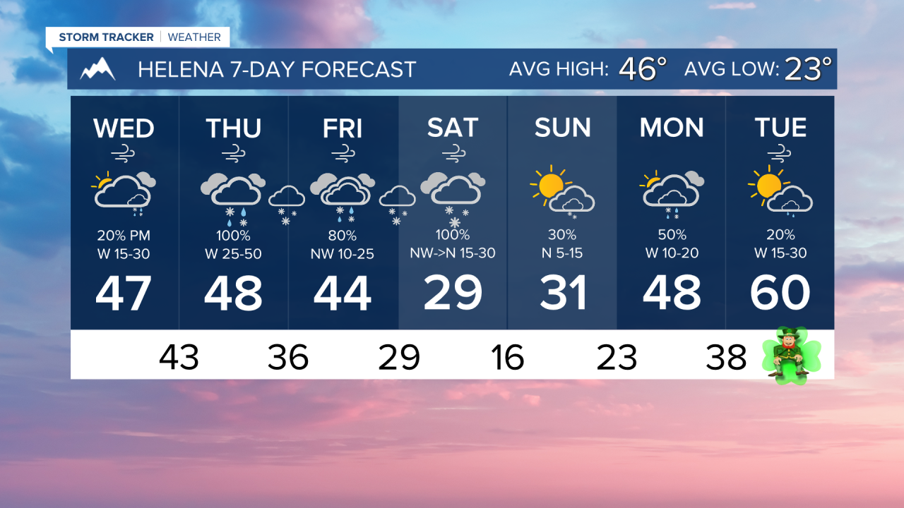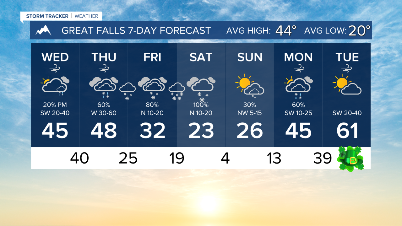


WEDNESDAY, MARCH 11TH: The day starts off cold with lows in the teens and 20s under partly cloudy skies. Moisture moves over the Continental Divide later today, producing heavy snow over the higher terrain west of Helena.
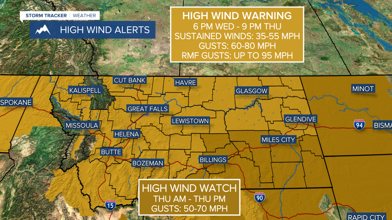
Highs reach the 40s today with increasing cloud cover and winds this afternoon. Wind gusts will reach 40-50 MPH through north-central Montana by the early afternoon and will remain strong overnight. The Helena Valley will be very windy as well. High wind warnings will start to take effect by 6 PM on Wednesday night.
The lower-elevations of Helena should remain mostly dry today, but heavy snow will fall west of town near MacDonald Pass.
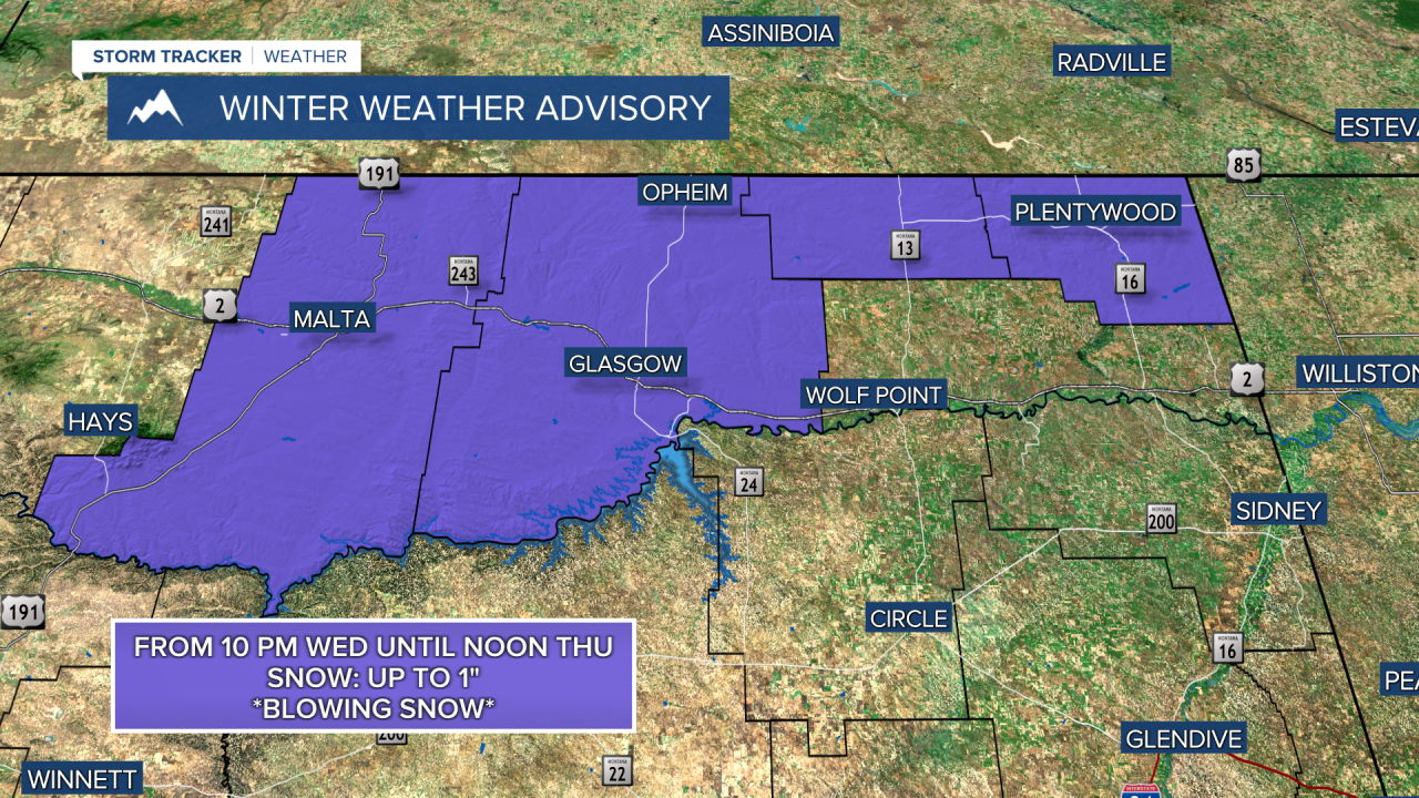
A warm front moving from the southwest to the northeast throughout the day will bring rain and light snow to parts of central and eastern Montana. The Glasgow area is expected to receive light snow, with an accumulation of around an inch overnight. With winds picking up, this could create areas of blowing snow tomorrow morning.
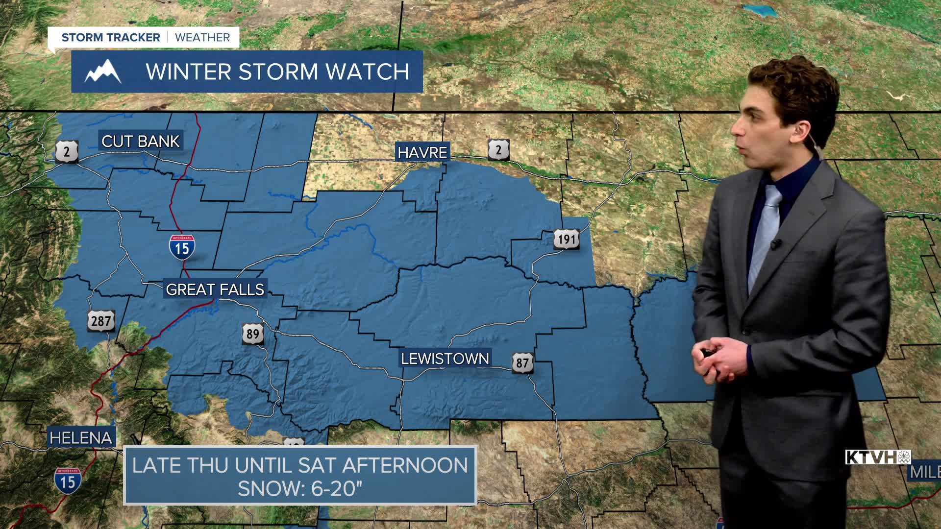
THURSDAY, MARCH 12TH: We are expecting another high wind event. Wind gusts will range from 50 to 80 MPH for all lower elevations, with locally higher gusts possible. With the recent stresses on trees and infrastructure from Sunday's wind, more power outages and damage are possible.
Rain and snow will fall, especially in the mountains where feet of snow are expected. Lower elevations will see a rain/snow mix at times. The sheer amount of moisture coming in with this system should overcome the downslope winds in most areas, which usually would create drier conditions. This is not going to be a day when you'll want to be outdoors.
Highs reach the upper 40s in the morning, with temperatures dropping in the afternoon.
A cold front from the north will begin to push into the state in the afternoon, bringing relief to the winds from north to south. Pacific moisture will overrun this front to create rain and snow in the plains.
FRIDAY, MARCH 13TH: An atmospheric river will continue to impact the state, dropping heavy snow in the mountains. Lower elevations will see a rain/snow mix south of where the cold front stalls out, and light to moderate snow north of the front. This front is expected to stall near the central island mountain ranges. Snowfall rates will pick up on Friday night. Highs will reach the 30s and 40s for most areas.
SATURDAY, MARCH 14TH: The cold front will continue its trek southward through the state Saturday morning, bringing moderate to heavy snow to lower elevations. Snow totals combining Friday and Saturday could be significant in north-central Montana. A few inches of snow may fall in the Helena area as well. Temperatures will continue to decrease as highs only reach the 20s and 30s. Snow moves out of the area late Saturday night
LONG-RANGE FORECAST: Colder temperatures stick around through Sunday. Another small disturbance passes through the state on Monday, bringing a mix of rain and snow. Temperatures warm rapidly heading into St. Patrick's Day.
——————————————————————————————————————————
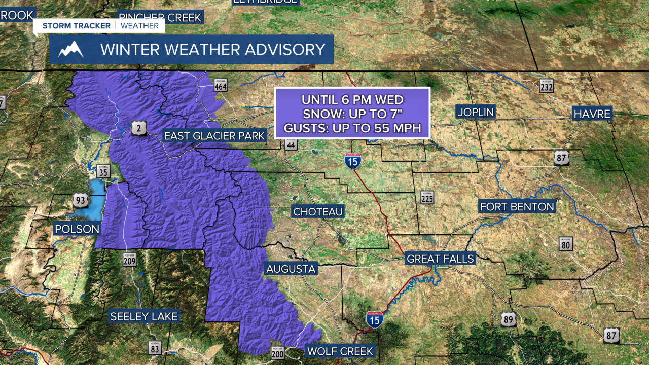
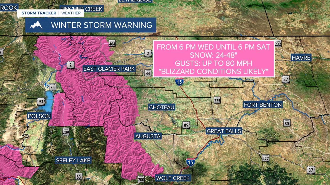
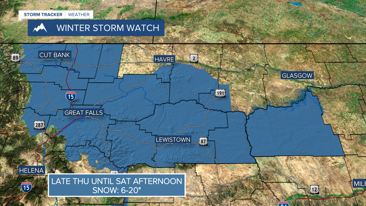
WEATHER ALERTS:


——————————————————————————————————————————
Helena Temperature Records Today:
High: 69 (2005)
Low: -16 (1969)
AVG: 46/23
Great Falls Temperature Records Today:
High: 70 (1916)
Low: -29 (1932)
AVG: 44/20