


Wet weather continues to push towards the southeast along a cold front tonight. Some lower elevations could wake up to a touch of snow tomorrow morning.
MONDAY, FEBRUARY 23RD: Warmer conditions move throughout the state today with increasing west and southwest winds. Highs will reach the upper 40s to mid 50s. Wind gusts will be around 20-30 MPH in north-central Montana. Helena will have slightly less wind. Some areas of blowing snow are possible near the Rocky Mountain Front.
Heavy snow will fall on the Continental Divide throughout the day, with an atmospheric river influencing it. Be careful traveling over mountain passes such as Marias Pass over the coming days.
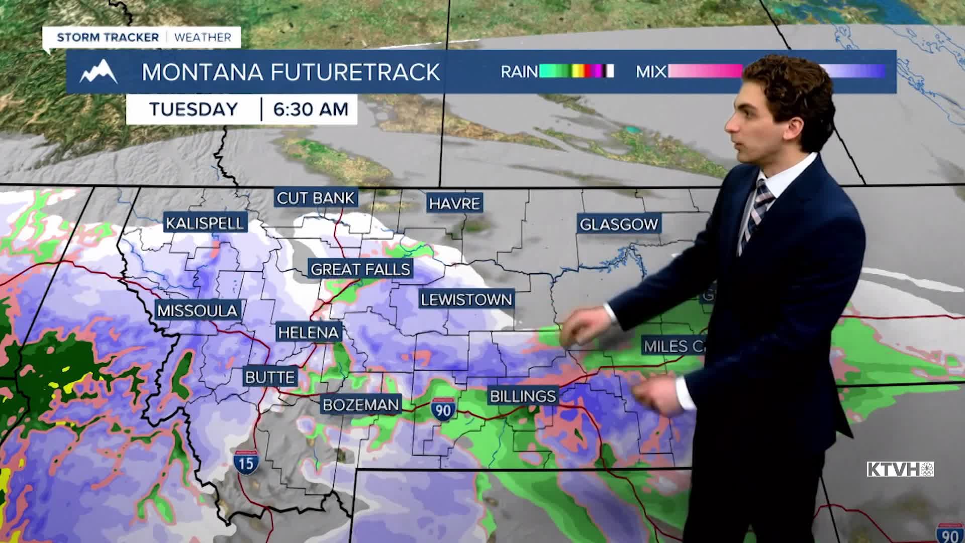
A cold front will move in from the northwest tonight, bringing light precipitation back to lower elevations. Light rain will begin after dark in north-central Montana, moving into the Helena area around midnight. We will see the conversion over to snow by early tomorrow morning with minimal accumulation. Watch out for slick and slushy roads for the Tuesday morning commute.
TUESDAY, FEBRUARY 24TH: Rain and snow showers will be around the southern half of the state for most of the day. Expect snow converting over to rain near the Helena area tomorrow morning, with scattered showers in the afternoon. Heavy snow is expected in the Beartooth Mountains, with up to 2 feet accumulating through Wednesday.
Winds scale down briefly on Tuesday. with gusts around 10-20 MPH in the plains. Wind will be light in the Helena Valley.
Temperatures will also be slightly cooler with highs in the upper 30s to 40s.
WEDNESDAY, FEBRUARY 25TH: A High Wind Watch has been issued for most of central Montana. Gusts will be around 60-85 MPH in the plains of north-central Montana. The Helena Valley will have gusts around 65 MPH. The wind will be strongest in the afternoon.
Highs will reach the 40s for most locations. with mostly sunny skies.
THURSDAY, FEBRUARY 26TH: Winds are expected to be the strongest on Thursday. Gusts could be approaching 60-70 MPH for much of north-central Montana and the Helena Valley. The Rocky Mountain Front has the potential to gust around 100 MPH.
Highs will reach the upper 40s and low 50s. A chinook arch cloud will develop over the plains.
——————————————————————————————————————————
WEATHER ALERTS:
NWS WEATHER AND HAZARDS VIEWER
——————————————————————————————————————————
Helena Temperature Records Today:
High: 60 (2009)
Low: -22 (1922)
AVG: 40/19
Great Falls Temperature Records Today:
High: 63 (1921)
Low: -25 (2022)
AVG: 39/16


