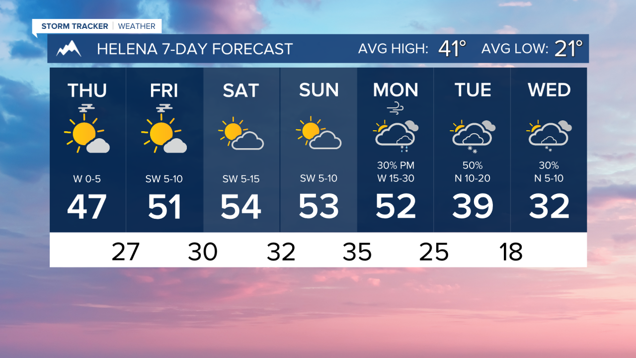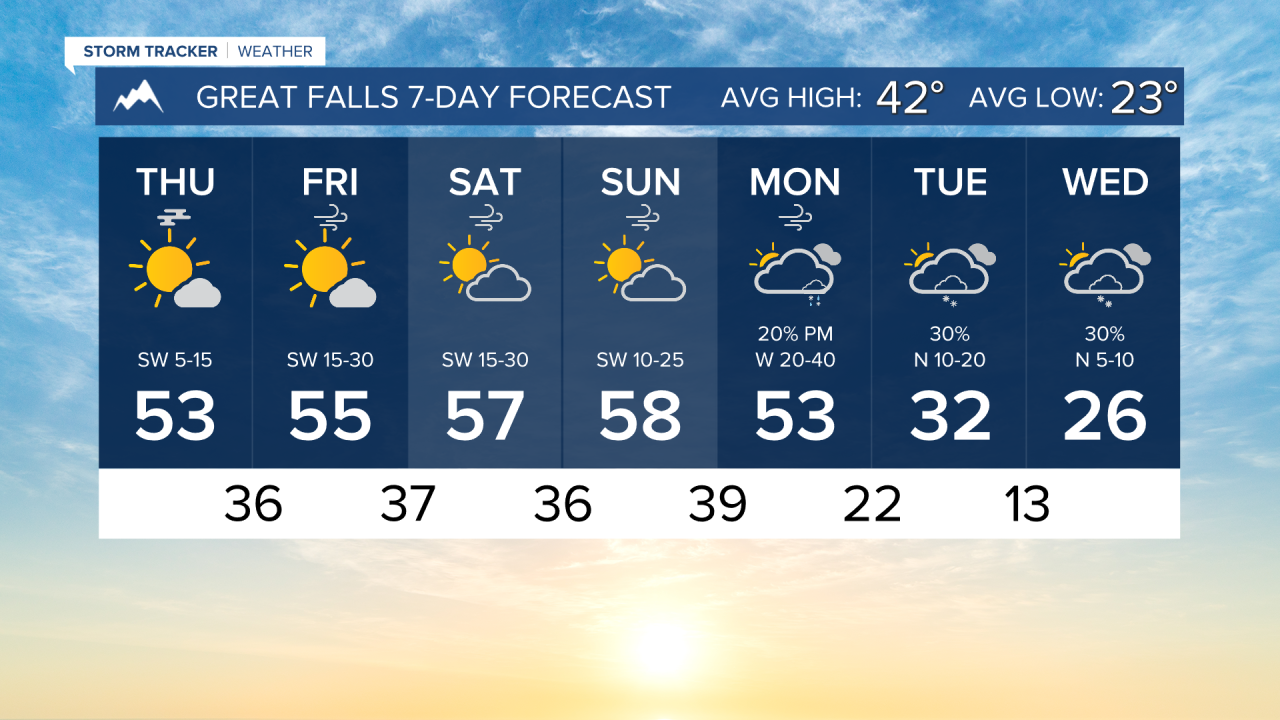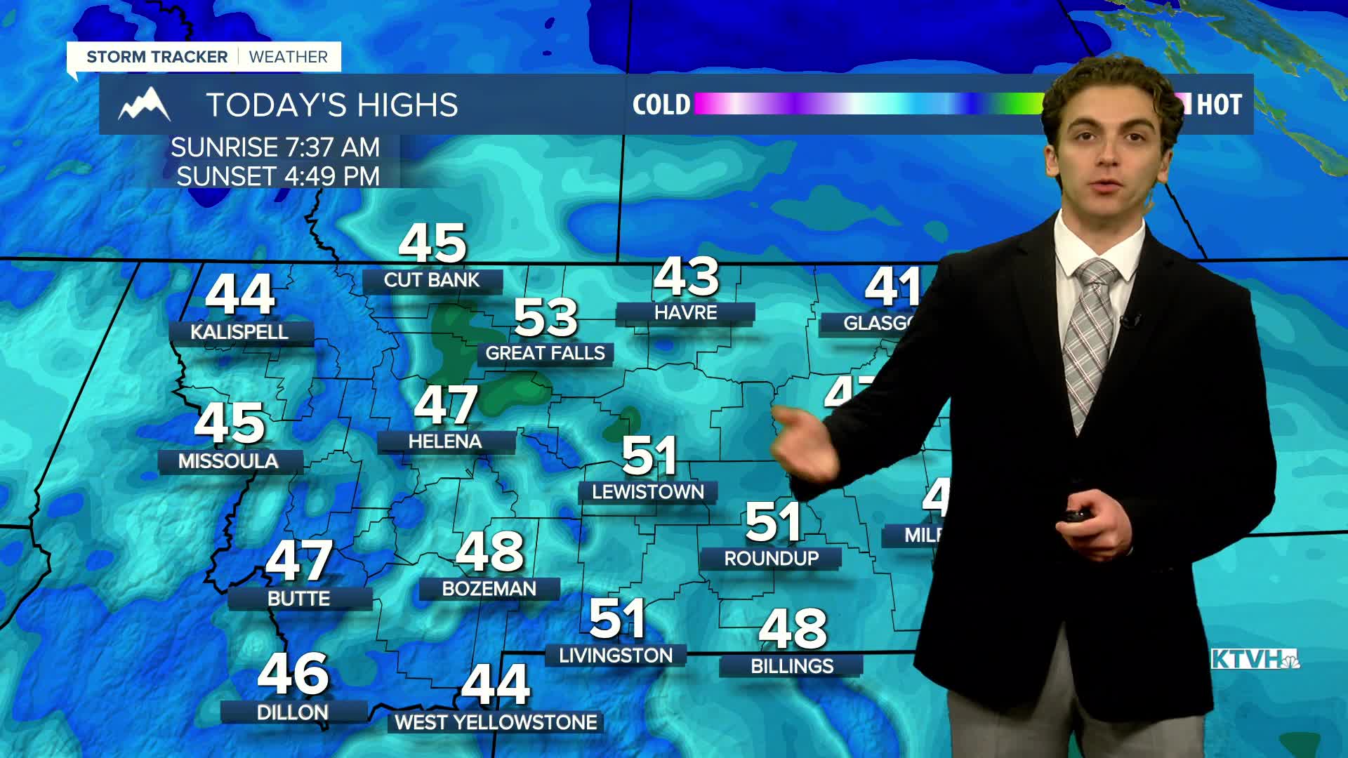


Fog and ice cover the mountains around the Helena area, making travel difficult in the higher terrain around town. Skies will clear by the afternoon, leaving us under plenty of sunshine.
Highs today will only reach the 40s, with some isolated spots reaching the low 50s.
Temperatures will warm a few degrees each day throughout the weekend. Reaching the mid to upper 50s by Sunday.
Wind will pick up along the Rocky Mountain Front on Friday. Gusts exceeding 60 MPH are possible near the mountains. The north-central plains will see wind gusts from 30-50 MPH through Monday. The Helena Valley will only have light wind until a cold front arrives on Monday.
Light snow will accompany the cold front on Monday and last into Tuesday. The coldest temperatures of the season so far will impact the state during Thanksgiving week. Highs will only reach the 20s and 30s, while lows dip into the single digits and teens.
——————————————————————————————————————————
WEATHER ALERTS:
A DENSE FOG ADVISORY continues for Central and Southern Valley and Western Roosevelt Counties until 10 AM Thursday
——————————————————————————————————————————
Helena Temperature Records Today:
High: 64 (1966)
Low: -17 (1900)
AVG: 41/21
Great Falls Temperature Records Today:
High: 67 (1936)
Low: -19 (1900)
AVG: 42/23