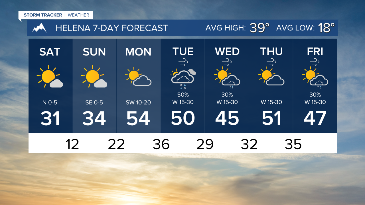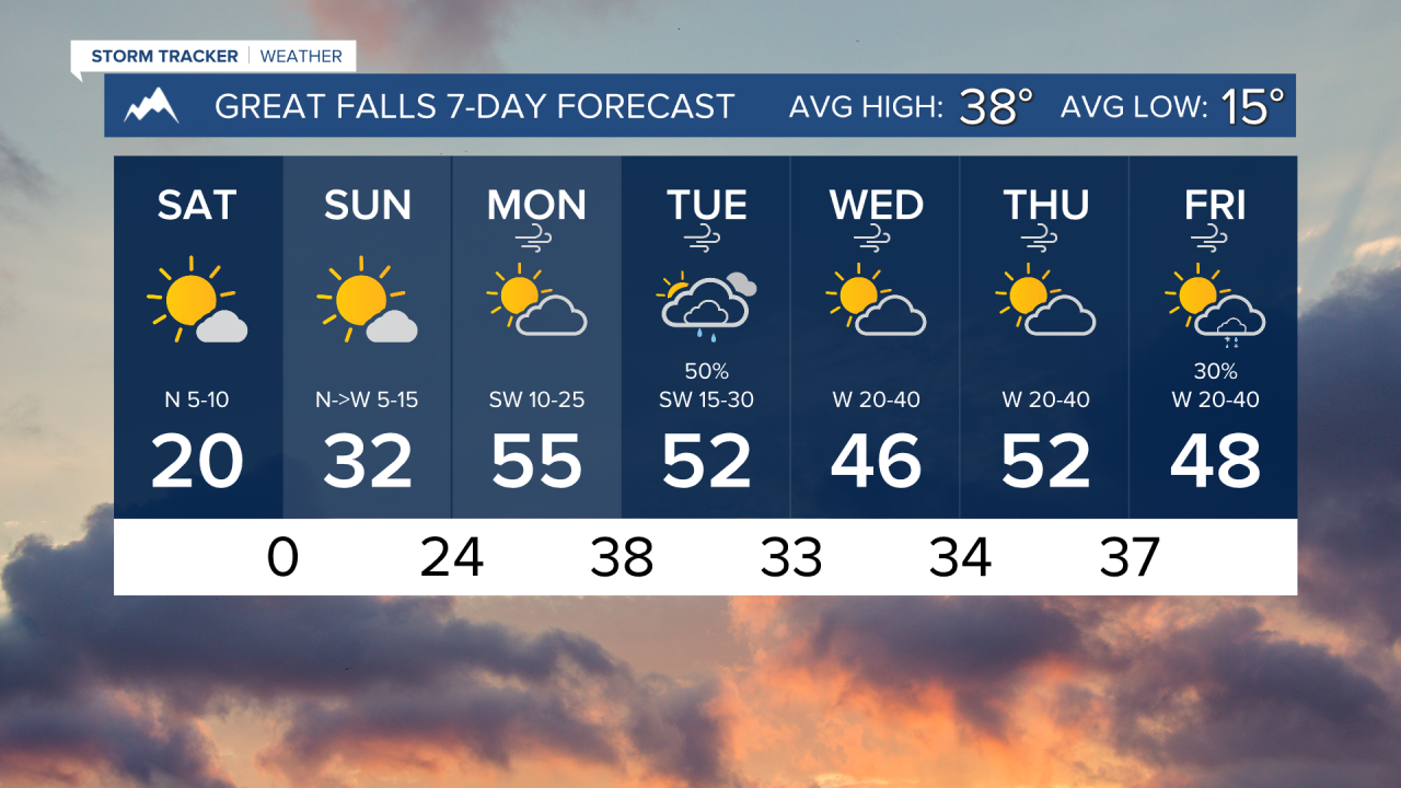


Colder-than-normal temperatures will continue through the weekend, but conditions will quickly switch on Monday with wind picking up out of the west with highs reaching the 50s.
FRIDAY, FEBRUARY 20TH: Temperatures will begin to warm slightly today, but not by much. Morning lowshave been below zero for many. Wind chills in portions of north-central Montana are around the -20s to -30s. Highs will reach the teens and 20s. More light snow will come through western Montana this morning. Accumulation should be around an inch in the mountains, with flurries in the lower elevations.
SATURDAY, FEBRUARY 21ST: Morning lows dip into the single digits and teens. Highs will reach the 20s and 30s with mostly sunny to partly cloudy skies. Snow moves out temporarily.
SUNDAY, FEBRUARY 22ND: Sunday will be similar to Saturday. Highs reach the 30s and 40s under partly cloudy skies.
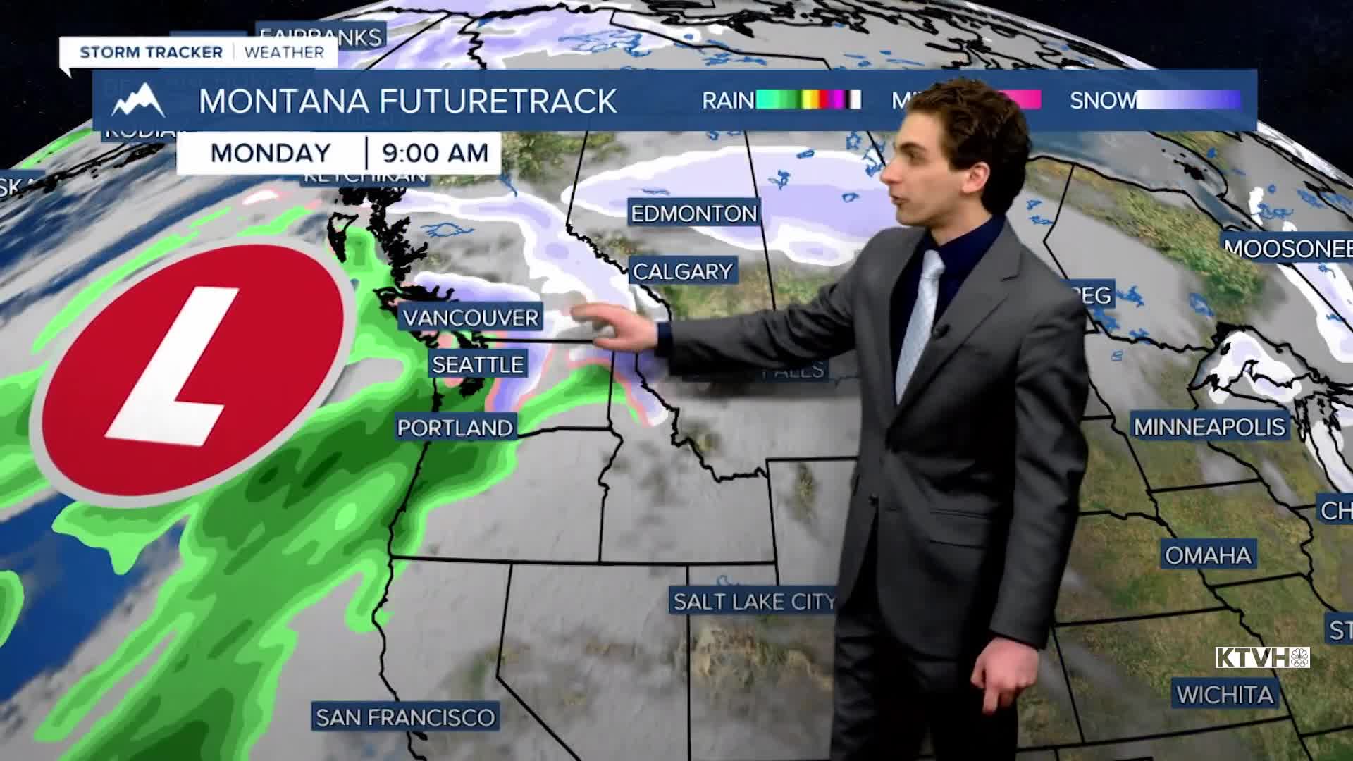
MONDAY, FEBRUARY 23RD: Wind will pick up off the Rocky Mountain Front and Continental Divide, warming most locations back above average into the 40s and 50s.
LONG-RANGE FORECAST: Wind will be strong and gusty through most of next week. Some more rain and snow will enter the state on Tuesday.
——————————————————————————————————————————
WEATHER ALERTS:
NONE
——————————————————————————————————————————
Helena Temperature Records Today:
High: 64 (1995)
Low: -19 (1986)
AVG: 39/18
Great Falls Temperature Records Today:
High: 66 (1977)
Low: -29 (1918)
AVG: 38/15