


A weak wave of moisture will bring light snow to the mountains today, but a warmer and drier pattern will last through the beginning of February in the lower elevations.
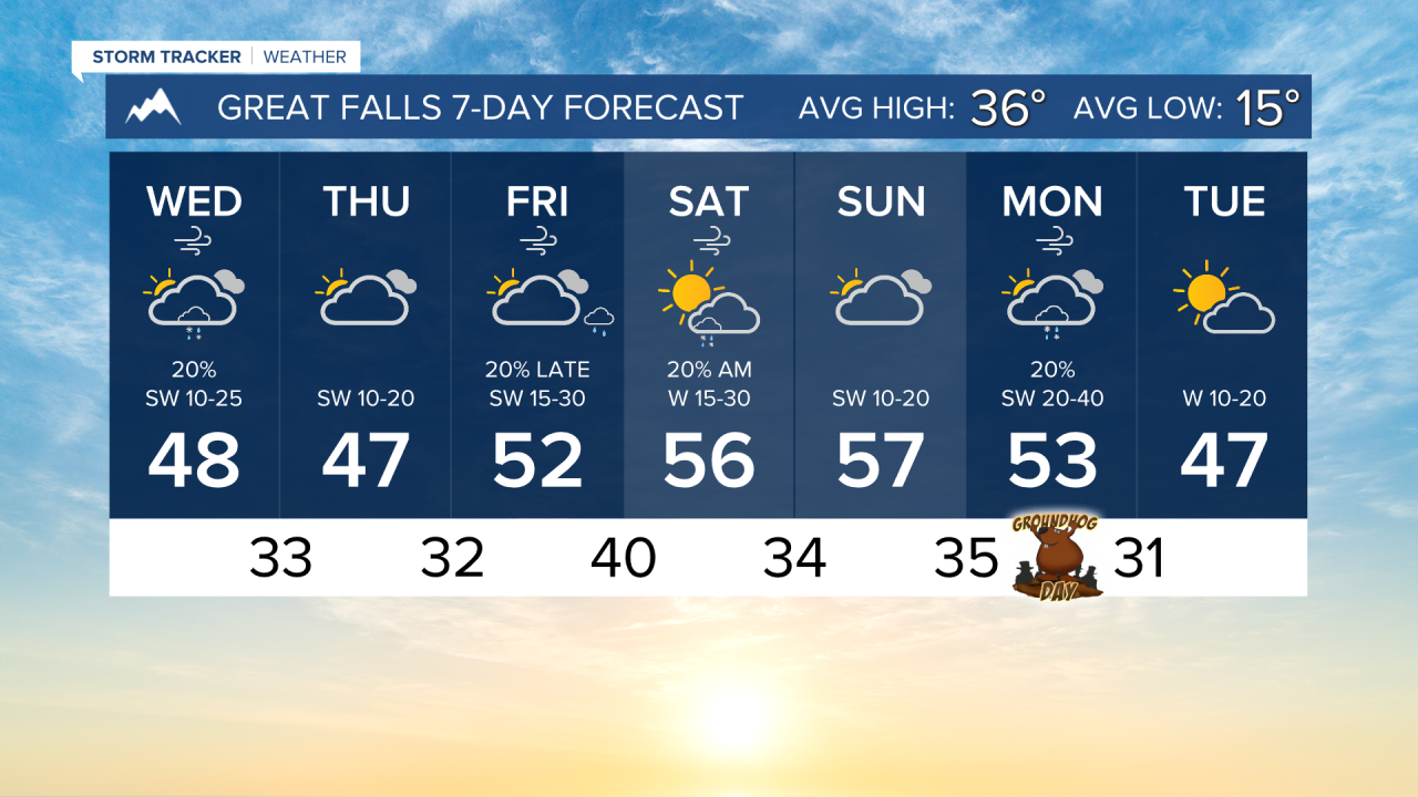
WEDNESDAY, JANUARY 28TH: We will have a round of light snow working its way through Montana on Wednesday. The most significant accumulation appears to be on the northern Continental Divide, where isolated instances of over half a foot will fall through Thursday. Slick spots could develop over mountain passes.
Some lower-elevation rain and snow is possible, but due to very dry air near the surface, most of the precipitation will evaporate before it reaches the ground. The best chance to see a few snowflakes and raindrops will be this afternoon as a weak front passes through.
Mountains like the Little Belts, Big Belts, Boulders, Elkhorns, and Highwoods will get about an inch or two in the higher peaks.
It will be a cloudy day with high temperatures in the 30s and 40s.
THURSDAY, JANUARY 29TH: Most areas will be in the 40s, but some locations in more wind-prone areas could be near the upper 40s. Some light snow will develop along the stationary boundary in northeast Montana. Around an inch or two may accumulate around the Glasgow area. There may be an isolated shower in the mountains by Thursday night.
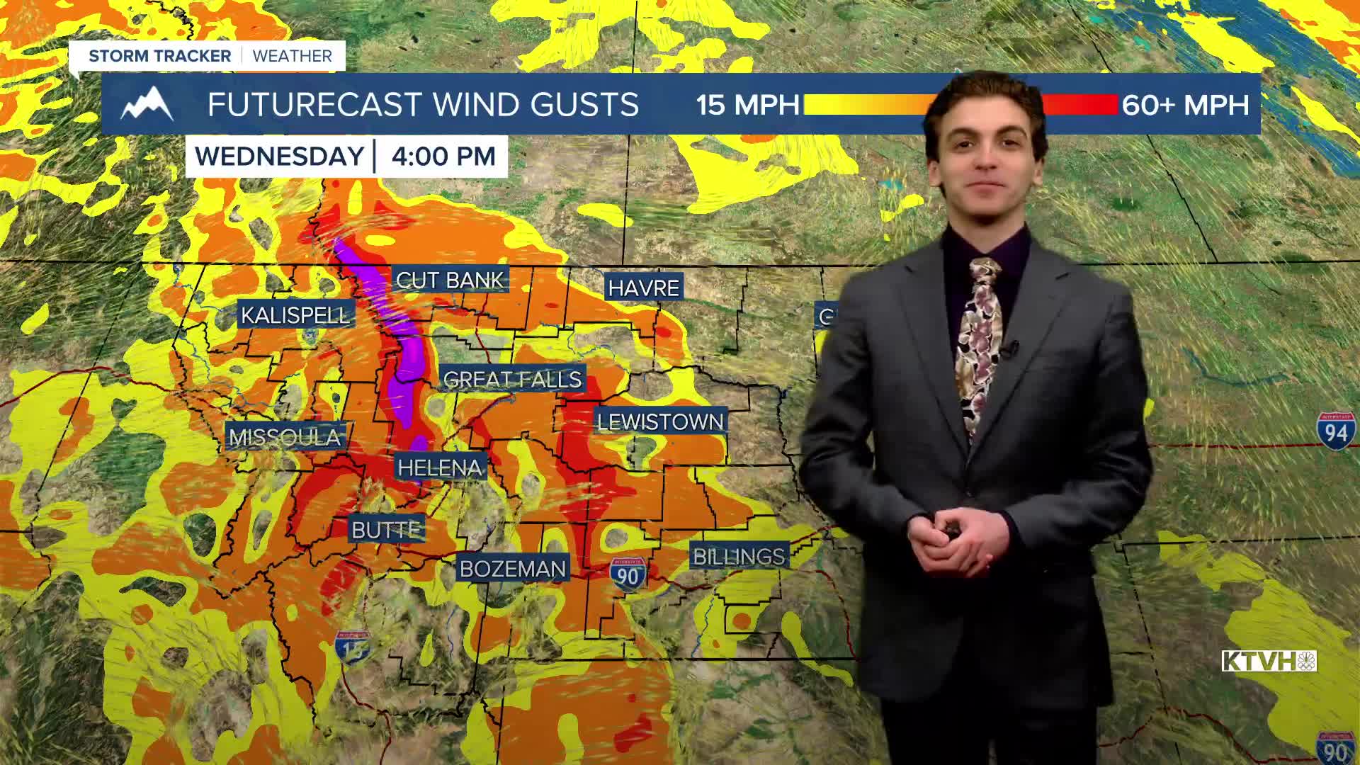
FRIDAY, JANUARY 30TH: Expect a day similar to Thursday near the Helena and Great Falls areas, aside from a little more cloud cover. Eastern Montana will dry out. Stronger winds will begin to pick up Friday night, gusting to about 60 MPH near the Rocky Mountain Front.
SATURDAY, JANUARY 31ST: This will be one of the warmest days of the week for many. Above freezing temperatures spread into eastern Montana with gustier winds. Highs will reach the 50s to the east of the Continental Divide. A few rain and snow showers will come through in the morning.
LONG-RANGE FORECAST: Warmer and drier weather will stick around through the end of January and into the beginning of February.
——————————————————————————————————————————
WEATHER ALERTS:
NONE
——————————————————————————————————————————
Helena Temperature Records Today:
High: 56 (1931)
Low: -32 (1929)
AVG: 34/15
Great Falls Temperature Records Today:
High: 61 (1931)
Low: -42 (1916)
AVG: 36/15