


It will be a gorgeous day today under mostly sunny skies with highs in the upper 70s around the Helena area. However, the wind is expected to ramp up this weekend to close out the summer.
A few isolated showers and storms are possible in eastern Montana today with a weak center of low moving slowly into the Dakotas. Western Montana will be dry.
A minor cold front comes through the state tomorrow. No precipitation is expected; however, we can expect a brief increase in cloud cover. We will return to sunny conditions on Saturday.
Temperatures will reach the upper 70s to mid-80s during this period.
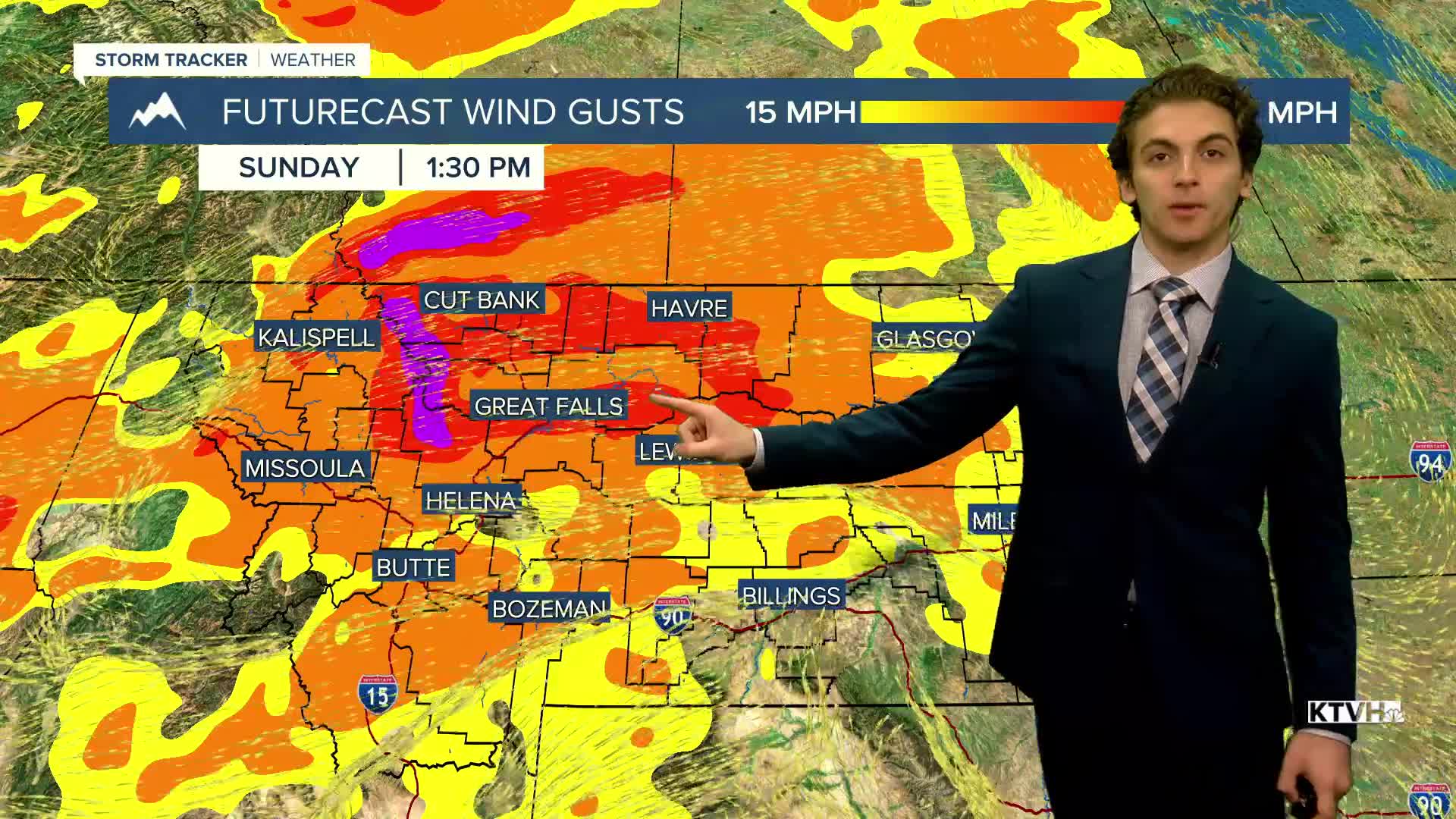
A strong jet streak and cold front come into the state late Saturday into Sunday. Surface wind gusts intensify to around 40 to 50 MPH for a good majority of north-central Montana and the Helena Valley. A few showers and thunderstorms will accompany the wind during the day on Sunday.
An upper-level low moves over our area on Monday, locking in slightly cooler temperatures with highs in the upper 60s to 70s.
Warmer air quickly returns as highs reach the 80s by the middle of next week with dry weather. The wind will also decrease.
——————————————————————————————————————————
WEATHER ALERTS:
NONE
——————————————————————————————————————————
Helena Temperature Records Today:
High: 91 (1966)
Low: 19 (1965)
AVG: 73/44
Great Falls Temperature Records Today:
High: 93 (1981)
Low: 23 (1965)
AVG: 71/42


