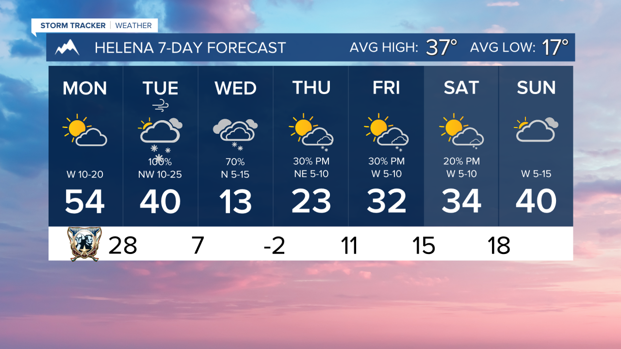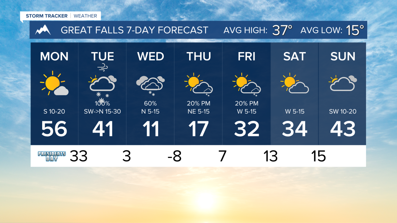


The President's Day forecast will be mostly dry and warmer, but drastic changes are coming tomorrow with snow and arctic air.
PRESIDENT'S DAY: This will be the last day of warmth for the entire week. Highs will reach the 50s for most locations. Expect mostly sunny to partly cloudy skies. Some rain and snow will move into the area late tonight.
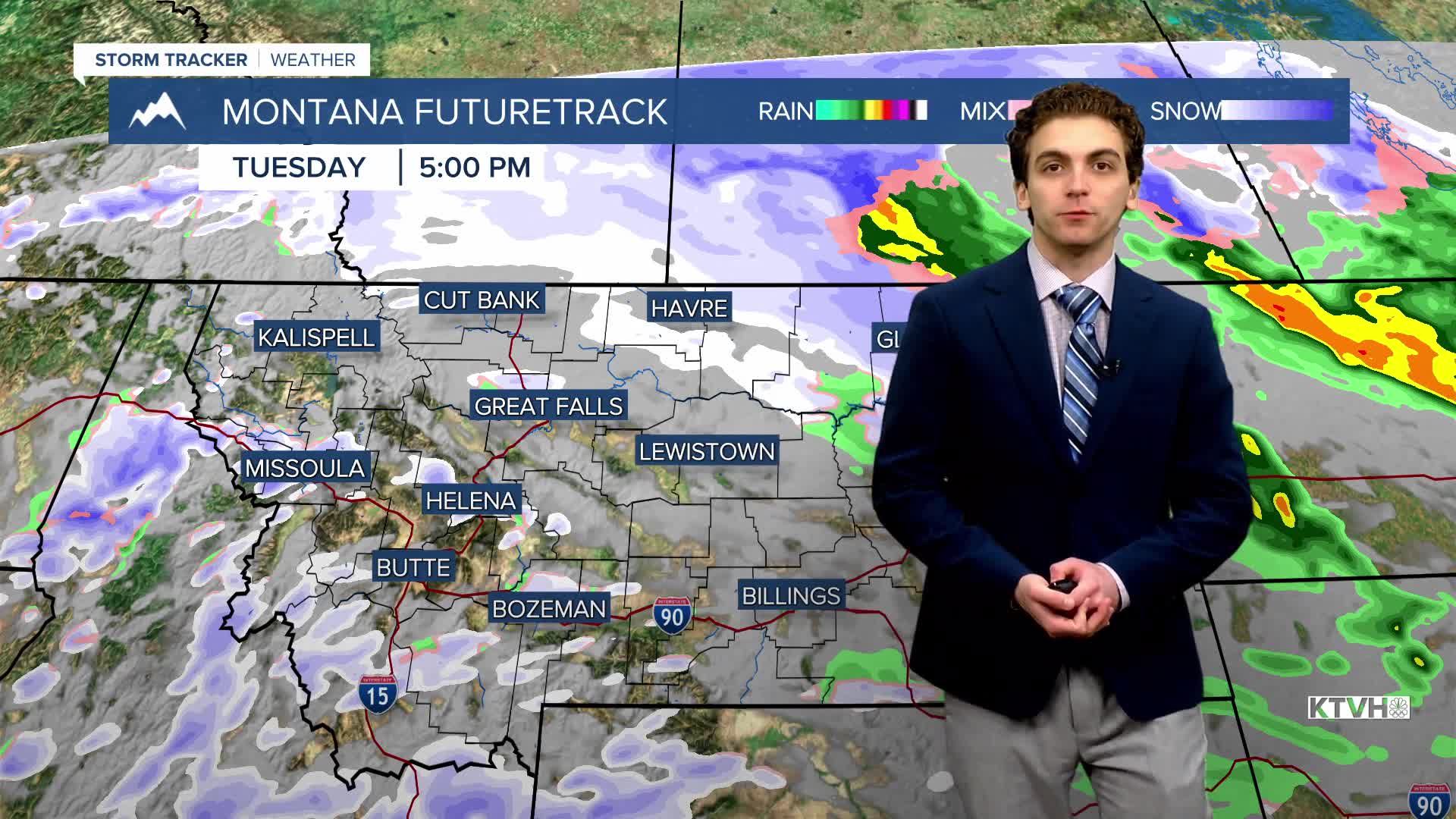
TUESDAY, FEBRUARY 17TH: A cold front will move through western Montana in the morning. This will bring gusty winds and a short period of moderate to heavy snow. Blowing snow and squalls are possible. We will reach the high temperature in the morning, getting cooler throughout the day as arctic air moves in. Convective snow showers will form over southwestern Montana in the afternoon.
WEDNESDAY, FEBRUARY 18TH: Another disturbance will pass through the southern half of the state, bringing another round of light snow back to the forecast. Arctic air sets up in north-central Montana and the Helena Valley. Morning lows will dip into the single digits, and highs will only reach the teens.
THURSDAY, FEBRUARY 19TH: Thursday will be another cold day. Lows dip below zero, and highs only reach the teens. Pop-up snow showers will form in the mountains in the afternoon.
——————————————————————————————————————————
WEATHER ALERTS:
——————————————————————————————————————————
Helena Temperature Records Today:
High: 59 (1977)
Low: -30 (1956)
AVG: 37/17
Great Falls Temperature Records Today:
High: 63 (2017)
Low: -35 (1936)
AVG: 37/15