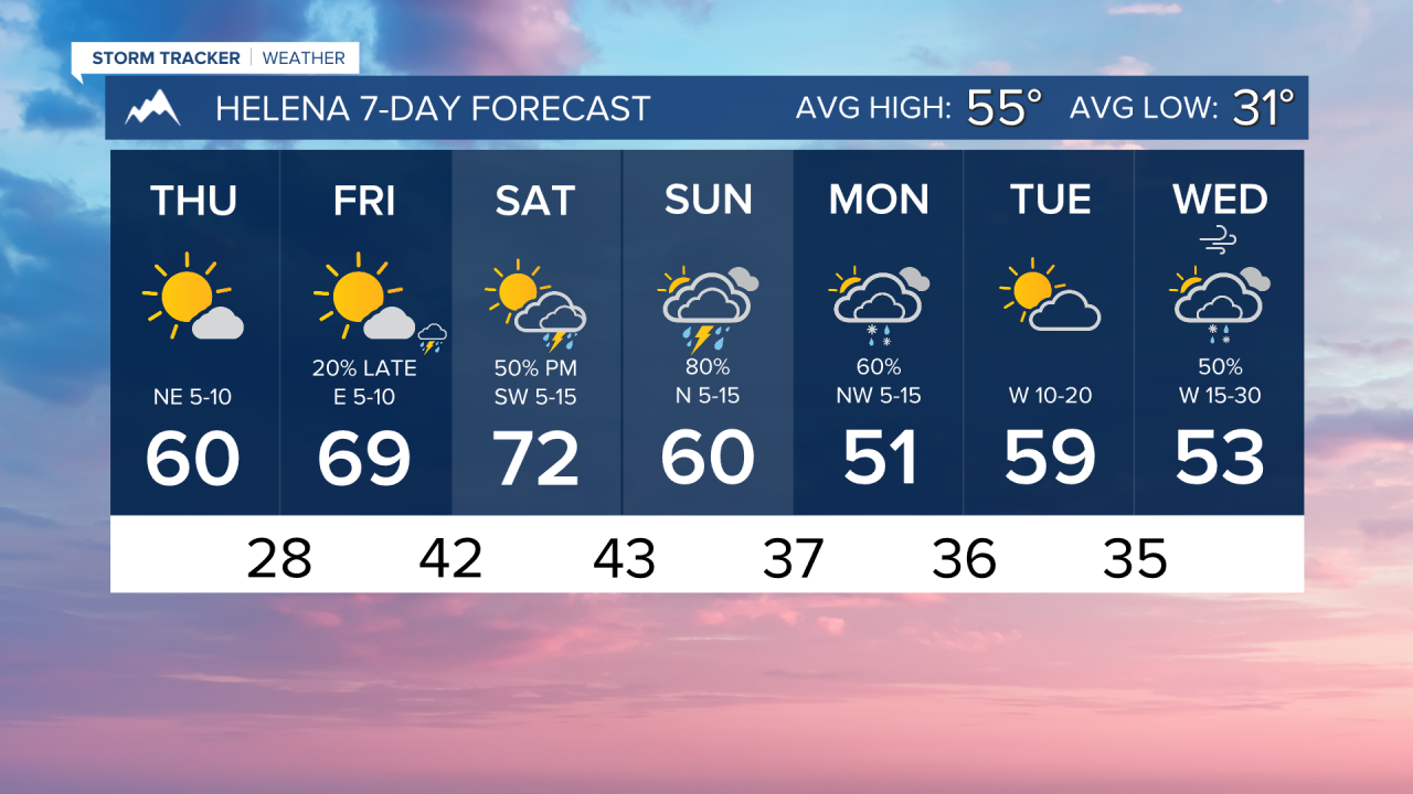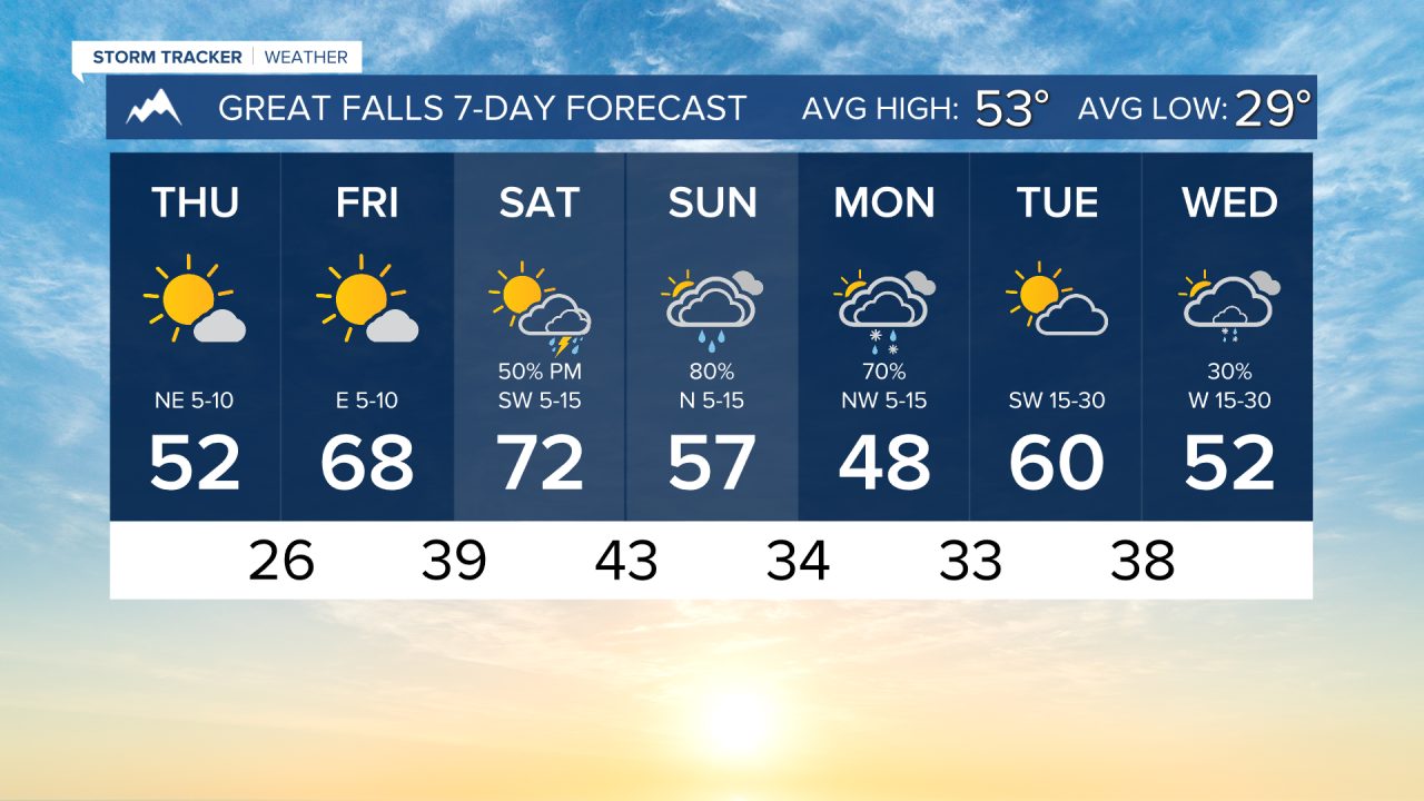


THURSDAY, APRIL 9TH: A shortwave disturbance bringing isolated snow showers moved through parts of north-central and eastern Montana this morning. A few rain showers may clip northeast Montana later this afternoon, but otherwise most of the state will be dry under mostly sunny skies.
It's cold this morning with lows in the 20s and low 30s. High temperatures will warm into the 50s and 60s later this afternoon with light northeast winds of around 5-10 MPH.
FRIDAY, APRIL 10TH: Friday will be a beautiful day with highs warming into the 60s for most areas, with a few spots potentially hitting 70 under mostly sunny conditions. Upper-level clouds will move in the afternoon. A couple of thunderstorms will form in southwest Montana. These should stay south of Helena. Expect light winds out of the east of around 5-10 MPH.
SATURDAY, APRIL 11TH: A warm, moist southwest flow moves into the area, which will prompt the formation of scattered showers and thunderstorms Saturday afternoon. Severe weather is not looking likely, but lightning strikes and gusty winds will be produced by some storms. Highs will reach the upper 60s to 70s across the state.
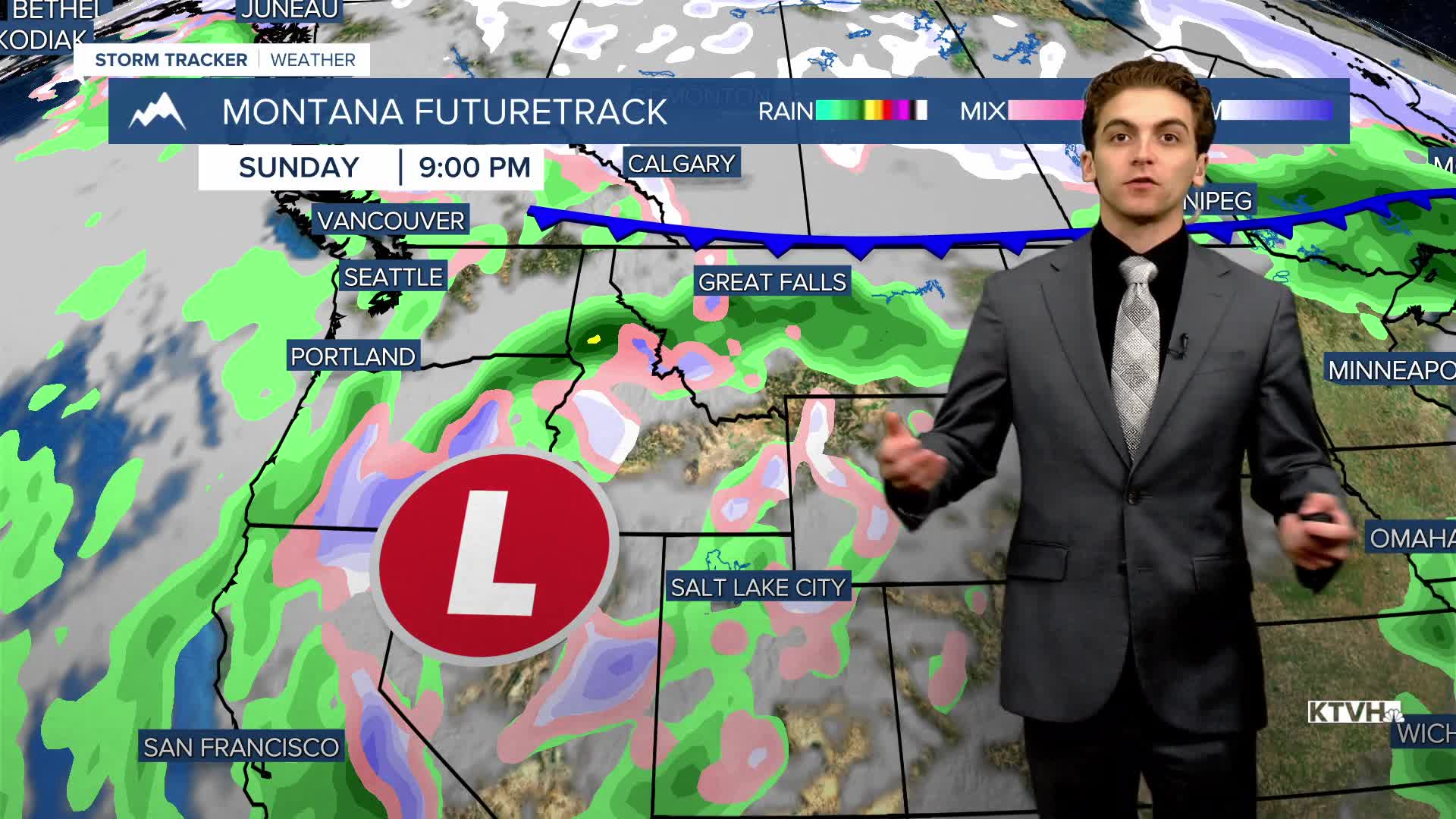
SUNDAY, APRIL 12TH: Wet weather will stick around on Sunday. A few thunderstorms will stick around in the southern half of the state, but a surface cold front moving in from the north will reduce instability, and therefore reduce the likelihood of storms in the northern half of Montana.
Rain in lower elevations and snow in the mountains will be heaviest from Sunday afternoon through Monday morning.
LONG-RANGE FORECAST: Several storm systems are on the way next week bring cooler temperatures and overall wetter weather.
——————————————————————————————————————————
WEATHER ALERTS:
NONE
——————————————————————————————————————————
Helena Temperature Records Today:
High: 79 (1996)
Low: 12 (1959)
AVG: 55/31
Great Falls Temperature Records Today:
High: 79 (1996)
Low: 9 (2013)
AVG: 53/29