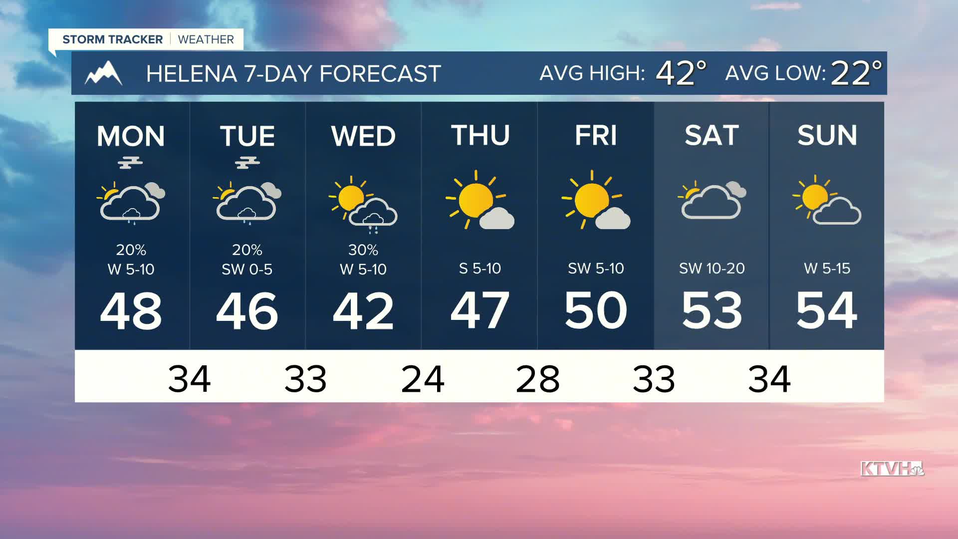


There won't be a whole lot of sunshine over the next few days as a couple of weaker weather systems pass through, bringing cooler air and isolated rain showers to start the week.
Highs today will range quite drastically depending on your location in the state. Valleys will only reach the 40s and low 50s. North central Montana will reach the upper 50s to low 60s. Northeast Montana will only be in the 40s.
Fog will be possible over the next couple of mornings with cooler morning lows and almost no wind in the valleys. Isolated drizzles are possible through the rest of the day today. A little more activity is expected to occur on Tuesday evening and Wednesday morning with the passage of a cold front.
Temperatures will slowly warm after Wednesday. Highs will reach the 50s for most of the state by the weekend. Some wind will return to north-central Montana by the latter portion of the week and the weekend.
——————————————————————————————————————————
WEATHER ALERTS:
NONE
——————————————————————————————————————————
Helena Temperature Records Today:
High: 65 (1976)
Low: -16 (1955)
AVG: 42/22
Great Falls Temperature Records Today:
High: 66 (2009)
Low: -20 (1903)
AVG: 43/23


