


FRIDAY, MAY 15TH: We are waking up to partly to mostly clear skies across the Treasure State with winds still gusting to 20-30 MPH. It will be another windy day overall, but not as intense as yesterday. Maximum gusts should reach around 30-40 MPH for most areas later this morning and early in the afternoon. Areas near the Rocky Mountain Front could record isolated 50-60 MPH gusts.
High temperatures will reach the 60s in most locations, with a few areas in southeast Montana holding on to the low 70s.
Isolated showers and perhaps a thunderstorm or two are possible this afternoon on the Hi-Line and in northeast Montana. The Helena area will remain dry. The influence of our next weather system will be seen tonight on and west of the Continental Divide with scattered rain and snow showers.
SATURDAY, MAY 16TH: A center of low-pressure will begin moving into western and central Montana in the morning. Scattered showers will develop around the mountains of Helena, with a chance that a few will move over the valley. Expect rain in the valley, with snow levels beginning the day at around 6000 feet. Snow levels will drop to around 4000 feet by the evening.
Expect mostly cloudy conditions, with morning temperatures in the upper 30s to low 40s. Afternoon highs will only reach the 50s before a cold front passes through the area.
It will still be breezy for most of the state, but stronger gusts will be limited to the 20-30 MPH range.
SUNDAY, MAY 17TH: There is still variability between weather models, but it is trending more likely that we see widespread precipitation across the state on Sunday. North flow builds in behind the center of low as it exits the region. This will upslope on the mountains and generate a rain/snow mix at times for lower elevations. As of now, most snow accumulation looks to be confined to the mountains, but grassy surfaces may pick up less than an inch in the valleys and plains.
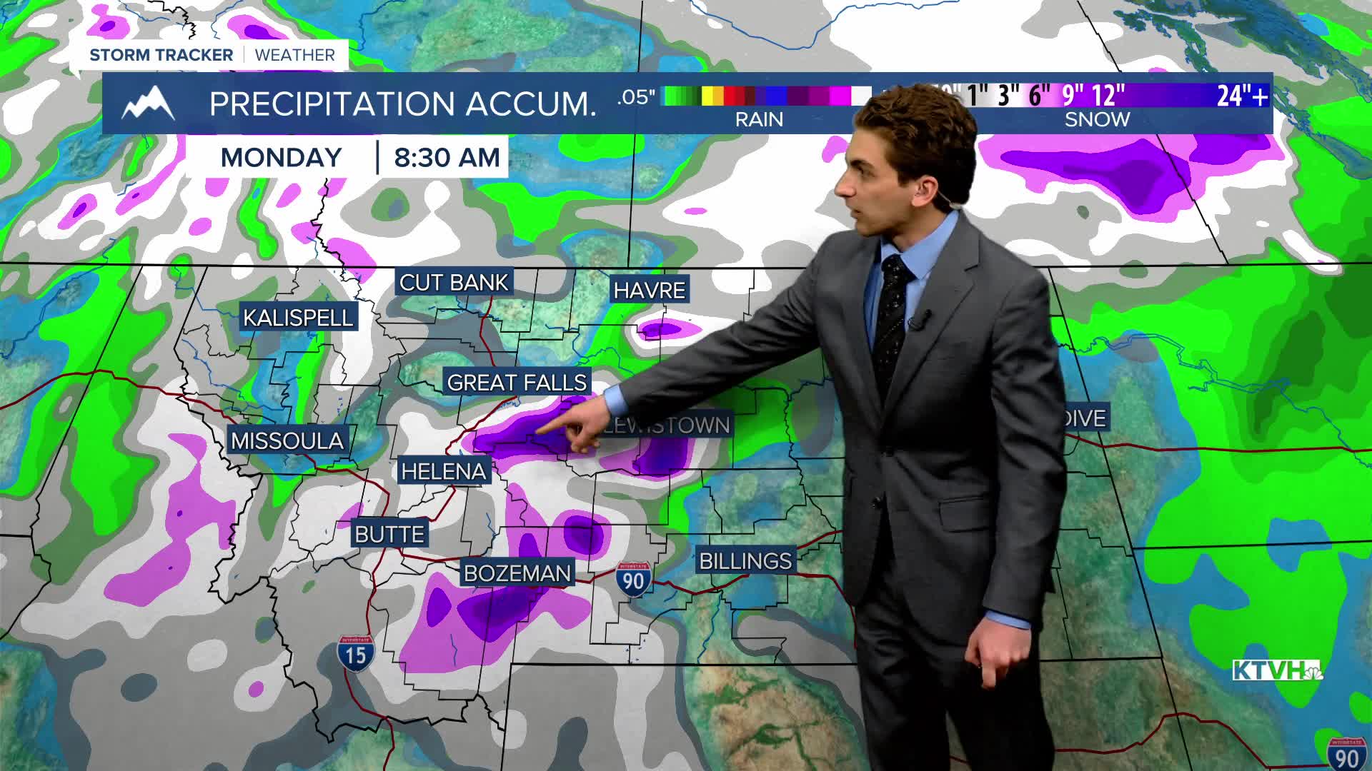
Some of the mountain ranges of central and southern look poised to pick up quite a bit of snow. Over half a foot may fall in the Little Belts, Snowys, Madisons, and Gallatins.
Gusty north winds will develop as well, with maximum speeds looking to be around 20-30 MPH.
Lows get close to the freezing point in the morning, while afternoon temperatures only reach the 40s.
MONDAY, MAY 18TH: Widespread precipitation moves out into eastern Montana in the morning. We will be left under partly cloudy skies with temperatures near or below freezing. A frost looks likely in most areas.
A few instability rain and snow showers will pop over the mountains in the afternoon. Afternoon highs will reach the 50s.
The wind decreases on Monday. It will be out of the north at 5 to 15 MPH.
——————————————————————————————————————————
WEATHER ALERTS:


————————————————————————————————————————
Helena Temperature Records Today:
High: 88 (1944)
Low: 26 (1943)
AVG: 66/41
Great Falls Temperature Records Today:
High: 93 (1897)
Low: 28 (1929)
AVG: 65/38


