


New daily records were set across the state yesterday. Highs today will reach some of the warmest ever recorded in the month of February.
THURSDAY, FEBRUARY 5TH: Daily high temperature records are in serious jeopardy today as a ridge of high pressure continues to strengthen over Montana. Some all-time monthly temperature records may even be broken.
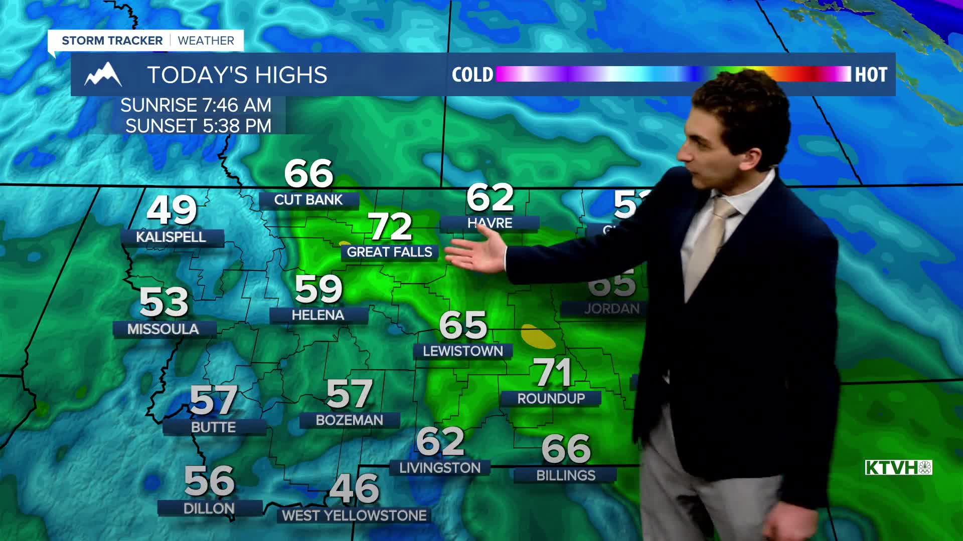
Great Falls is one of those areas. The current February high temperature record is 70° set on February 27th, 1932, and February 27th, 1992. Due to the strength of the ridge and the southwest winds, it's looking more likely than not that we set a new record by the end of the day.
Helena and the valleys of western Montana will be trapped under temperature inversions. Our temperatures will still reach near daily record highs, but not as warm as the plains. Expect highs in the valleys to reach the 50s and low 60s.
Most of the plains of central Montana will reach the upper 60s and low 70s under sunny skies.
FRIDAY, FEBRUARY 6TH: Friday morning will be a little colder as a weak Canadian boundary moves through the area. Lows will dip to the upper 20s and 30s.
The afternoon will be very warm for February again, with most areas still near or above the record daily high criteria, but a few degrees cooler than Thursday. Highs across the state will reach the 50s and 60s. Expect sunny to mostly sunny skies.
SATURDAY, FEBRUARY 7TH: A jet streak moves over the Rocky Mountain Front, bringing gusty winds back to north-central Montana. Helena's wind will pick up a bit as well, but not as windy as areas like Great Falls. Temperatures will still be well above normal with highs in the 50s to mid-60s. Some record highs could even still be broken on Saturday.
Most of the state will be dry, aside from a couple of showers northwest of Kalispell.
SATURDAY, FEBRUARY 7TH: Gusty west to southwest winds continue in north-central Montana. Temperatures will warm into the 50s and low 60s before a cold front comes in Sunday night.
This front will bring some rain showers to lower elevations and snow to the mountains. Snow levels will lower through the night.
LONG-RANGE FORECAST: Once the cold front comes through Sunday night into Monday morning, this introduces a large-scale pattern change heading into next week. Rain will convert to snow by Monday for the lower elevations. Temperatures will be near to slightly above average next week.
——————————————————————————————————————————
WEATHER ALERTS:
NONE
——————————————————————————————————————————
Helena Temperature Records Today:
High: 63 (2007)
Low: -28 (1893)
AVG: 35/16
Great Falls Temperature Records Today:
High: 62 (1941)
Low: -27 (2014)
AVG: 36/15


