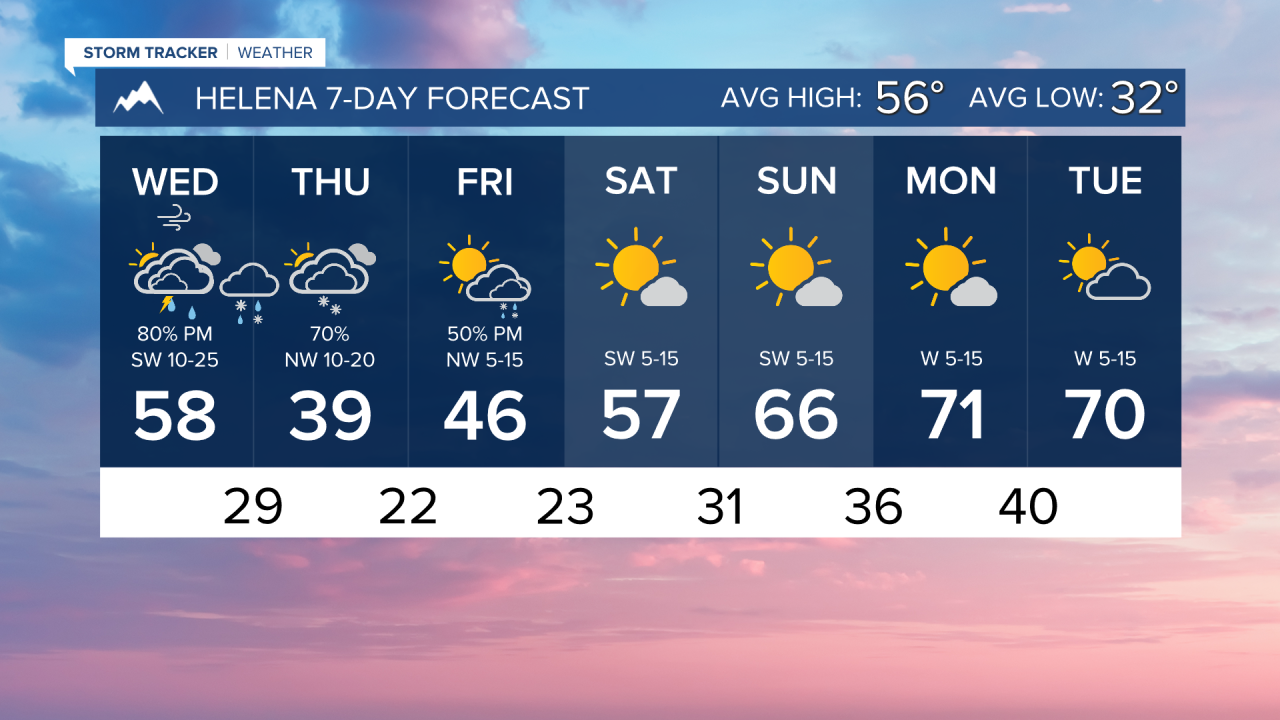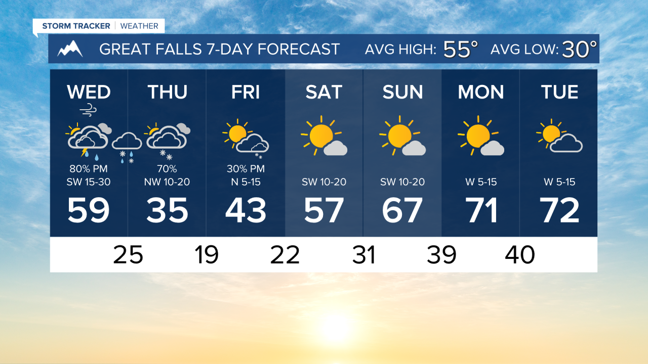


WEDNESDAY, APRIL 15TH: Winds are expected to be gusty again today, with maximum gusts approaching 30-40 MPH.
Wind will once again push high temperatures into the 50s and low 60s, but we will have a bit more cloud cover this time around with more upper-level moisture moving in.
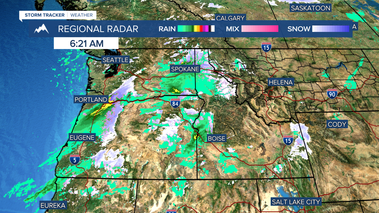
There will be mountain rain and snow showers on and west of the divide later this morning and this afternoon. A few pop-up showers and thunderstorms will move into the Helena area in mid to late afternoon before the arrival of the cold front at around 8-9 PM. The boundary will bring a burst of rain, converting to snow.
THURSDAY, APRIL 16TH: Intermittent snow will fall throughout the day on Thursday with much colder air behind the cold front. Morning lows will dip into the 20s and low 30s.
In terms of snow accumulation, this is mainly looking to be a mountain snow event. However, light snow is expected in most valleys and the plains. Generally speaking, around a trace to 2" may fall in lower elevations, except for localized heavier amounts around the Bozeman area.
Expect mostly cloudy conditions with afternoon highs only reaching the 30s and low 40s.
FRIDAY, APRIL 17TH: Colder air sticks around to close out the workweek. Atmospheric instability in the afternoon will pop numerous snow showers over the mountains near the Continental Divide. Snow accumulation will be minimal, but a few snow showers could produce heavy bursts of snow for a short time. High temperatures will reach the 40s.
SATURDAY, APRIL 18TH: Clouds and precipitation will move out by Saturday morning. Morning lows will be cold with temperatures in the 20s. Afternoon temperatures will warm up to the 50s under mostly sunny conditions. Winds will be out of the southwest at 5-15 MPH.
LONG-RANGE FORECAST: The weekend will be warmer and drier. Another storm system will move in towards the middle of next week.
——————————————————————————————————————————
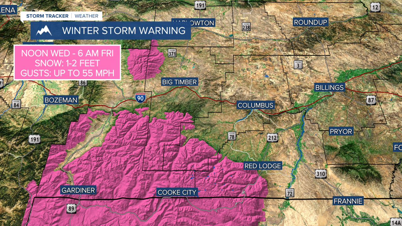
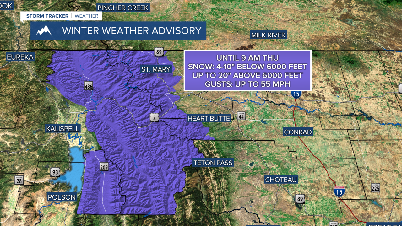
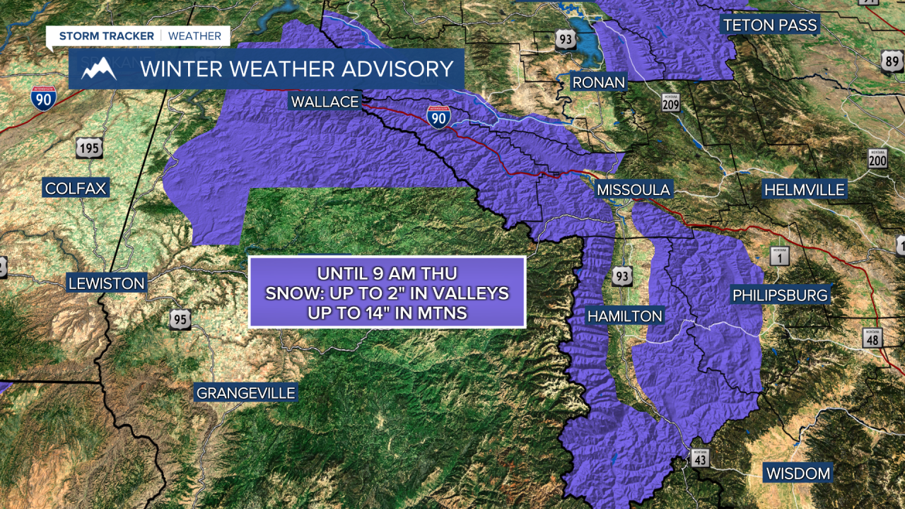
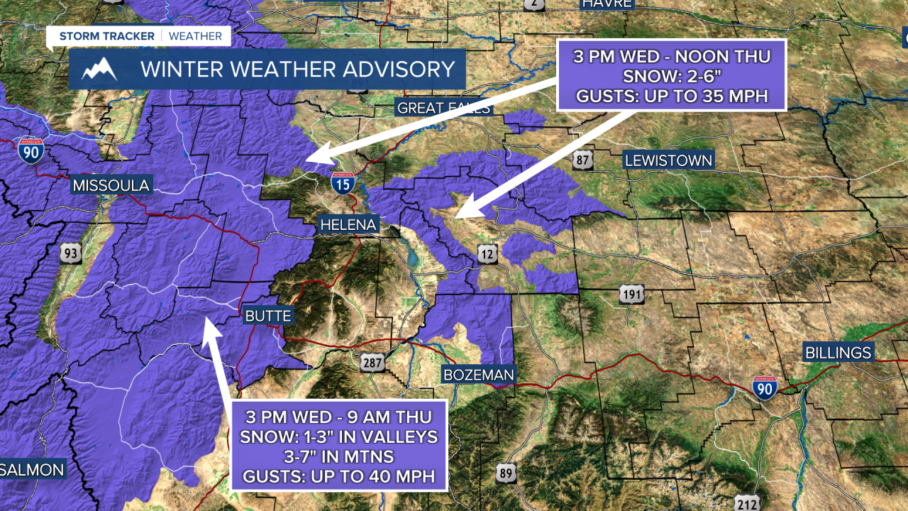
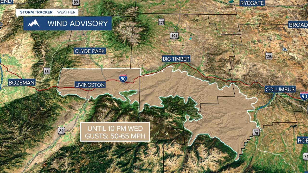
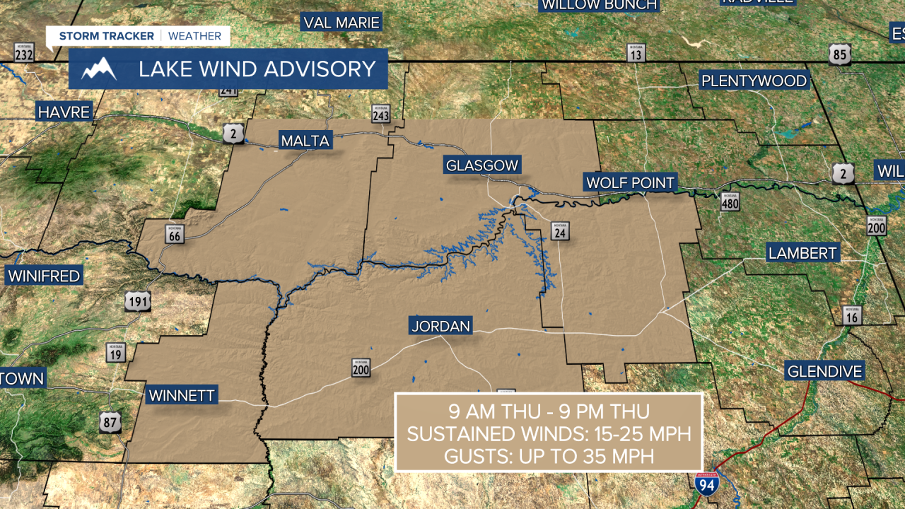
WEATHER ALERTS:
——————————————————————————————————————————
Helena Temperature Records Today:
High: 78 (1988)
Low: 9 (1896)
AVG: 56/32
Great Falls Temperature Records Today:
High: 82 (1926)
Low: 7 (2022)
AVG: 55/30