


Happy Tuesday, everyone! So glad to be back with you all in Montana. We have some very interesting and unusual weather, so let's get right into it!
A rare, stormy pattern has set up across the state and will stick around for the next few days. A stronger-than-normal summertime Aleutian Low has set up off the southern coast of Alaska, steering small areas of low pressure into the Pacific Northwest and Montana. This will bring daily thunderstorm chances through the rest of this week and into early next week.
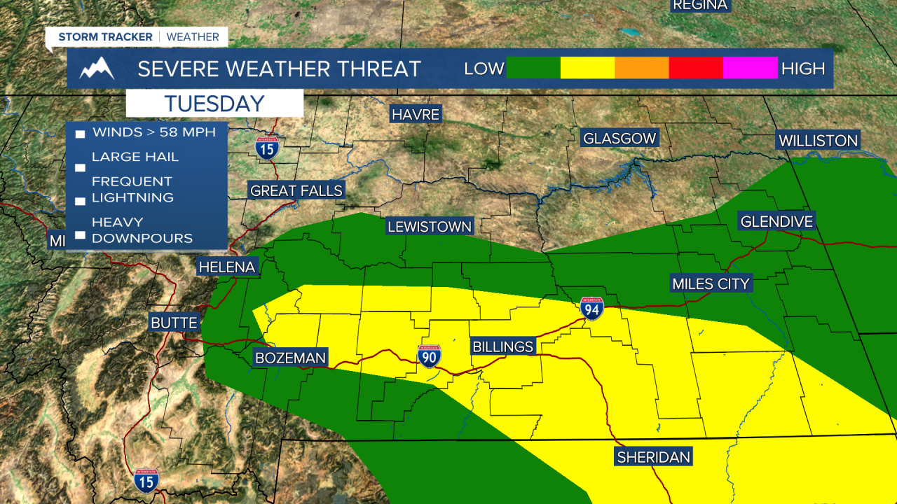
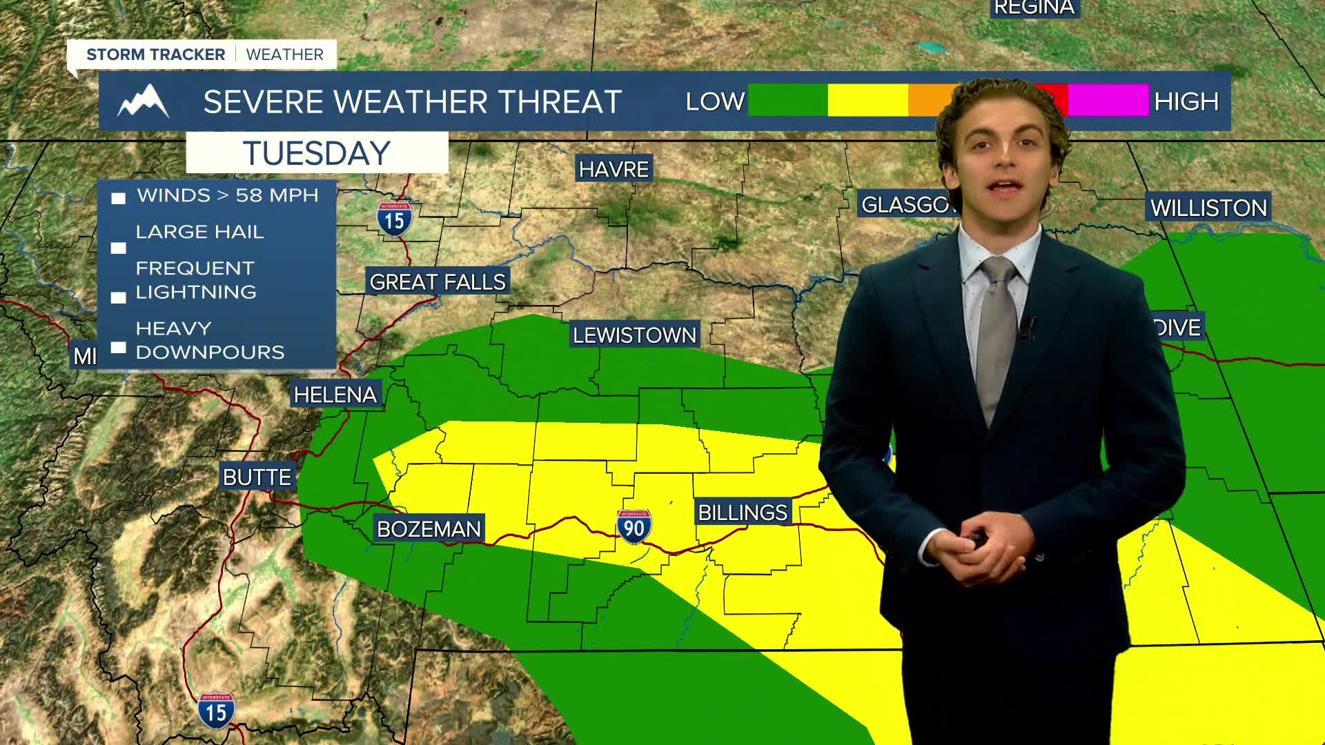
Storms could reach severe status once again today as one of the many little centers of low pressure makes its way to the south of Big Sky Country today. The main severe threat will stretch from Bozeman, along the I-90 corridor into northern Wyoming. The main threats will be damaging winds and large hail.
This stagnant weather pattern will create daily opportunities for thunderstorms while holding high temperatures near the upper 70s to mid-80s statewide. The strongest and most impactful day for thunderstorms looks to be Thursday for Helena and Great Falls.
This pattern starts to change towards the middle of next week, with higher pressure building leading to warmer and drier conditions.
——————————————————————————————————————————
WEATHER ALERTS:
A FLOOD WATCH continues for Deer Lodge, Granite, Lake, Missoula, Powell, Ravalli, and Silver Bow Counties until Tuesday evening
——————————————————————————————————————————
Helena Temperature Records Today:
High: 101 (2006)
Low: 40 (1959)
AVG: 89/56
Great Falls Temperature Records Today:
High: 102 (1934)
Low: 45 (1971)
AVG: 87/53
Have a great Tuesday
Joey Biancone
Meteorologist


