


Phil predicts we will have six more weeks of winter, but that is not coming this week. We will reach near record highs for much of the state.
MONDAY, FEBRUARY 2ND: The day starts off windy and mild for most of the state, with lows in the upper 30s and low 40s. Wind is gusting around 20-30 MPH at times for most of the plains and the Helena Valley. The wind will decrease later this afternoon. Highs will reach the 40s and low 50s.
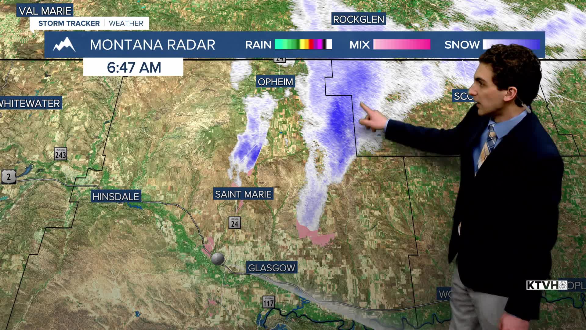
There is an area of dense freezing fog near Glasgow as wintry air tries to hang on. This will be pushed out by the late morning hours. You can expects a glaze of freezing rain and up to an inch of snow with scattered showers moving through the area today.
A couple of mountain showers will be around Helena later tonight as the last wave of moisture for the week moves through the area. Don't expect any meaningful accumulation.
TUESDAY, FEBRUARY 3RD: Any remaining moisture moves out by the time you wake up, aside for an isolated snow shower in northeast Montana. Northwest flow should keep temperatures right around the same as Monday. Highs in the 40s to low 50s again.
WEDNESDAY, FEBRUARY 4TH: Temperatures will begin to climb rapidly with a bit of wind picking up off the Rocky Mountain Front and a ridge of high pressure moving in. Wind will be gusting around 20-40 MPH through north-central Montana. Most locations will reach the 50s and low 60s by the afternoon under partly to mostly sunny skies.
THURSDAY, FEBRUARY 5TH: Although the wind decreases on Thursday, this will be the warmest day for many, as the ridge of high pressure fully builds over the region. Valleys will be a bit cooler due to temperature inversions, but parts of the plains cloud hit the upper 60s to even low 70s. This would break many daily records, and potentially the all-time temperature record for the entire month for many cities.
——————————————————————————————————————————
WEATHER ALERTS:
A DENSE FOG ADVISORY continues for Central and Southern Valley, Daniels, Eastern Roosevelt, Sheridan, and Western Roosevelt Counties until 10 AM Monday
A WINTER WEATHER ADVISORY continues for a portion of northeast Montana until 5 PM Monday
——————————————————————————————————————————
Helena Temperature Records Today:
High: 66 (1962)
Low: -42 (1996)
AVG: 34/15
Great Falls Temperature Records Today:
High: 64 (1934)
Low: -35 (1996)
AVG: 36/15


