


Temperatures are on the rise once again this week, as some locations may be recording records on Thursday.
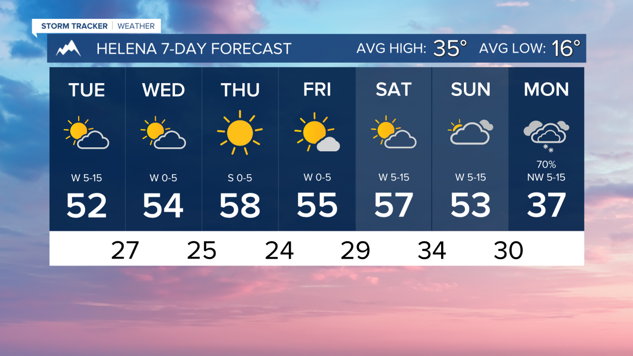
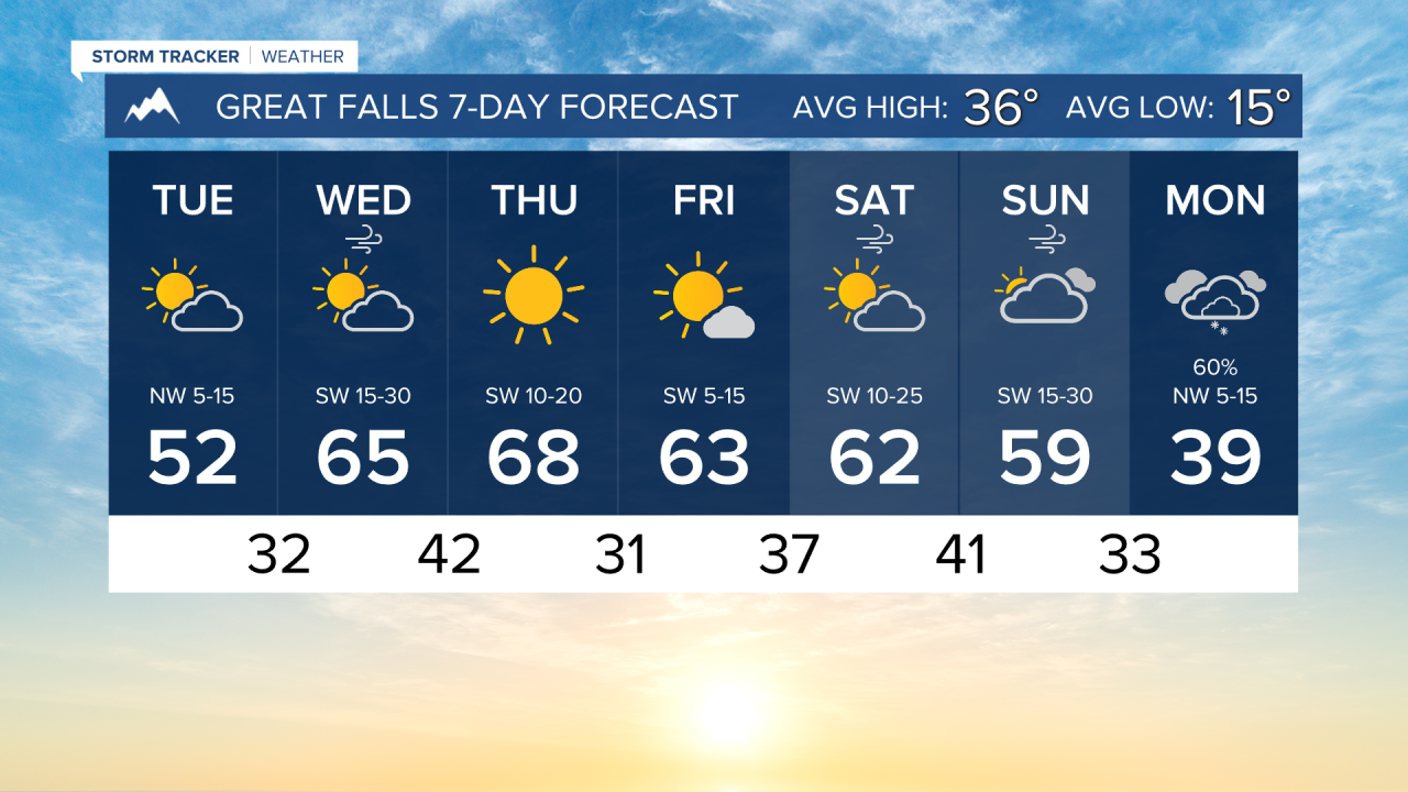
TUESDAY, FEBRUARY 3RD: A few rain and snow showers are moving through south central Montana, aside from an isolated snow shower in northeast Montana. Northwest flow should keep temperatures right around Monday's with highs in the 40s to low 50s again.
WEDNESDAY, FEBRUARY 4TH: Temperatures will begin to climb rapidly with a bit of wind picking up off the Rocky Mountain Front and a ridge of high pressure moving in. Wind will be gusting around 20-40 MPH through north-central Montana. Most locations will reach the 50s and low 60s by the afternoon under partly to mostly sunny skies.
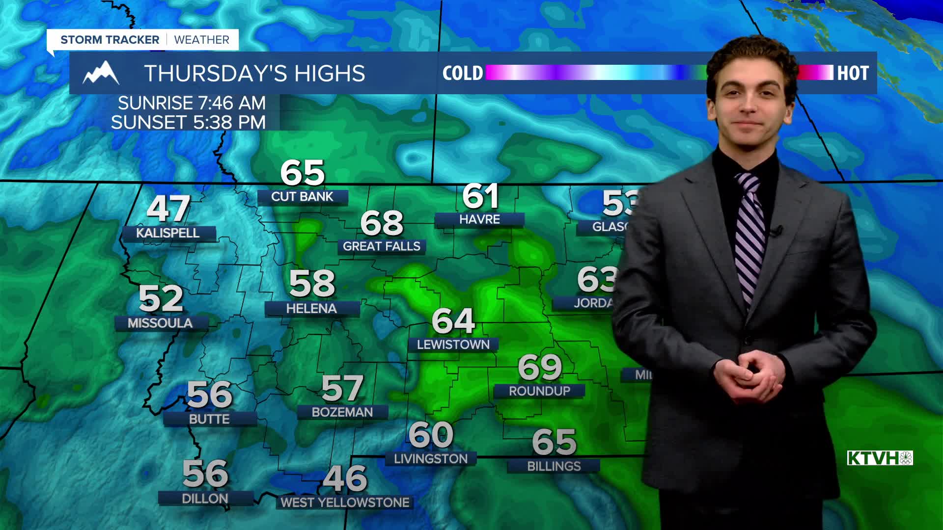
THURSDAY, FEBRUARY 5TH: Although the wind decreases on Thursday, this will be the warmest day for many, as the ridge of high pressure fully builds over the region. Valleys will be a bit cooler due to temperature inversions, but parts of the plains could hit the upper 60s to potentially the low 70s. This would break many daily records. A weak surface front bringing in northwest flow by the afternoon should keep highs maxing out in the upper 60s for north central Montana.
FRIDAY, FEBRUARY 6TH: Temperatures will still be quite warm, with highs in the 50s and 60s, but not as warm as Thursday. The wind will begin to pick up Friday night and remain gusty through the weekend in north-central Montana
LONG-RANGE FORECAST: Generally cooler and wetter weather returns towards the beginning of next week.
——————————————————————————————————————————
WEATHER ALERTS:
A DENSE FOG ADVISORY continues for Valley, Daniels, Sheridan, and Roosevelt Counties until 10 AM Tuesday
A DENSE FOG ADVISORY continues for Dawson, McCone, Prairie, Richland, and Wibaux Counties until 10 AM Tuesday
——————————————————————————————————————————
Helena Temperature Records Today:
High: 61 (1962)
Low: -36 (1996)
AVG: 34/15
Great Falls Temperature Records Today:
High: 62 (1935)
Low: -35 (1989)
AVG: 36/15