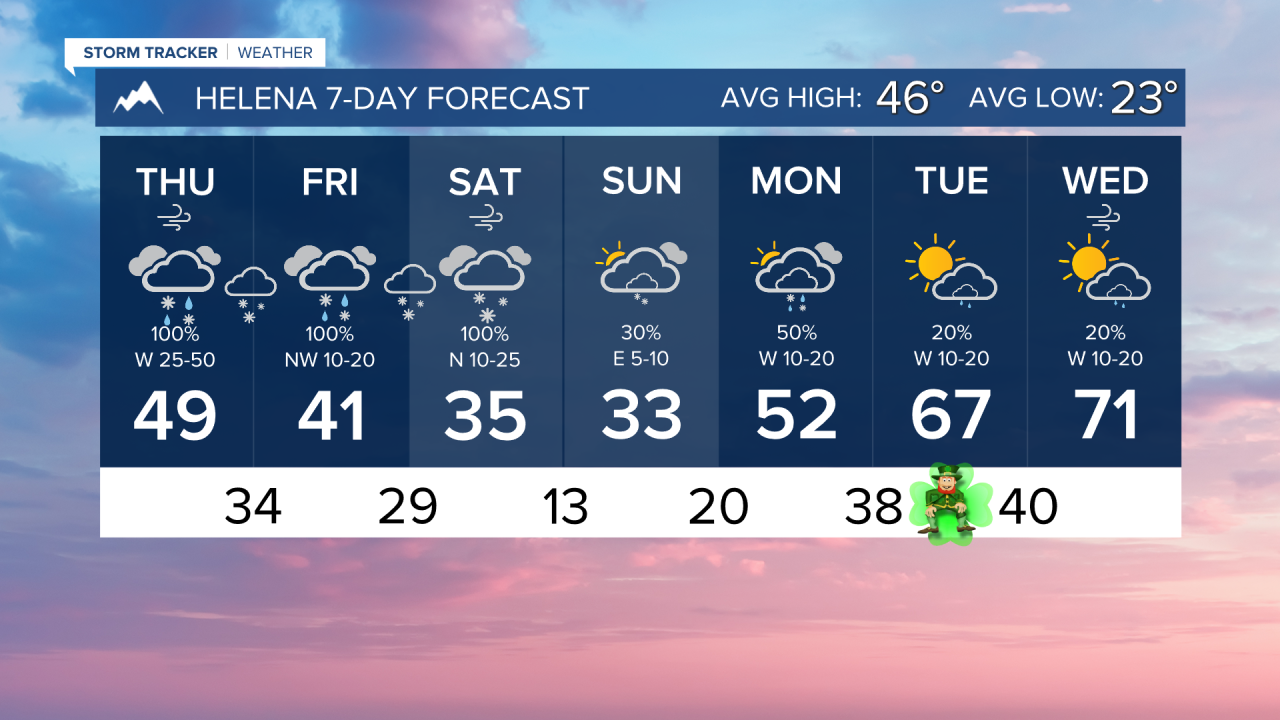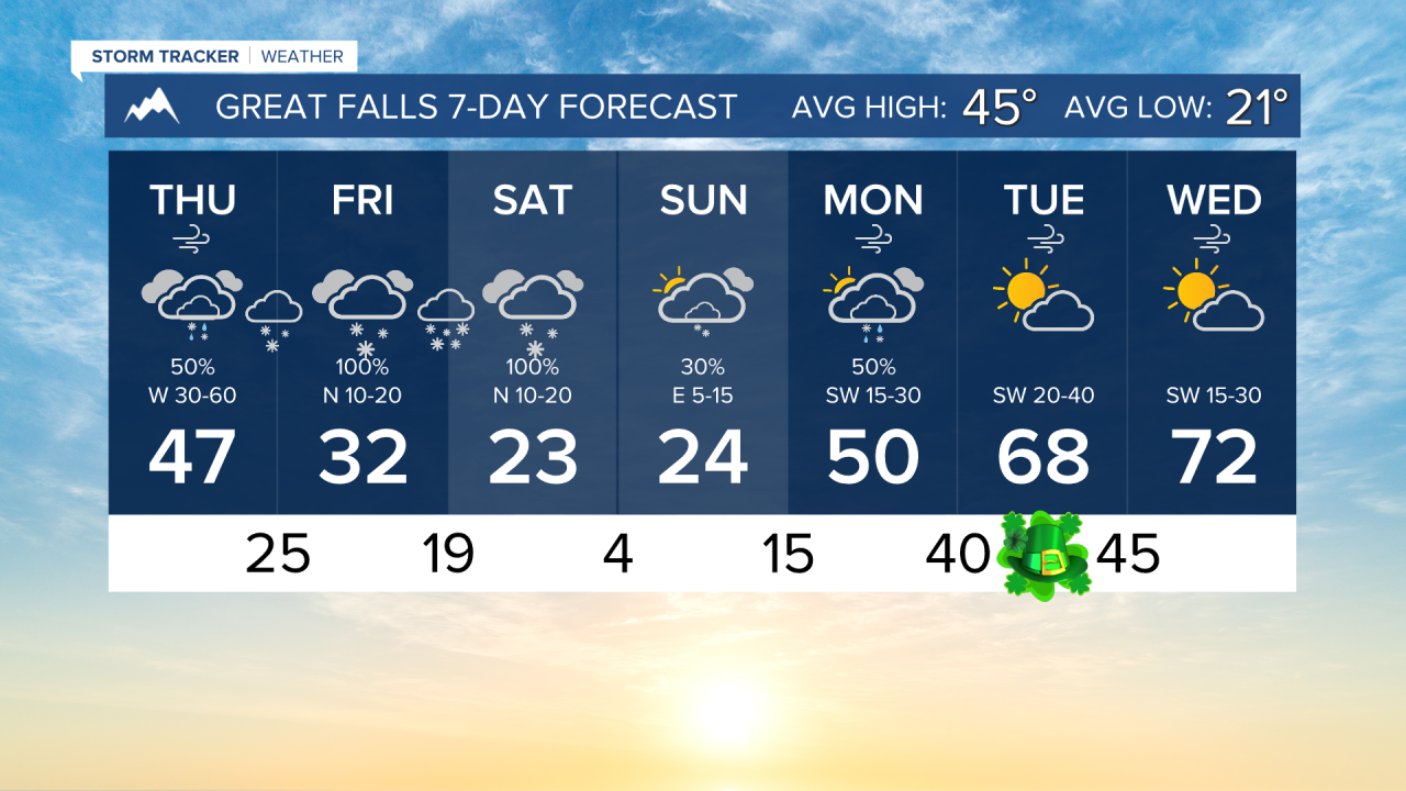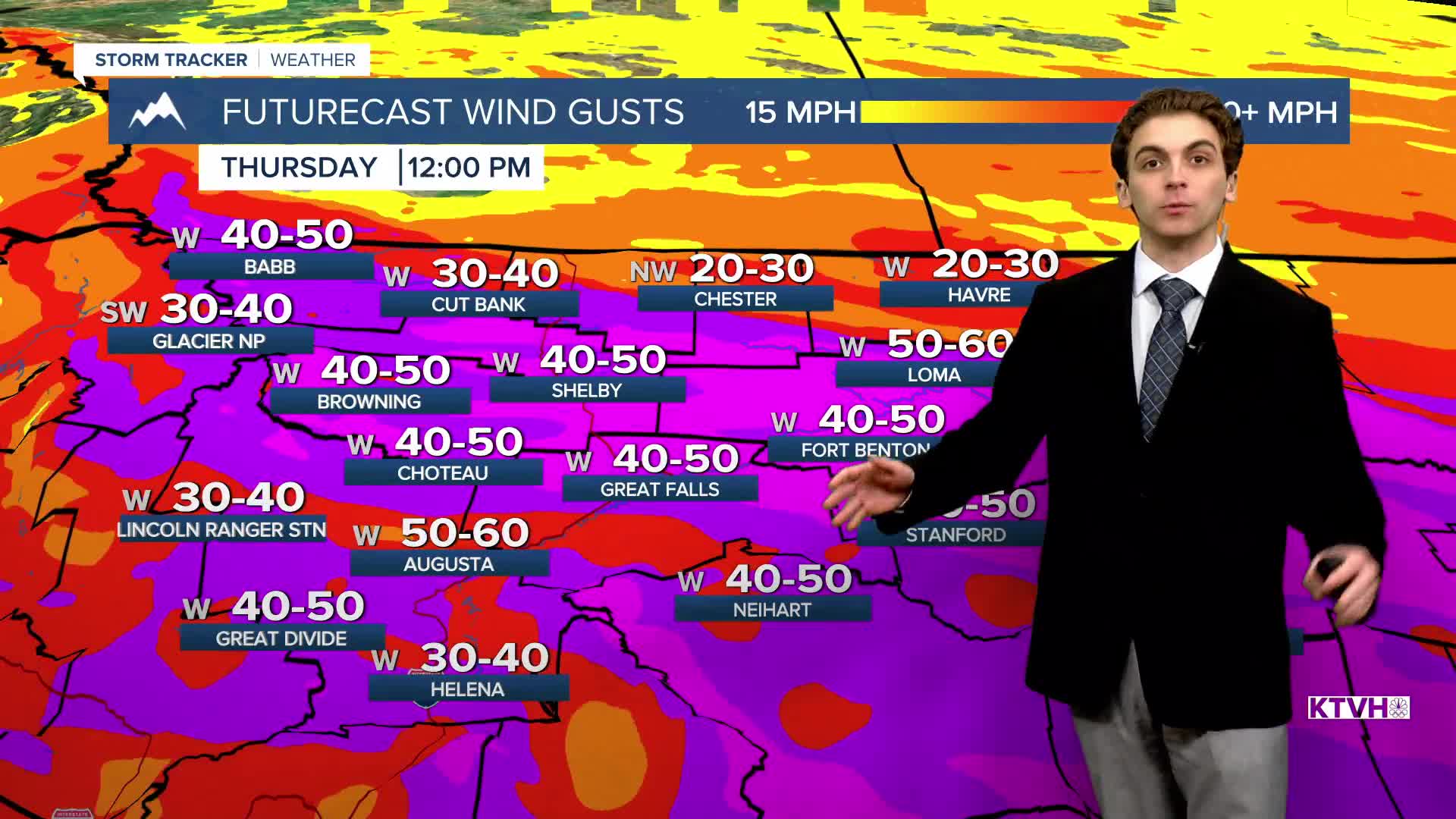


THURSDAY, MARCH 12TH: We have already recorded gusts ranging from 50-80 MPH through north-central Montana and the Helena area. With the recent stresses on trees and infrastructure from Sunday's wind near Great Falls, more power outages and damage are possible.
Rain and snow will fall, especially in the mountains where feet of snow are expected. The sheer amount of moisture coming in with this system should overcome the downslope winds in Helena, which usually would create drier conditions. Gusty winds with light rain through the day.
A cold front from the north will begin to push into the state in the afternoon, bringing relief to the winds from north to south. Pacific moisture will overrun this front to create rain and snow in the plains. We will eventually see a conversion from rain to snow in the Helena area later tonight.
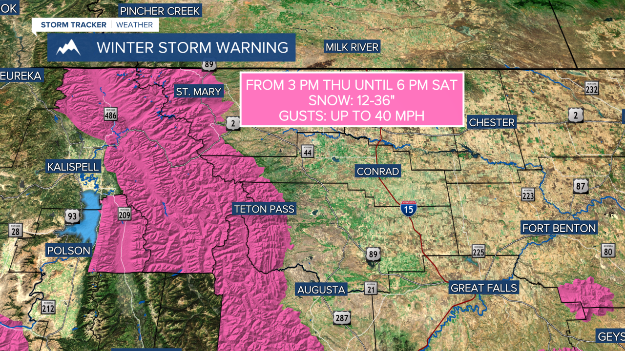
As this front moves southward, moist Pacific air will overrun this shallow colder region, enhancing snowfall heading into Thursday night over north-central Montana
Temperatures are in the 40s this morning and will slowly drop throughout the day.
FRIDAY, MARCH 13TH: An atmospheric river will continue to impact the state, dropping heavy snow in the mountains. Snow will fill back into north-central Montana. Snow in the morning around Helena could convert over to a rain/snow mix in the afternoon as temperatures warm above freezing, and then back to snow Friday night.
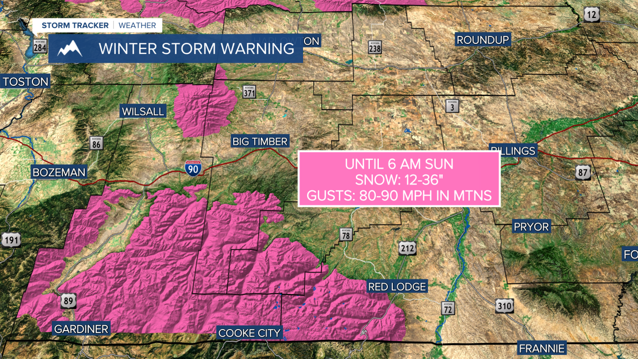
The statewide high wind event will be over, but you can expect gusty winds to persist near and south of I-90.
Highs will reach the 30s and low 40s for most areas.
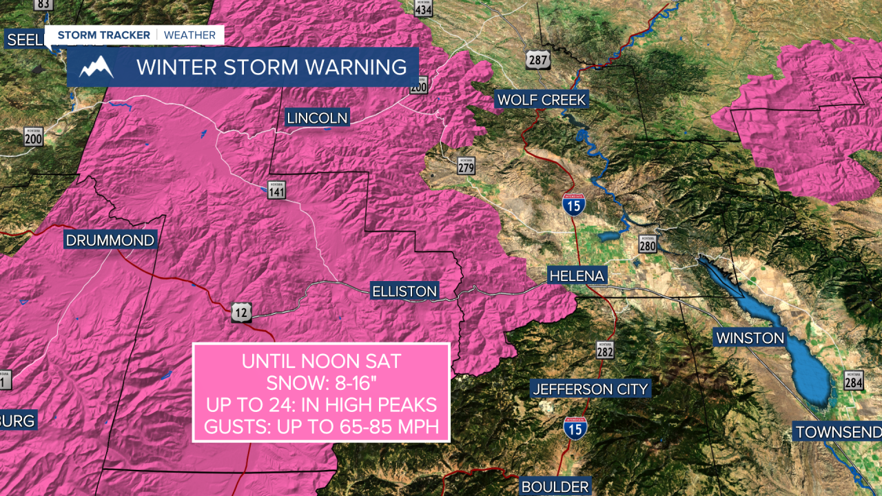
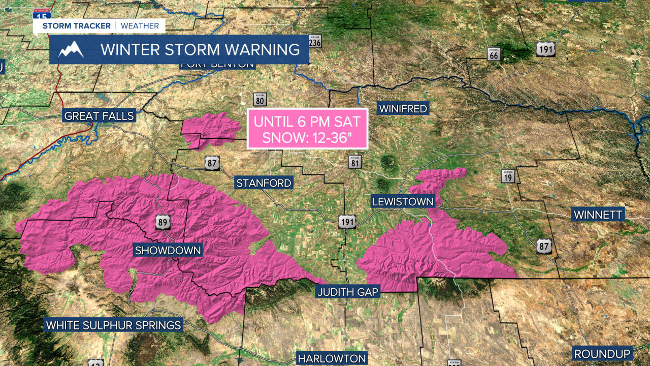
SATURDAY, MARCH 14TH: The cold front will continue its trek southward through the state Saturday morning, bringing moderate to heavy snow to lower elevations.
Snow totals combining Friday and Saturday will be the most significant they have been all winter in north-central Montana and Helena. We expect around 3-6 inches of snow through Saturday around Helena, 4-8" in Great Falls, and locally higher amounts in other portions of the plains.
Temperatures will continue to decrease as highs only reach the 20s and 30s. Snow moves out of the area late Saturday night.
SUNDAY, MARCH 15TH: Widespread snow moves out of the area by Sunday morning, with just a few lingering mountain snow showers in the afternoon. It will be a very cold morning, with lows dipping into the single digits. Due to snow on the ground, don't expect temperatures to be higher than the 20s and 30s.
LONG-RANGE FORECAST: Colder temperatures stick around through Monday morning. Another small disturbance passes through the state on Monday, bringing a mix of rain and snow. Temperatures warm rapidly heading into St. Patrick's Day. We could reach the 70s for highs by the middle of next week.
——————————————————————————————————————————
WEATHER ALERTS:


——————————————————————————————————————————
Helena Temperature Records Today:
High: 74 (2007)
Low: -12 (1950)
AVG: 46/23
Great Falls Temperature Records Today:
High: 69 (2007)
Low: -18 (1897)
AVG: 45/21