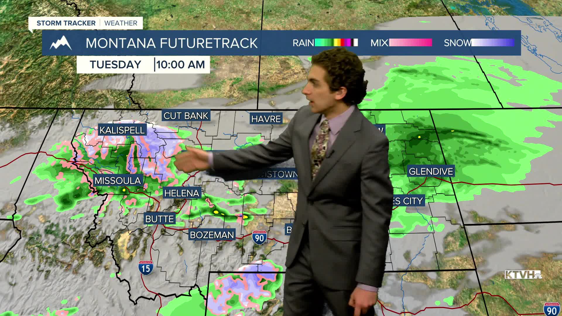


Light rain and mountain snow continue to fall on the morning of Election Day. Cloudy skies and some isolated showers will stick around, but travel to the polls shouldn't be impacted in Helena.
Highs will only reach the 40s and low 50s again today as a weak storm system continues to push through.
A High Wind Watch has already been issued for Cut Bank for Wednesday. Strong winds pick up for most areas on Thursday and Friday, where gusts could exceed 60 MPH again.
Through the rest of the workweek, another couple of storm systems will blast through the state, bringing some more mountain snow and rain showers, mainly on and west of the Continental Divide, although some isolated showers will be possible in Helena as well.
The weekend will be a bit cooler, but with less wind and drier conditions.
——————————————————————————————————————————
WEATHER ALERTS:
A WINTER WEATHER ADVISORY continues for Highway 37 Eureka to Libby, Highway 93 Eureka to Whitefish, Highway 56 Bull Lake Road, and Highway 2 Kalispell to Libby until noon Tuesday
A WINTER WEATHER ADVISORY continues for Highway 200 Thompson Falls to Plains, Highway 200 Trout Creek to Heron, Evaro Hill, and I-90 Lookout Pass to Haugan until noon Tuesday
A WINTER WEATHER ADVISORY continues for Glacier National Park, Marias Pass, Bad Rock Canyon, Essex, Highway 83 Bigfork to Swan Lake, and Polebridge until noon Tuesday
A WINTER WEATHER ADVISORY continues for the East Glacier Park Region until noon Tuesday
A HIGH WIND WATCH has been issued for Eastern Glacier, Western Toole, and Central Pondera Counties from Tuesday evening until Wednesday afternoon
——————————————————————————————————————————
Helena Temperature Records Today:
High: 69 (1945)
Low: -5 (1959)
AVG: 48/26
Great Falls Temperature Records Today:
High: 70 (1975)
Low: -9 (2017)
AVG: 48/26


