


A very unusual July storm will bring near-record cold air, heavy rain, and strong winds to much of the state over the next few days.
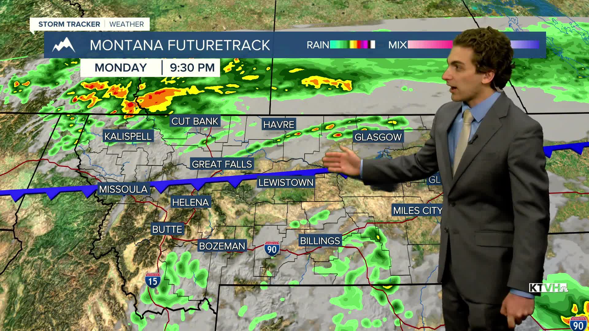
Most of the state will still be holding on to the 90s and mostly sunny conditions, but thunderstorms will begin to affect the Hi-Line this afternoon as the front starts to move into the area. A few of these storms could be strong to severe with damaging wind gusts. The severe threat will last overnight. From East Glacier to Havre, highs will only reach the 70s and 80s.
The front moves through most of the state tonight into tomorrow morning. This will bring the gustiest of winds through most areas while it is dark. Rain showers will be common around the state by tomorrow morning, lasting through the day. Highs only reach the 50s and 60s. This will be a 30-40 degree drop from the day before.
The system will begin to move out on Wednesday morning. A few light rain showers may be left before the sun rises, but expect decreasing cloud cover and mainly dry conditions in the afternoon. Highs warm into the 60s and 70s.
A small weather system passing through north-central Montana on Thursday keeps the plains from warming quickly. Helena will reach the mid-80s by Thursday with mainly dry conditions, while Great Falls is still in the 70s with some isolated thunderstorms.
Temperatures will continue to slowly warm through the end of the week, when we max out in the low 90s on Saturday.
——————————————————————————————————————————
WEATHER ALERTS:
A HIGH WIND WATCH has been issued for the Kootenai/Cabinet Region and West Glacier Region from Monday afternoon until Tuesday morning
A HIGH WIND WATCH has been issued for the Flathead/Mission Valleys from Monday afternoon until Tuesday morning
A WIND ADVISORY has been issued for the Potomac/Seeley Lake Region from 9 PM Monday until 8 PM Tuesday
A WIND ADVISORY has been issued for the Butte/Blackfoot Region from 9 PM Monday until 8 PM Tuesday
A LAKE WIND ADVISORY has been issued for Fort Peck Lake from 6 PM Monday until 6 PM Tuesday
——————————————————————————————————————————
Helena Temperature Records Today:
High: 102 (2007)
Low: 40 (1912)
AVG: 86/55
Great Falls Temperature Records Today:
High: 101 (2002)
Low: 41 (1912)
AVG: 84/51
Have a great Monday!
Joey Biancone
Meteorologist


