


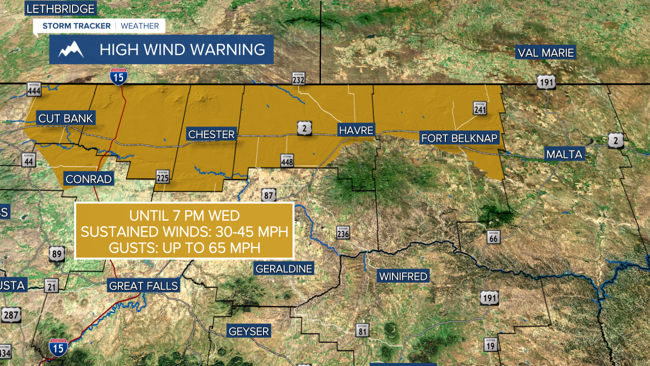
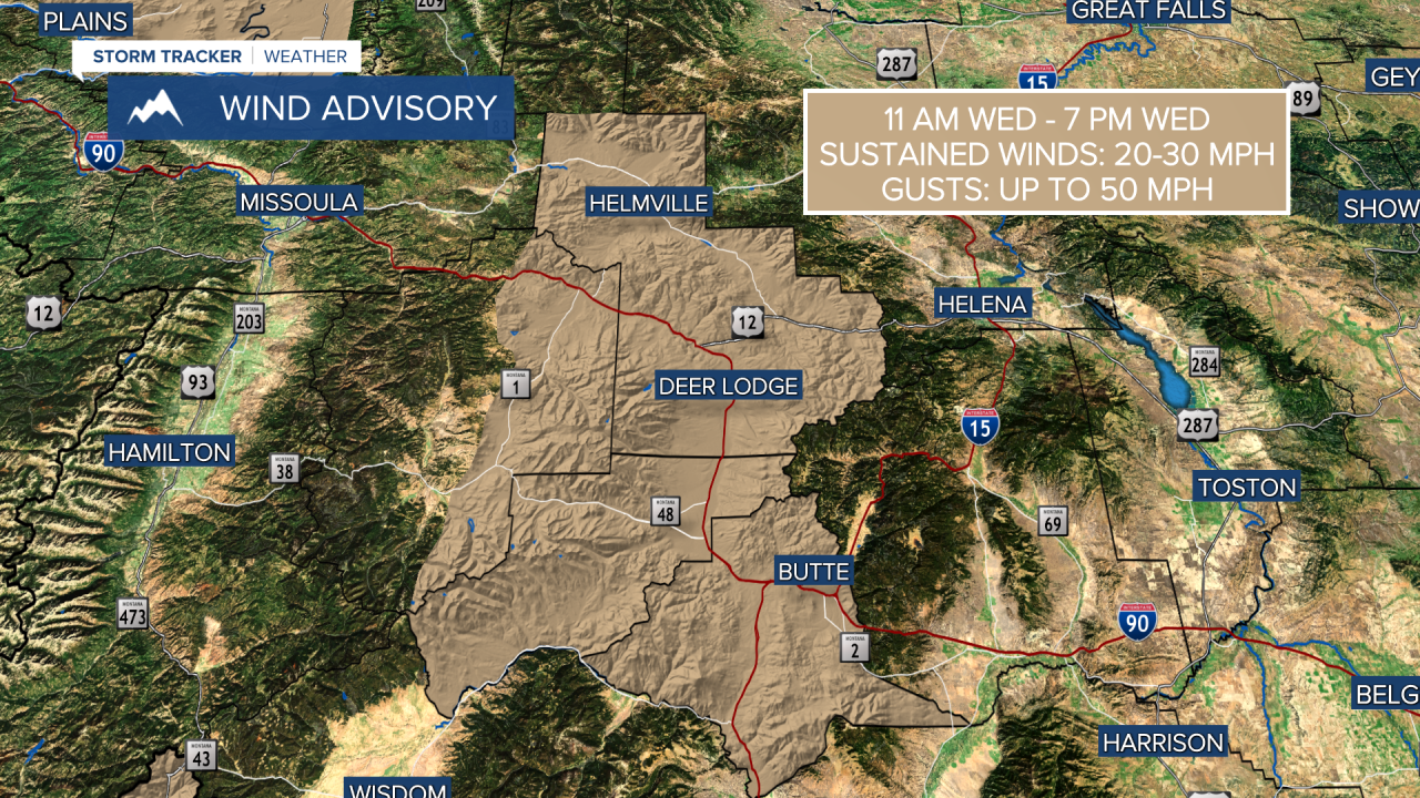
WEDNESDAY, MARCH 25TH: Wind is beginning to pick up this morning and will become stronger by the afternoon. We expect the gustiest conditions to be in southwest Montana and near the Hi-Line this afternoon, where 60 MPH gusts are possible. It will be windy everywhere else, but most locations will have peak gusts below the High Wind Warning criteria.
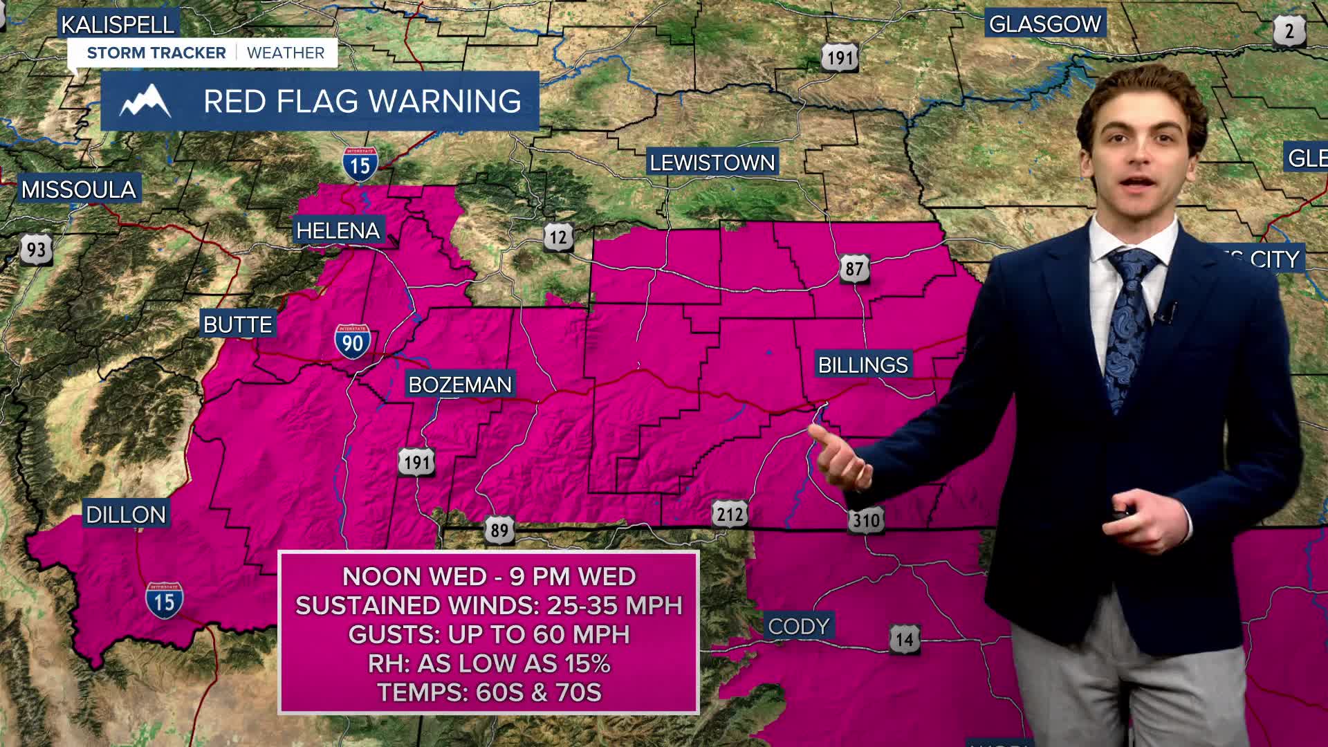
There is elevated fire danger throughout the Helena area today, even with the little bit of rain we received earlier this morning. Fire danger increases the further south and east you go from Helena. Weather conditions will be warm, dry, and windy in the Red Flag Warning area, so any new fire starts could spread rapidly.
A few rain and snow showers will linger around the higher terrain of Helena throughout the day. Mostly cloudy skies are expected with highs in the low to mid 60s. A cold front coming through later in the day will begin to drop temperatures into the low 30s by tomorrow morning.
THURSDAY, MARCH 26TH: Around Helena, a few light snow showers will pass over before sunrise. Accumulation is not expected. The skies will be partly cloudy to mostly sunny throughout the day. Aside from isolated snow showers forming in north-central Montana in the afternoon, the rest of the state will remain dry.
It will be a blustery day with afternoon highs only reaching the 30s and 40s, and wind still gusting up to 50 MPH in some areas. By Thursday night, the wind dies down and stays on the calmer side through Friday.
FRIDAY, MARCH 27TH: Morning lows dip into the teens and 20s for most areas. Temperatures rebound and warm into the 50s by the afternoon under mostly sunny skies. The wind will be light.
SATURDAY, MARCH 28TH: Temperatures in the morning will be in the 20s and 30s, but the overall pattern continues to warm as afternoon highs reach the 60s. Expect partly to mostly cloudy conditions with no precipitation.
LONG-RANGE FORECAST: Monday night into Tuesday looks to be the next transition back to cooler and wetter weather.
——————————————————————————————————————————
WEATHER ALERTS:


——————————————————————————————————————————
Helena Temperature Records Today:
High: 74 (1999)
Low: -30 (1955)
AVG: 51/27
Great Falls Temperature Records Today:
High: 73 (1999)
Low: -17 (1955)
AVG: 49/25


