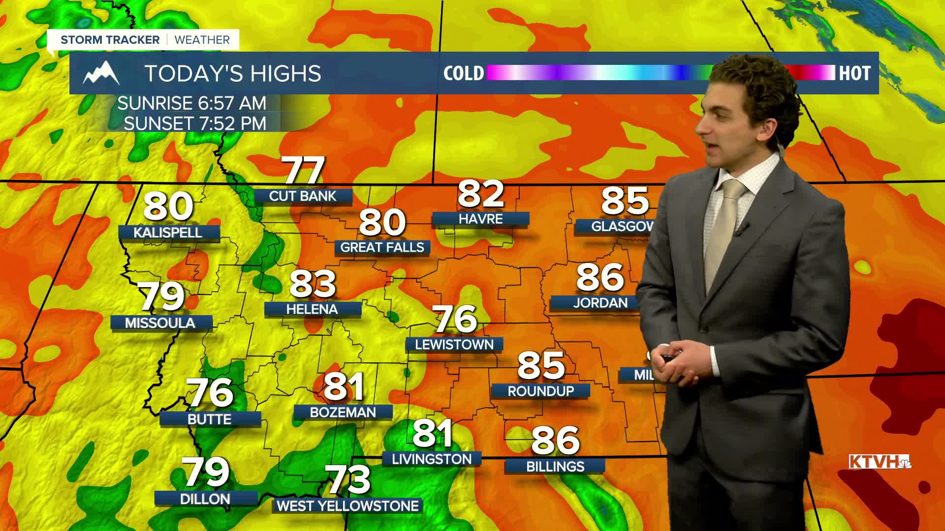


Air quality is beginning to improve this morning across western Montana. With varying wind directions over the next few days, light smoke could work its way back in, but air quality should not be as bad as Sunday. Thunderstorms will begin to filter out the atmosphere this week.
Several rounds of Pacific moisture bringing rain and thunderstorms will gradually cool daytime highs below normal by the end of the week! We dip as low as the 60s!
Early in the week, there will be daily afternoon thunderstorms, a few of which could produce strong wind gusts and small hail. By the end of the week, the storms will convert to mostly rain, with Saturday looking like the greatest potential for widespread measurable precipitation.
——————————————————————————————————————————
WEATHER ALERTS:
NONE
——————————————————————————————————————————
Helena Temperature Records Today:
High: 93 (1994)
Low: 29 (1960)
AVG: 77/47
Great Falls Temperature Records Today:
High: 98 (1979)
Low: 28 (2020)
AVG: 75/45
Have a great Monday!
Joey Biancone
Meteorologist


