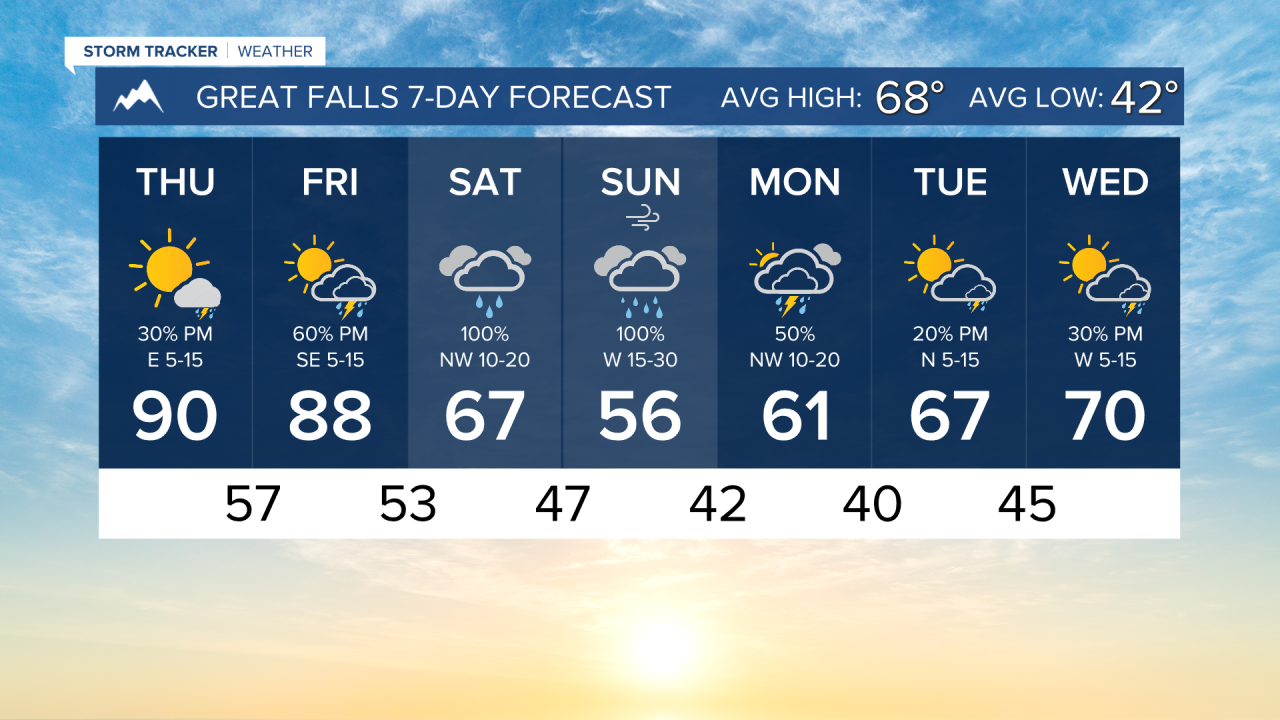


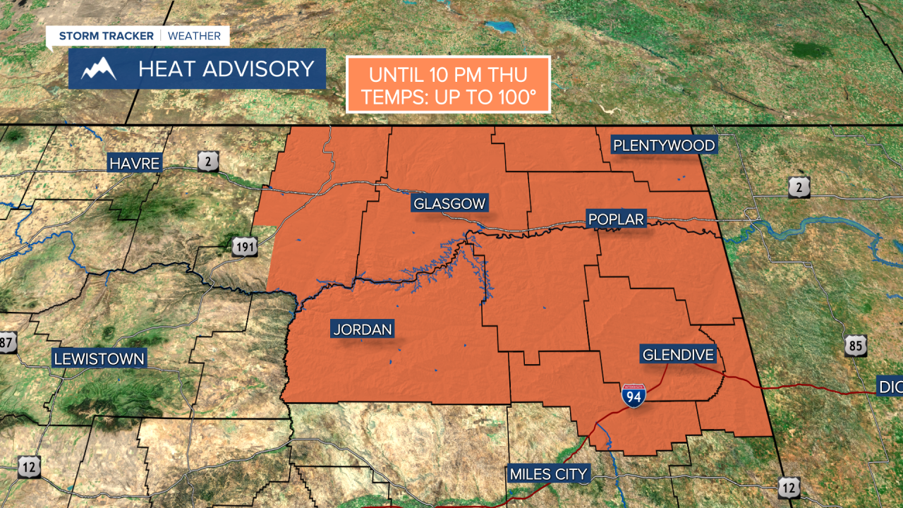
THURSDAY. MAY 28TH: Skies will be mostly sunny to partly cloudy. Highs will be the hottest of the week in the upper 80s to 90s across our area. Some areas may approach record daily highs
An isolated storm or two is possible in the afternoon. A few stronger storms may produce wind gusts up to 50 MPH, but there is not a severe threat today.
FRIDAY. MAY 29TH: Expect a bit more thunderstorm activity compared to Thursday. Scattered showers and storms will be around in the afternoon, with partly cloudy skies.
Storms could be strong to severe on Friday. The Storm Prediction Center has outlined an area in western and central Montana, including Helena and Great Falls, to see marginally severe storms with gusty winds and small hail.
This is expected to be the last day of temperatures in the 80s and 90s before significantly cooler air moves in for the weekend.
SATURDAY. MAY 30TH: A center of low pressure moves over the state, bringing widespread thunderstorms and showers to the area. Scattered light rain showers will move in the morning. It is trending that the arrival time of the heavy rain is between Saturday afternoon and evening.
Highs cool into the 50s and 60s in the southern half of the state, but some areas closer to the Hi-line still may hit the 70s.
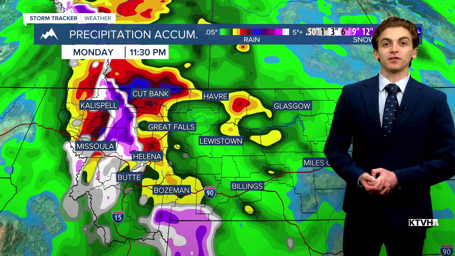
SUNDAY. MAY 31ST: Sunday will be a cool and wet day. Widespread moderate to heavy rainfall is expected for a lot of the state. Some flooding may occur in areas that see the heaviest precipitation totals. The latest model runs put the greatest risk in parts of northwest and north-central Montana, but this may change as this event gets closer.
Highs will only reach the 50s and 60s for most areas under overcast skies.
LONG-RANGE FORECAST: Some areas of rain and thunderstorms stick around through the first few days of June. Temperatures will slowly warm back up next week.
——————————————————————————————————————————
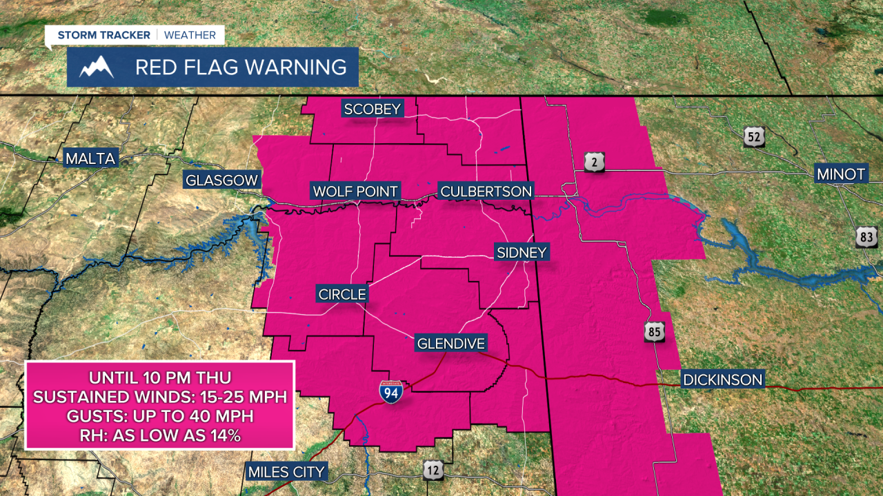
WEATHER ALERTS:
——————————————————————————————————————————
Helena Temperature Records Today:
High: 95 (1919)
Low: 28 (1947)
AVG: 70/45
Great Falls Temperature Records Today:
High: 100 (1919)
Low: 27 (1947)
AVG: 68/42