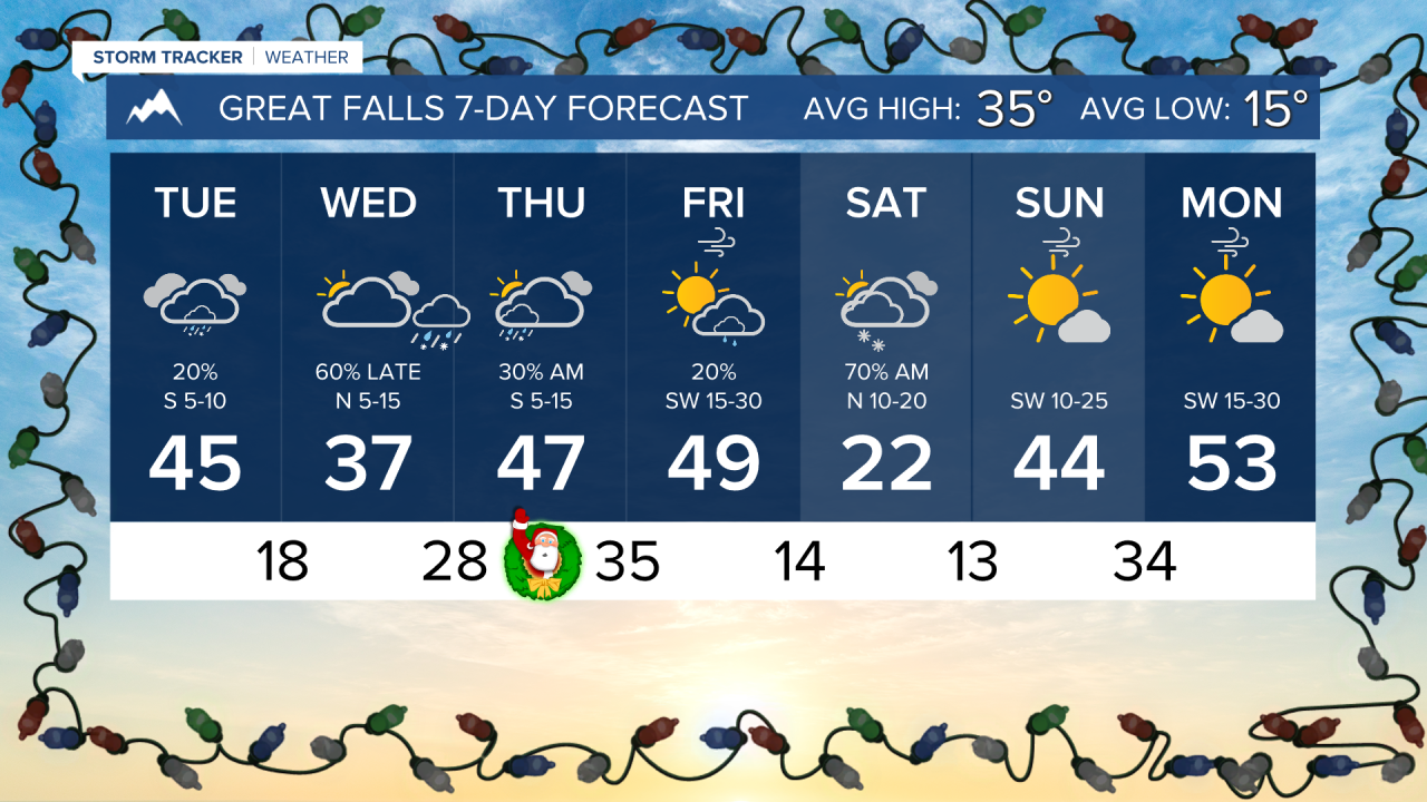


A round of mixed precipitation is expected to move through the state on Christmas Eve and Christmas morning. Freezing rain is looking likely in north-central Montana, which could impact Christmas travel.
Cold air has invaded most of the northern half of the state this morning. Lows are dipping into the single digits and teens. The cold air will be pushed back towards the Hi-Line this afternoon. Helena will reach a high of around 40 degrees today. Expect cloud cover to stick around.
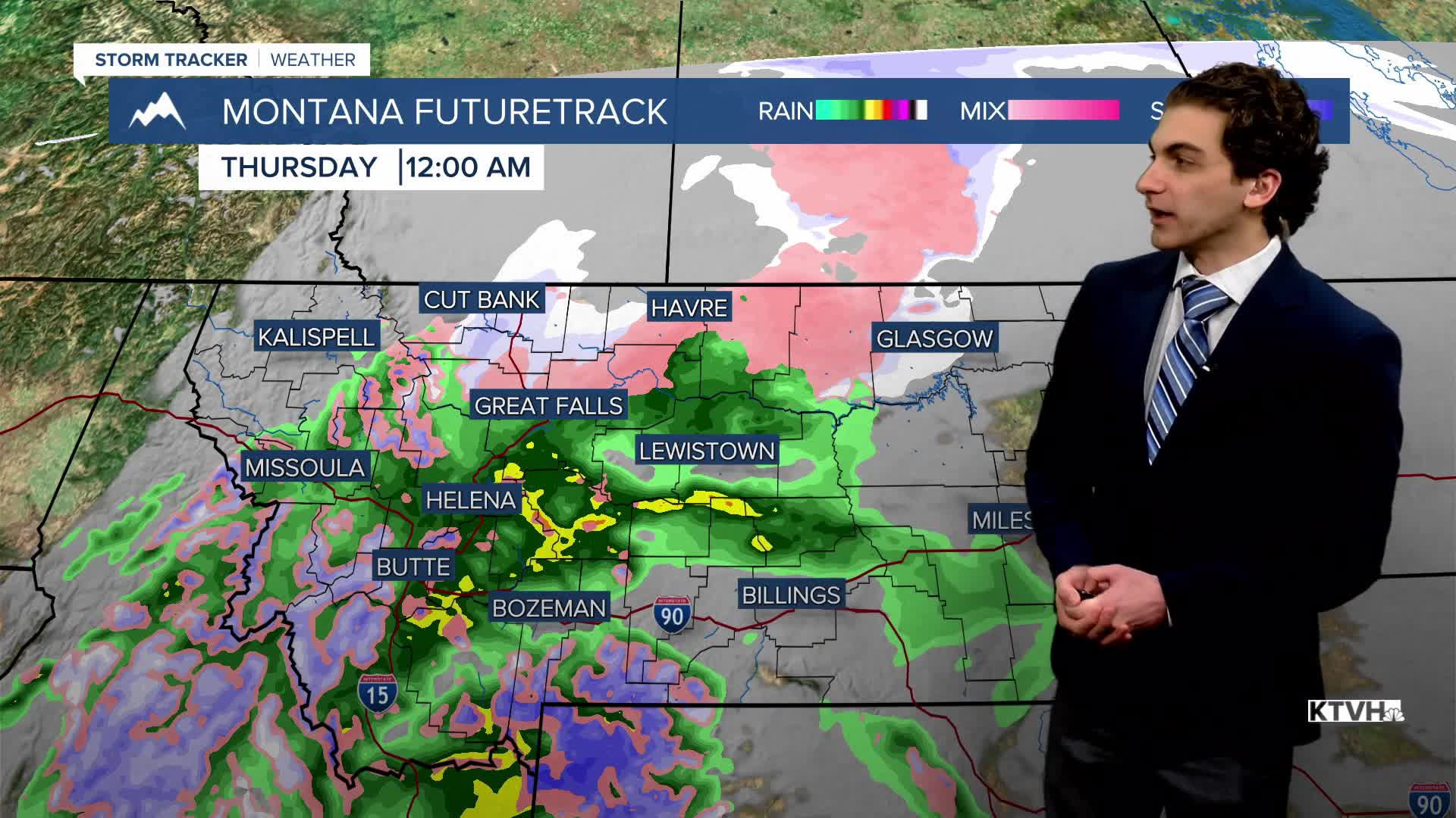
A wave of moisture will begin to move in on Christmas Eve. Most lower elevations will see rain. The mountains above 7000 feet will get some snow. As warmer air moves over the shallow cold air mass in the plains, freezing rain will form heading into Christmas morning. A light glaze may be present on roadways around Great Falls and Havre, creating slick conditions.
The cold air mass will eventually move south into Helena on Saturday. Overnight lows across the state will range from the 0s to the 20s by Sunday morning. Highs will be in the teens and low 30s.
Warmer air will return to much of the state next week, along with overall dry conditions, but inversions may form in valleys.
——————————————————————————————————————————
WEATHER ALERTS:
NWS Weather and Hazards Viewer
——————————————————————————————————————————
Helena Temperature Records Today:
High: 54 (1936)
Low: -32 (1983)
AVG: 31/13
Great Falls Temperature Records Today:
High: 56 (1960)
Low: -30 (1983)
AVG: 35/15