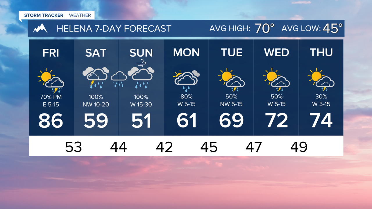


FRIDAY. MAY 29TH: Expect a bit more thunderstorm activity compared to Thursday. Scattered showers and storms will be around in the afternoon, with partly to mostly cloudy skies.
Storms could be strong to severe today. The Storm Prediction Center has outlined an area in western and central Montana, including Helena and Great Falls, for marginally severe storms, with gusty winds as the main threat and small hail and heavy downpours as secondary threats.
This is expected to be the last day of temperatures in the 80s and 90s before significantly cooler air moves in for the weekend.
SATURDAY. MAY 30TH: A center of low pressure moves over the state, bringing widespread thunderstorms and showers to the area.
A round of showers and thunderstorms will impact the area from Dillon to Great Falls around 7-10 AM. It will be drier for a few hours until more widespread precipitation moves into most of the state by the afternoon and evening. This is definitely going to be an indoor activity weekend.
Eastern Montana will be dealing with scattered thunderstorms, a few of which could be severe with gusty winds and hail.
Highs cool into the 50s and 60s for most areas. Winds will be out of the northwest at 10 to 20 MPH.
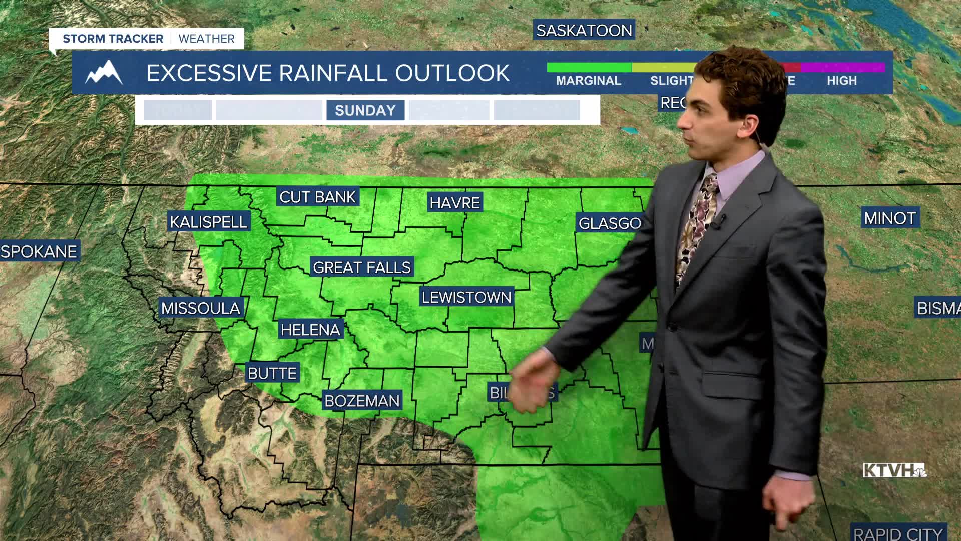
SUNDAY. MAY 31ST: Sunday will be a cool and wet day. Widespread moderate to heavy rainfall is expected for a lot of the state. Some flooding may occur in areas that see the heaviest precipitation totals. We are narrowing down an area confined to the northern Rocky Mountain Front that may see 3+ inches of rain Saturday through Sunday. However, most of the state is in some level of drought, so this rain event should improve those conditions.
As the center of low slowly wobbles through central Montana, gusty westerly to northwesterly winds will pick up in north-central Montana and the Helena area in the morning. Gusts could approach 30-40 MPH at times with the rain falling. It will stay breezy through most of the day, but it will decrease in speed in the afternoon.
Some higher elevation snow is possible on Sunday, though most of it will stay above the mountain pass level aside from some wet snowflakes at times. Accumulating snow will likely occur in peaks exceeding 7000 feet.
Highs will only reach the 50s in most areas under overcast skies.
MONDAY. JUNE 1ST: Most of the heavier rain moves closer to the Hi-Line on Monday, adding to the already impactful precipitation totals they would see through this point. The Helena area will be left with scattered light to moderate rain showers.
By this point, most of western and central Montana would have accumulated at least 1-3 inches of rain. We will be watching the river and stream levels for flooding.
Highs only warm into the upper 50s and low 60s. Winds will be out of the west at 5 to 15 MPH.
LONG-RANGE FORECAST: Some areas of rain and thunderstorms stick around through the first few days of June. Temperatures will slowly warm back up next week.
——————————————————————————————————————————
WEATHER ALERTS:

——————————————————————————————————————————
Helena Temperature Records Today:
High: 91 (2003)
Low: 27 (1951)
AVG: 70/45
Great Falls Temperature Records Today:
High: 95 (1936)
Low: 31 (1895)
AVG: 68/43