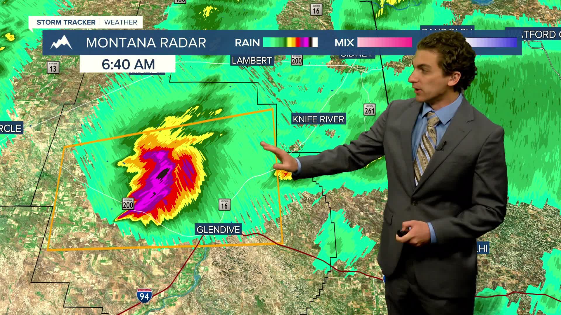


Yet another round of severe weather is expected today across a good stretch of Montana. A line of severe storms has already impacted the eastern plains near Glendive this morning. More are on the way this afternoon, including back in western Montana.
A cold front is moving through the western mountains. This will help spawn thunderstorms beginning in the early afternoon and lasting into the evening. Several rounds of storms may come through the same areas.
Highs will range from the upper 60s in the west to the low 90s in the east. Helena and Great Falls will only reach the mid-70s before storms form.
The severe weather threat diminishes tomorrow, but it will remain unsettled with rain showers and weak thunderstorms extending into north-central Montana. It will also be breezy with wind gusts topping off around 30 MPH.
Friday will be the coolest day of the week for many, with highs only reaching the 60s and 70s.
The weekend will be much nicer, with warming temperatures and mostly sunny skies.
Next week will be much warmer and drier as a ridge of high pressure builds over the region. Highs reach the 90s by midweek.
——————————————————————————————————————————
WEATHER ALERTS:
NONE
——————————————————————————————————————————
Helena Temperature Records Today:
High: 100 (2001)
Low: 39 (1939)
AVG: 88/55
Great Falls Temperature Records Today:
High: 101 (1970)
Low: 35 (1939)
AVG: 86/52
Have a great Thursday!
Joey Biancone
Meteorologist


