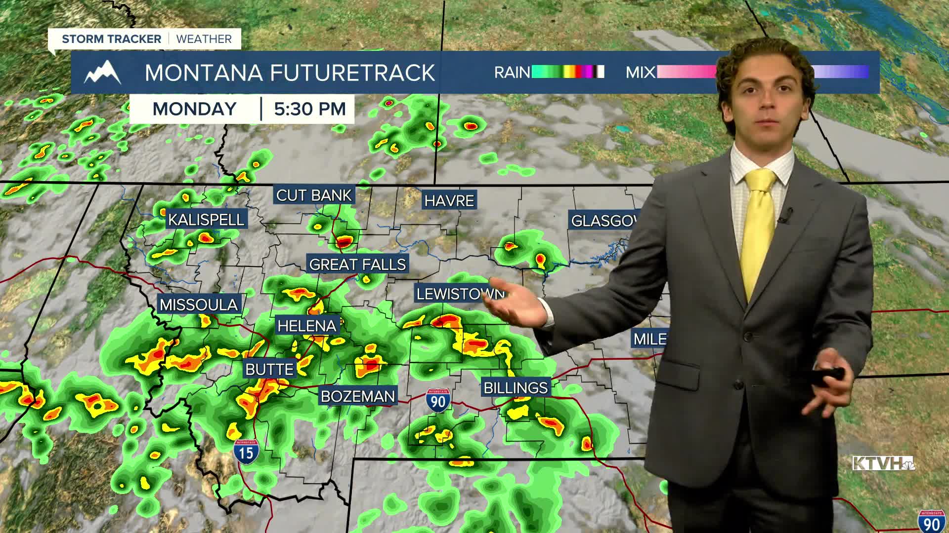


We will be tracking scattered storms through most of the state this afternoon and evening.
The greatest potential for severe storms will exist in eastern Montana, as there is less cloud cover, allowing for greater instability in that region. Storms will kick off in the early afternoon in southwestern Montana and move northeast through the rest of the day and overnight. There could be areas of localized flash flooding as storms will produce heavy rain once again.
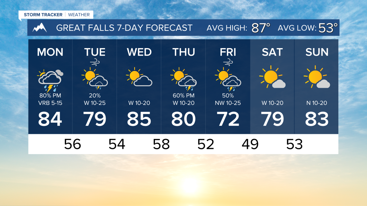
High temperatures will range from the 80s in western Montana to the low 90s in the eastern plains.
The severe threat moves to northeast Montana tomorrow as the center of low departs. A few storms may produce gusty winds and small hail.
Highs will be slightly cooler tomorrow, with most of the state in the upper 70s to low 80s.
A very nice day is expected on Wednesday. Dry with mostly sunny to partly cloudy skies with highs in the 80s.
A cold front will come through the state on Thursday, bringing more thunderstorms and cooler air.
Highs on Friday will only reach the 60s and 70s in the cold air behind the front.
The weekend will be much nicer, with warming temperatures and mostly sunny skies.
——————————————————————————————————————————
WEATHER ALERTS:
NONE
——————————————————————————————————————————
Helena Temperature Records Today:
High: 102 (1961)
Low: 41 (1923)
AVG: 88/56
Great Falls Temperature Records Today:
High: 102 (1961)
Low: 41 (1982)
AVG: 87/53
Have a great Monday!
Joey Biancone
Meteorologist