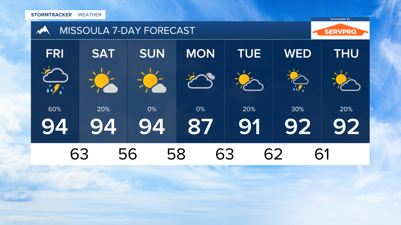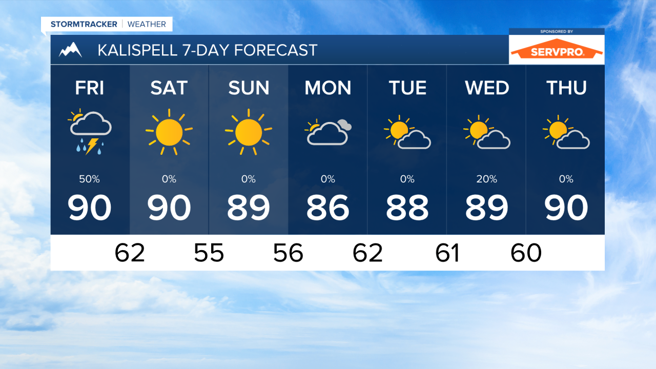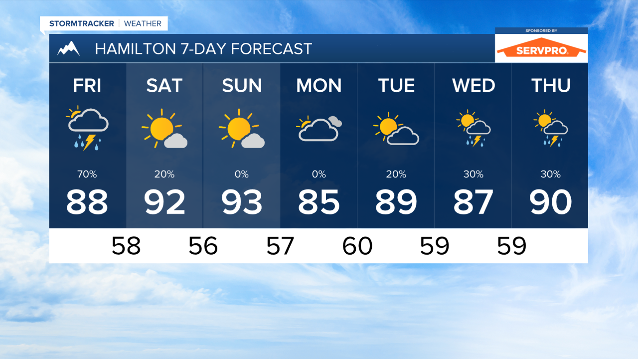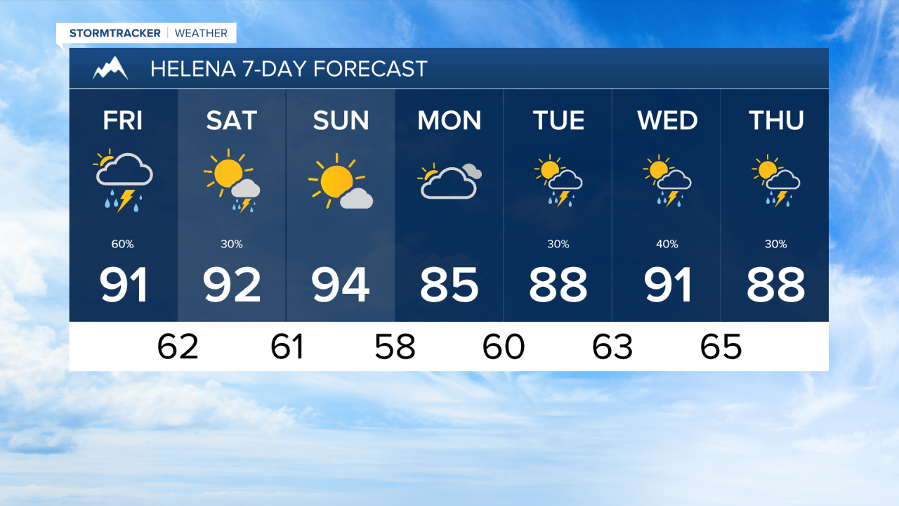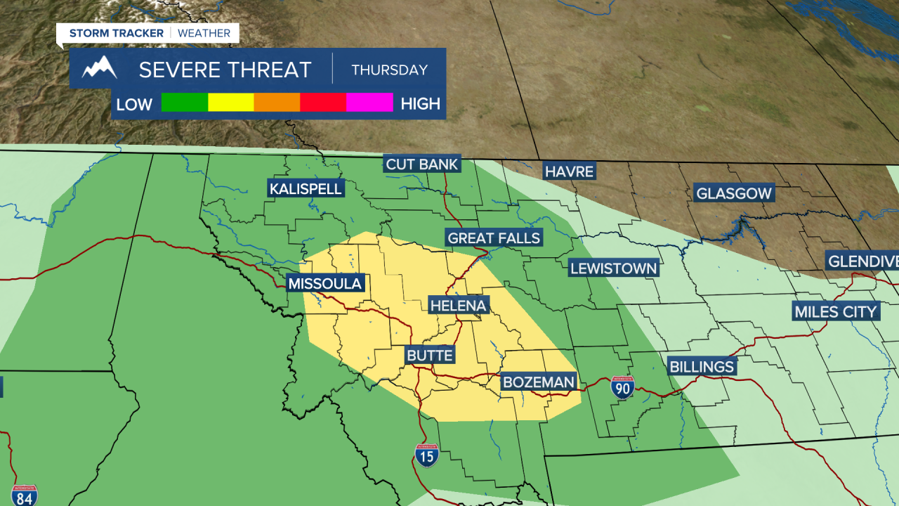


Severe weather is possible over the next couple of days as waves of monsoonal moisture move into western and central Montana.
As storms begin to pop over the southwestern higher terrain, the environment is favorable for storms to build and produce large hail in excess of 1 inch in diameter. Storms will not impact everybody, but those who do see storms pass over could be in store for dangerous weather.
Storms will continue to move northeast through the rest of the evening. The target times for the Bitterroot Valley and Missoula Valley are from 3 PM to 9 PM. Kalispell and northwest Montana have the threat a little later in the evening, from about 5 PM to midnight.
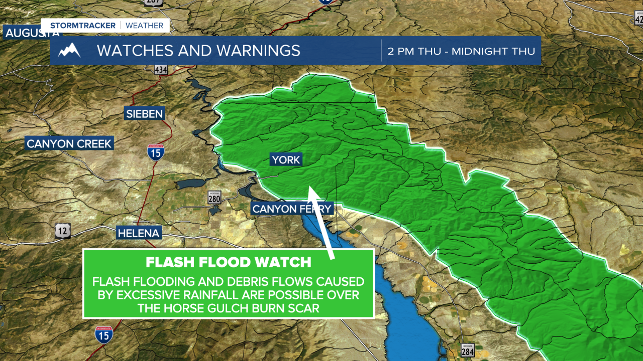
The Helena area, I think, has the best chance to see these stronger storms. There is also a Flash Flood Watch in effect for the Horse Gulch Burn Scar. The severe threat lasts until about sunset.
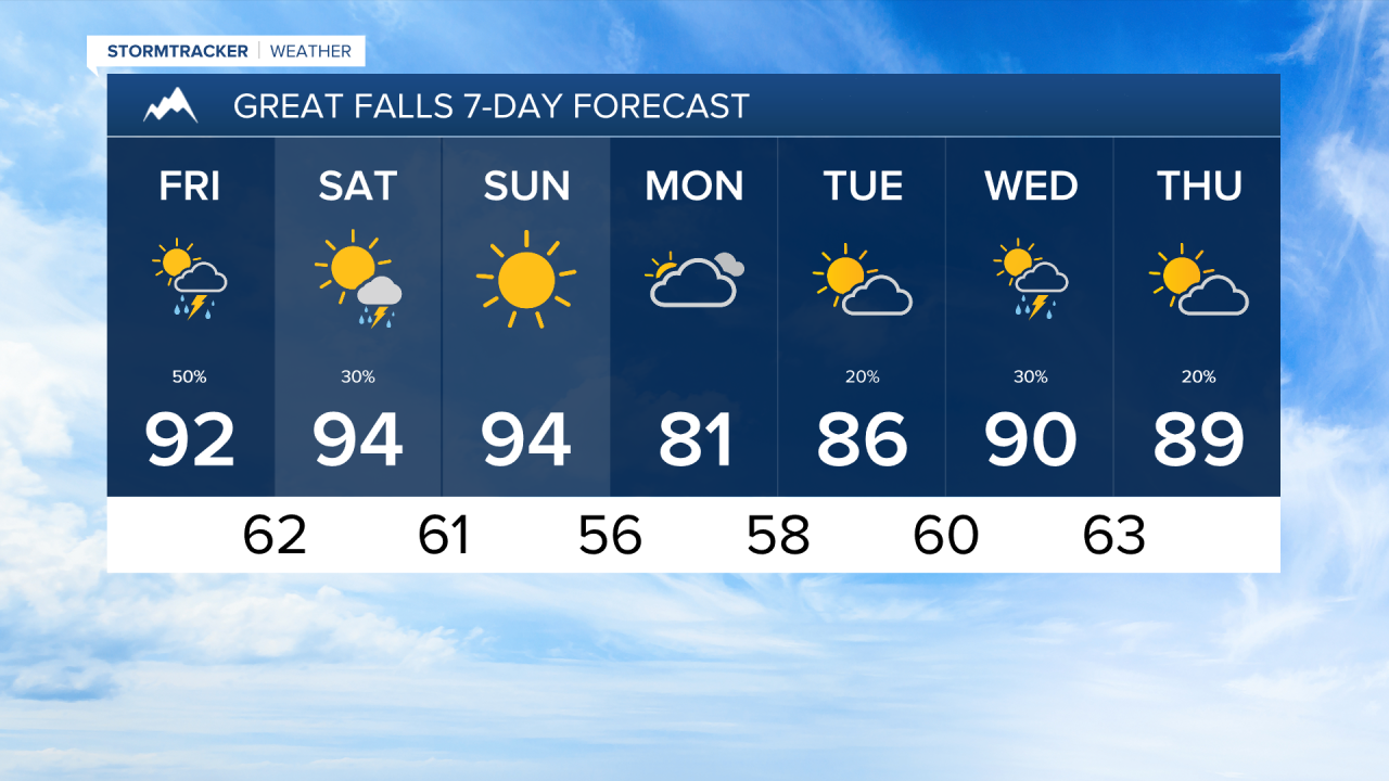
Great Falls and north-central Montana will initially see isolated storms over the Rocky Mountain Front and Little Belt Mountains. Additional storms will come into the area in the later afternoon and early evening, but lose steam after sunset.
Tomorrow will start dry, outside of some passing rain showers near Lincoln County. Another wave of thunderstorms develop in the afternoon over southwest Montana and move north-northeast through the evening. Forecast models show these developing more into a line, which would increase the likelihood of damaging winds and heavy rain.
Tomorrow's storms give areas west of the Continental Divide a better chance to see active weather moving through your area. I expect to see active weather in the Missoula, Helena, and Great Falls regions.
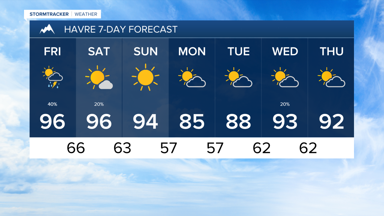
High temperatures will reach the upper 80s and low 90s yet again tomorrow.
Aside from isolated storms on Saturday in southwest Montana, the weekend will be dry and hot with highs in the 90s. Cloud cover moves in Monday which should help regulate temperatures.
——————————————————————————————————————————
MONTANA WEATHER ALERTS:
——————————————————————————————————————————